Property Record
200 Sears Blvd, Wilmington, DE 19804
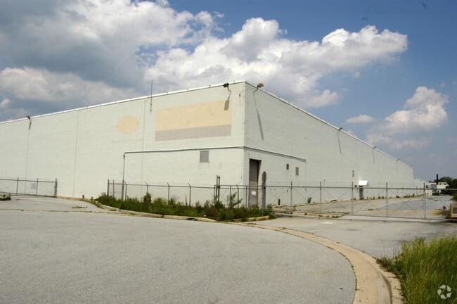

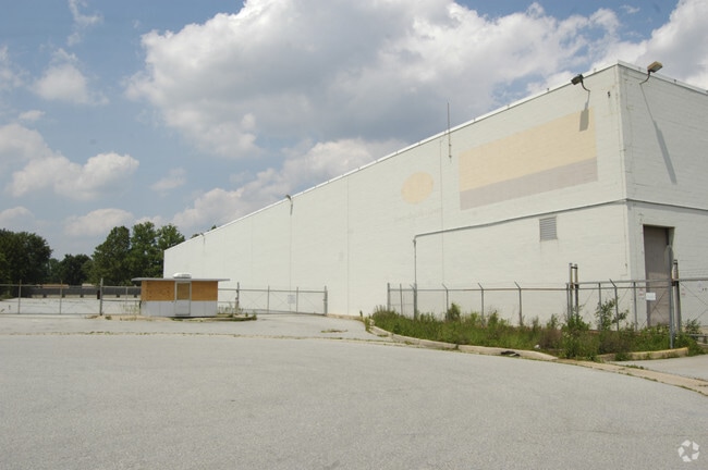

Property Detail
200 Sears Blvd
07-046.40-128
New Castle
Warehouse
Delaware
I
b
B and X Area of moderate flood hazard, usually the area between the limits of the 100-year and 500-year floods.
12.50 AC
2025
New Castle County
2025
Philadelphia
012700
Philadelphia-Camden-Wilmington, PA-NJ-DE-MD
16,920 SF
NEARBY LISTINGS FOR SALE OR LEASE
DEMOGRAPHICS near 200 Sears Blvd
1 mile
3 mile
5 mile
2025 Total Population
5,026
62,501
231,422
2030 Population
5,126
63,978
238,372
Pop Growth 2025-2030
+ 1.99%
+ 2.36%
+ 3.00%
Average Age
43
41
41
2025 Total Households
2,107
24,840
95,423
HH Growth 2025-2030
+ 2.09%
+ 2.52%
+ 3.19%
Median Household Inc
$66,837
$82,080
$74,665
Avg Household Size
2.30
2.40
2.40
2025 Avg HH Vehicles
2.00
2.00
2.00
Median Home Value
$242,183
$269,735
$289,863
Median Year Built
1957
1959
1965
Nearby Places
Map Layers
Map Styles
 Street
 Aerial
Layers
 Traffic
 Biking
Places
Listings with unknown addresses are not visible on the map
- Restaurants
- Banks
- Shops
- Fitness
- Groceries
PUBLIC TRANSPORTATION
COMMUTER RAIL
Churchmans Crossing (R2 - Southeastern Pennsylvania Transportation Authority Regional Rail (SEPTA Regional Rail))
Drive
Walk
Distance
Churchmans Crossing (R2 - Southeastern Pennsylvania Transportation Authority Regional Rail (SEPTA Regional Rail))
11 min
4.3 mi
Wilmington (R2 - Southeastern Pennsylvania Transportation Authority Regional Rail (SEPTA Regional Rail))
Drive
Walk
Distance
Wilmington (R2 - Southeastern Pennsylvania Transportation Authority Regional Rail (SEPTA Regional Rail))
16 min
6.2 mi
AIRPORT
Philadelphia International
Drive
Walk
Distance
Philadelphia International
43 min
28.5 mi
Freight Ports
Port of Wilmington, RI
Drive
Walk
Distance
Port of Wilmington, RI
18 min
8.4 mi
Nearby Properties
Address
Land Use
TOTAL SIZE
Lot Size
Zoning
Address
Land Use
TOTAL SIZE
Lot Size
Zoning
525,757 SF
189.70 AC
NCPUD
Address
Land Use
TOTAL SIZE
Lot Size
Zoning
163,588 SF
1,229.95 AC
I
Address
Land Use
TOTAL SIZE
Lot Size
Zoning
467,262 SF
28.74 AC
CR
Address
Land Use
TOTAL SIZE
Lot Size
Zoning
624,255 SF
132.95 AC
SR
Address
Land Use
TOTAL SIZE
Lot Size
Zoning
22,013 SF
55.17 AC
S
Address
Land Use
TOTAL SIZE
Lot Size
Zoning
803,690 SF
155.50 AC
NCPUD
Address
Land Use
TOTAL SIZE
Lot Size
Zoning
819,930 SF
78.51 AC
HI
Address
Land Use
TOTAL SIZE
Lot Size
Zoning
488,637 SF
229.83 AC
NCPUD
Address
Land Use
TOTAL SIZE
Lot Size
Zoning
116,042 SF
108.83 AC
SR
Address
Land Use
TOTAL SIZE
Lot Size
Zoning
216,689 SF
16.44 AC
CR
Address
Land Use
TOTAL SIZE
Lot Size
Zoning
38,900 SF
16.31 AC
BP
Address
Land Use
TOTAL SIZE
Lot Size
Zoning
203,570 SF
83.85 AC
OR
Address
Land Use
TOTAL SIZE
Lot Size
Zoning
30,127 SF
6.53 AC
CR
Address
Land Use
TOTAL SIZE
Lot Size
Zoning
194,234 SF
67.12 AC
S
Address
Land Use
TOTAL SIZE
Lot Size
Zoning
660 SF
291.15 AC
I
Address
Land Use
TOTAL SIZE
Lot Size
Zoning
269,354 SF
29.13 AC
NCPUD
Address
Land Use
TOTAL SIZE
Lot Size
Zoning
242,811 SF
38.77 AC
CR
Address
Land Use
TOTAL SIZE
Lot Size
Zoning
2,368 SF
486.90 AC
SR
Address
Land Use
TOTAL SIZE
Lot Size
Zoning
187,286 SF
24.20 AC
CR
Address
Land Use
TOTAL SIZE
Lot Size
Zoning
94,470 SF
22.40 AC
CR
Address
Land Use
TOTAL SIZE
Lot Size
Zoning
68,173 SF
16.18 AC
OR
Address
Land Use
TOTAL SIZE
Lot Size
Zoning
1,815 SF
115.74 AC
S
Address
Land Use
TOTAL SIZE
Lot Size
Zoning
166,492 SF
19.73 AC
S
Address
Land Use
TOTAL SIZE
Lot Size
Zoning
220,880 SF
62.11 AC
HI
Address
Land Use
TOTAL SIZE
Lot Size
Zoning
56,352 SF
11.29 AC
I
Address
Land Use
TOTAL SIZE
Lot Size
Zoning
343,217 SF
28.26 AC
CR
Address
Land Use
TOTAL SIZE
Lot Size
Zoning
110.84 AC
CR
Address
Land Use
TOTAL SIZE
Lot Size
Zoning
227,430 SF
10.80 AC
NCAP
Address
Land Use
TOTAL SIZE
Lot Size
Zoning
2,520 SF
9.03 AC
ST
Address
Land Use
TOTAL SIZE
Lot Size
Zoning
189,197 SF
20.78 AC
CR
The World's #1 Commercial Real Estate Marketplace
Connect with us
© 2026 CoStar Group
The information above has been obtained from sources believed reliable. While we do not doubt its accuracy we have not verified it and make no guarantee, warranty or representation about it. It is your responsibility to independently confirm its accuracy and completeness. Any projections, opinions, assumptions, or estimates used are for example only and do not represent the current or future performance of the property. The value of this transaction to you depends on tax and other factors which should be evaluated by your tax, financial, and legal advisors. You and your advisors should conduct a careful, independent investigation of the property to determine to your satisfaction the suitability of the property for your needs.