Property Record
200 Shepherd Dr, Houston, TX 77007


Property Detail
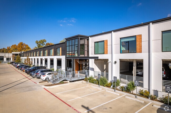
200 Shepherd Dr
1140890000003
RES A1 BLK 1 SHEPHERD PROPERTIES
Regionalshoppingcenterormallwithanchorstore
HARRIS
AE The base floodplain where base flood elevations are provided. AE Zones are now used on new format FIRMs instead of A1-A30 Zones.
Texas
2024
5.58 AC
2025
Inner Loop/Heights
510601
Houston
104,455 SF
Houston-Pasadena-The Woodlands, TX
NEARBY LISTINGS FOR SALE OR LEASE
DEMOGRAPHICS near 200 Shepherd Dr
1 mile
3 mile
5 mile
2025 Total Population
25,264
183,906
506,860
2030 Population
27,474
200,268
549,471
Pop Growth 2025-2030
+ 8.75%
+ 8.90%
+ 8.41%
Average Age
36
38
39
2025 Total Households
12,755
92,649
236,104
HH Growth 2025-2030
+ 8.97%
+ 9.11%
+ 8.88%
Median Household Inc
$160,080
$122,311
$97,067
Avg Household Size
2.00
1.90
2.00
2025 Avg HH Vehicles
2.00
2.00
2.00
Median Home Value
$556,340
$601,395
$529,691
Median Year Built
2010
2003
1997
Nearby Places
Map Layers
Map Styles
 Street
 Aerial
Transit
 Traffic
 Biking
Places
Listings with unknown addresses are not visible on the map
- Restaurants
- Banks
- Shops
- Fitness
- Groceries
PUBLIC TRANSPORTATION
COMMUTER RAIL
Drive
Walk
Distance
10 min
4.1 mi
AIRPORT
William P Hobby
Drive
Walk
Distance
William P Hobby
31 min
17.0 mi
George Bush Intcntl/Houston
Drive
Walk
Distance
George Bush Intcntl/Houston
29 min
20.9 mi
Nearby Properties
Address
Land Use
TOTAL SIZE
Lot Size
Zoning
Address
Land Use
TOTAL SIZE
Lot Size
Zoning
1,871,418 SF
1.44 AC
Address
Land Use
TOTAL SIZE
Lot Size
Zoning
1,232,364 SF
1.49 AC
Address
Land Use
TOTAL SIZE
Lot Size
Zoning
1,436,400 SF
1.44 AC
Address
Land Use
TOTAL SIZE
Lot Size
Zoning
1,321,033 SF
1.46 AC
Address
Land Use
TOTAL SIZE
Lot Size
Zoning
4,169,721 SF
31.23 AC
Address
Land Use
TOTAL SIZE
Lot Size
Zoning
2,005,097 SF
1.44 AC
Address
Land Use
TOTAL SIZE
Lot Size
Zoning
1,374,271 SF
1.44 AC
Address
Land Use
TOTAL SIZE
Lot Size
Zoning
1,150,681 SF
1.17 AC
Address
Land Use
TOTAL SIZE
Lot Size
Zoning
1,282,908 SF
2.74 AC
Address
Land Use
TOTAL SIZE
Lot Size
Zoning
555,351 SF
1.40 AC
Address
Land Use
TOTAL SIZE
Lot Size
Zoning
644,352 SF
8.05 AC
Address
Land Use
TOTAL SIZE
Lot Size
Zoning
608,233 SF
2.23 AC
Address
Land Use
TOTAL SIZE
Lot Size
Zoning
930,730 SF
1.89 AC
Address
Land Use
TOTAL SIZE
Lot Size
Zoning
567,282 SF
2.40 AC
Address
Land Use
TOTAL SIZE
Lot Size
Zoning
1,075,210 SF
2.26 AC
Address
Land Use
TOTAL SIZE
Lot Size
Zoning
265,878 SF
2.23 AC
Address
Land Use
TOTAL SIZE
Lot Size
Zoning
406,032 SF
2.74 AC
Address
Land Use
TOTAL SIZE
Lot Size
Zoning
453,456 SF
3.11 AC
Address
Land Use
TOTAL SIZE
Lot Size
Zoning
1,227,182 SF
4.43 AC
Address
Land Use
TOTAL SIZE
Lot Size
Zoning
432,689 SF
2.84 AC
Address
Land Use
TOTAL SIZE
Lot Size
Zoning
1,087,974 SF
1.18 AC
Address
Land Use
TOTAL SIZE
Lot Size
Zoning
957,961 SF
4.56 AC
Address
Land Use
TOTAL SIZE
Lot Size
Zoning
709,825 SF
4.92 AC
Address
Land Use
TOTAL SIZE
Lot Size
Zoning
649,000 SF
7.35 AC
Address
Land Use
TOTAL SIZE
Lot Size
Zoning
954,384 SF
1.69 AC
Address
Land Use
TOTAL SIZE
Lot Size
Zoning
535,500 SF
15.97 AC
Address
Land Use
TOTAL SIZE
Lot Size
Zoning
519,374 SF
6.18 AC
Address
Land Use
TOTAL SIZE
Lot Size
Zoning
788,433 SF
5.09 AC
Address
Land Use
TOTAL SIZE
Lot Size
Zoning
714,875 SF
5.79 AC
Address
Land Use
TOTAL SIZE
Lot Size
Zoning
404,603 SF
2.94 AC
The World's #1 Commercial Real Estate Marketplace
Connect with us
© 2026 CoStar Group
The information above has been obtained from sources believed reliable. While we do not doubt its accuracy we have not verified it and make no guarantee, warranty or representation about it. It is your responsibility to independently confirm its accuracy and completeness. Any projections, opinions, assumptions, or estimates used are for example only and do not represent the current or future performance of the property. The value of this transaction to you depends on tax and other factors which should be evaluated by your tax, financial, and legal advisors. You and your advisors should conduct a careful, independent investigation of the property to determine to your satisfaction the suitability of the property for your needs.