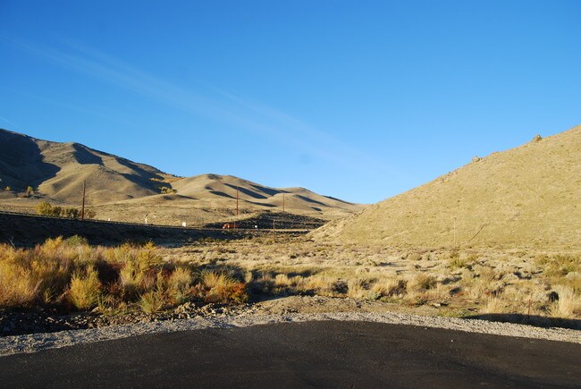
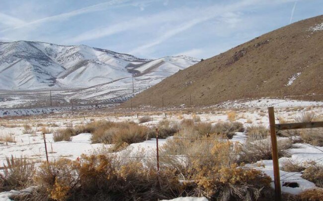
Property Record
200 Silver Lake Rd, Reno, NV 89508


Property Detail
200 Silver Lake Rd
087-350-24
FR S2 SEC 2 TWP 20 RGE 18
Commercialacreage
WASHOE
PGOS 27% /
Nevada
B and X Area of moderate flood hazard, usually the area between the limits of the 100-year and 500-year floods.
9.27 AC
0
N Outlying Washoe County
2026
Reno/Sparks
002612
Reno, NV
NEARBY LISTINGS FOR SALE OR LEASE
DEMOGRAPHICS near 200 Silver Lake Rd
1 mile
3 mile
5 mile
2025 Total Population
3,606
21,894
43,974
2030 Population
3,631
22,407
45,495
Pop Growth 2025-2030
+ 0.69%
+ 2.34%
+ 3.46%
Average Age
38
36
38
2025 Total Households
1,177
7,430
15,136
HH Growth 2025-2030
+ 0.85%
+ 2.45%
+ 3.49%
Median Household Inc
$82,788
$84,605
$85,118
Avg Household Size
3.00
2.90
2.80
2025 Avg HH Vehicles
2.00
2.00
2.00
Median Home Value
$414,337
$399,575
$418,529
Median Year Built
1995
1997
1999
Nearby Places
Map Layers
Map Styles
 Street
 Aerial
Layers
 Traffic
 Biking
Places
Listings with unknown addresses are not visible on the map
- Restaurants
- Banks
- Shops
- Fitness
- Groceries
PUBLIC TRANSPORTATION
AIRPORT
Reno/Tahoe International
Drive
Walk
Distance
Reno/Tahoe International
35 min
16.1 mi
Freight Ports
Port of Stockton
Drive
Walk
Distance
Port of Stockton
220 min
190.4 mi
SALE & LEASE HISTORY
LISTING DATE
SALE/LEASE

Sep 24, 2016
For Sale
Nearby Properties
Address
Land Use
TOTAL SIZE
Lot Size
Zoning
Address
Land Use
TOTAL SIZE
Lot Size
Zoning
334,980 SF
13.52 AC
GC
Address
Land Use
TOTAL SIZE
Lot Size
Zoning
770,330 SF
58.46 AC
PD
Address
Land Use
TOTAL SIZE
Lot Size
Zoning
1,629,177 SF
129.51 AC
MS
Address
Land Use
TOTAL SIZE
Lot Size
Zoning
215,893 SF
33.79 AC
PF
Address
Land Use
TOTAL SIZE
Lot Size
Zoning
10,255 SF
45.62 AC
PF
Address
Land Use
TOTAL SIZE
Lot Size
Zoning
144,098 SF
36.23 AC
IC 98% / M
Address
Land Use
TOTAL SIZE
Lot Size
Zoning
1,122,960 SF
218.48 AC
MA
Address
Land Use
TOTAL SIZE
Lot Size
Zoning
405,270 SF
24.86 AC
IC
Address
Land Use
TOTAL SIZE
Lot Size
Zoning
462,722 SF
38.34 AC
I
Address
Land Use
TOTAL SIZE
Lot Size
Zoning
545,550 SF
24.77 AC
I
Address
Land Use
TOTAL SIZE
Lot Size
Zoning
421,970 SF
66.81 AC
I
Address
Land Use
TOTAL SIZE
Lot Size
Zoning
357,500 SF
18.98 AC
IC
Address
Land Use
TOTAL SIZE
Lot Size
Zoning
806,920 SF
33.38 AC
I
Address
Land Use
TOTAL SIZE
Lot Size
Zoning
224,504 SF
22.46 AC
MF14
Address
Land Use
TOTAL SIZE
Lot Size
Zoning
187,275 SF
32.99 AC
I
Address
Land Use
TOTAL SIZE
Lot Size
Zoning
394,400 SF
26.17 AC
I
Address
Land Use
TOTAL SIZE
Lot Size
Zoning
286,487 SF
18.90 AC
I
Address
Land Use
TOTAL SIZE
Lot Size
Zoning
312,820 SF
15.59 AC
IC
Address
Land Use
TOTAL SIZE
Lot Size
Zoning
429,000 SF
21.62 AC
I
Address
Land Use
TOTAL SIZE
Lot Size
Zoning
390,000 SF
20.23 AC
I
Address
Land Use
TOTAL SIZE
Lot Size
Zoning
396,120 SF
21.24 AC
I
Address
Land Use
TOTAL SIZE
Lot Size
Zoning
200,000 SF
8.20 AC
PD
Address
Land Use
TOTAL SIZE
Lot Size
Zoning
228,547 SF
16.85 AC
IC
Address
Land Use
TOTAL SIZE
Lot Size
Zoning
228,547 SF
15.21 AC
IC
Address
Land Use
TOTAL SIZE
Lot Size
Zoning
158.75 AC
SPD
Address
Land Use
TOTAL SIZE
Lot Size
Zoning
170,761 SF
12.60 AC
MF30
Address
Land Use
TOTAL SIZE
Lot Size
Zoning
334,500 SF
17.10 AC
I
Address
Land Use
TOTAL SIZE
Lot Size
Zoning
138,170 SF
54.43 AC
I
Address
Land Use
TOTAL SIZE
Lot Size
Zoning
138,048 SF
18.71 AC
IC
Address
Land Use
TOTAL SIZE
Lot Size
Zoning
336,055 SF
17.46 AC
PD
The World's #1 Commercial Real Estate Marketplace
Connect with us
© 2026 CoStar Group
The information above has been obtained from sources believed reliable. While we do not doubt its accuracy we have not verified it and make no guarantee, warranty or representation about it. It is your responsibility to independently confirm its accuracy and completeness. Any projections, opinions, assumptions, or estimates used are for example only and do not represent the current or future performance of the property. The value of this transaction to you depends on tax and other factors which should be evaluated by your tax, financial, and legal advisors. You and your advisors should conduct a careful, independent investigation of the property to determine to your satisfaction the suitability of the property for your needs.