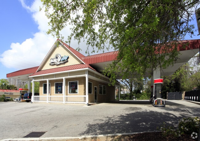
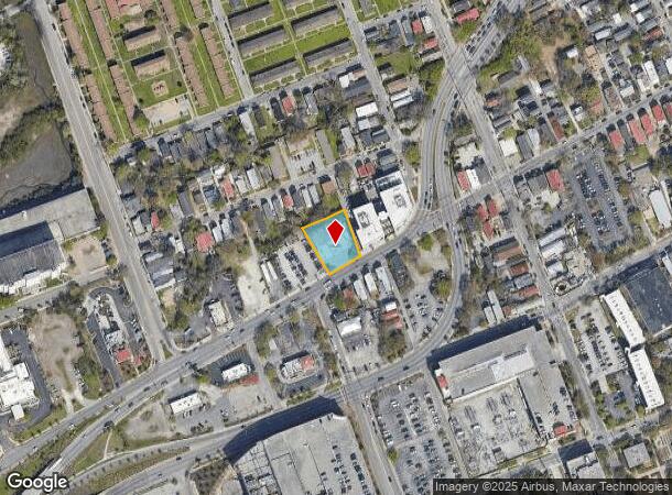
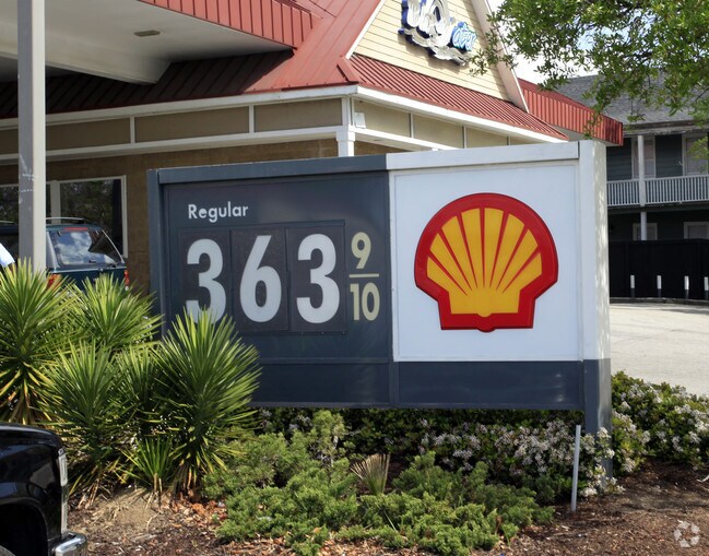
Property Record
200 Spring St, Charleston, SC 29403
NEARBY LISTINGS FOR SALE OR LEASE
Property Detail
200 Spring St
Charleston-North Charleston, SC
Plat Showing The Abandonment Of And Adju
460-11-01-011
DESCRIPTION -LOT A
Commercialacreage
Charleston
AE
South Carolina
45019C0512K
a
2025
0.42 AC
2024
Downtown Charleston
001100
Charleston/N Charleston
1,232 SF
DEMOGRAPHICS near 200 Spring St
1 Mile
3 Mile
5 Mile
2024 Total Population
16,878
58,735
133,147
2029 Population
18,512
63,738
143,543
Pop Growth 2024-2029
+ 9.68%
+ 8.52%
+ 7.81%
Average Age
34
38
40
2024 Total Households
8,071
26,879
59,311
HH Growth 2024-2029
+ 9.73%
+ 8.63%
+ 7.78%
Median Household Inc
$59,913
$68,035
$73,472
Avg Household Size
1.90
2.00
2.10
2024 Avg HH Vehicles
1.00
2.00
2.00
Median Home Value
$616,871
$551,272
$455,385
Median Year Built
1959
1963
1974
Nearby Places
Map Layers
Map Styles
 Street
 Aerial
- Restaurants
- Banks
- Shops
- Fitness
- Groceries
PUBLIC TRANSPORTATION
COMMUTER RAIL
DRIVE
WALK
Distance
14 min
8.1 mi
AIRPORT
Charleston AFB/International
DRIVE
WALK
Distance
Charleston AFB/International
24 min
14.1 mi
Freight Ports
Columbus Street Terminal
DRIVE
WALK
Distance
Columbus Street Terminal
4 min
1.6 mi
Nearby Properties
Address
Land Use
TOTAL SIZE
Lot Size
Zoning
Address
Land Use
TOTAL SIZE
Lot Size
Zoning
79,990 SF
9.22 AC
Address
Land Use
TOTAL SIZE
Lot Size
Zoning
2,592 SF
13.64 AC
Address
Land Use
TOTAL SIZE
Lot Size
Zoning
Address
Land Use
TOTAL SIZE
Lot Size
Zoning
0.62 AC
Address
Land Use
TOTAL SIZE
Lot Size
Zoning
80,044 SF
2.48 AC
Address
Land Use
TOTAL SIZE
Lot Size
Zoning
85,408 SF
9.39 AC
Address
Land Use
TOTAL SIZE
Lot Size
Zoning
22,620 SF
12.23 AC
Address
Land Use
TOTAL SIZE
Lot Size
Zoning
66,136 SF
1.88 AC
Address
Land Use
TOTAL SIZE
Lot Size
Zoning
8,472 SF
9.84 AC
Address
Land Use
TOTAL SIZE
Lot Size
Zoning
8,472 SF
9.83 AC
Address
Land Use
TOTAL SIZE
Lot Size
Zoning
Address
Land Use
TOTAL SIZE
Lot Size
Zoning
1,435 SF
1.98 AC
Address
Land Use
TOTAL SIZE
Lot Size
Zoning
6.11 AC
Address
Land Use
TOTAL SIZE
Lot Size
Zoning
17,459 SF
4.16 AC
Address
Land Use
TOTAL SIZE
Lot Size
Zoning
8,714 SF
1.60 AC
Address
Land Use
TOTAL SIZE
Lot Size
Zoning
Address
Land Use
TOTAL SIZE
Lot Size
Zoning
1,282 SF
8.42 AC
Address
Land Use
TOTAL SIZE
Lot Size
Zoning
Address
Land Use
TOTAL SIZE
Lot Size
Zoning
Address
Land Use
TOTAL SIZE
Lot Size
Zoning
5,733 SF
0.10 AC
Address
Land Use
TOTAL SIZE
Lot Size
Zoning
43,934 SF
1.50 AC
Address
Land Use
TOTAL SIZE
Lot Size
Zoning
14,240 SF
3.50 AC
Address
Land Use
TOTAL SIZE
Lot Size
Zoning
8,740 SF
0.58 AC
Address
Land Use
TOTAL SIZE
Lot Size
Zoning
1,150 SF
Address
Land Use
TOTAL SIZE
Lot Size
Zoning
24,320 SF
1.31 AC
Address
Land Use
TOTAL SIZE
Lot Size
Zoning
29,910 SF
2.82 AC
Address
Land Use
TOTAL SIZE
Lot Size
Zoning
41,070 SF
0.61 AC
Address
Land Use
TOTAL SIZE
Lot Size
Zoning
Address
Land Use
TOTAL SIZE
Lot Size
Zoning
22,825 SF
4.36 AC
Address
Land Use
TOTAL SIZE
Lot Size
Zoning
6.57 AC
The World's #1 Commercial Real Estate Marketplace
Connect with us
© 2026 CoStar Group
The information above has been obtained from sources believed reliable. While we do not doubt its accuracy we have not verified it and make no guarantee, warranty or representation about it. It is your responsibility to independently confirm its accuracy and completeness. Any projections, opinions, assumptions, or estimates used are for example only and do not represent the current or future performance of the property. The value of this transaction to you depends on tax and other factors which should be evaluated by your tax, financial, and legal advisors. You and your advisors should conduct a careful, independent investigation of the property to determine to your satisfaction the suitability of the property for your needs.