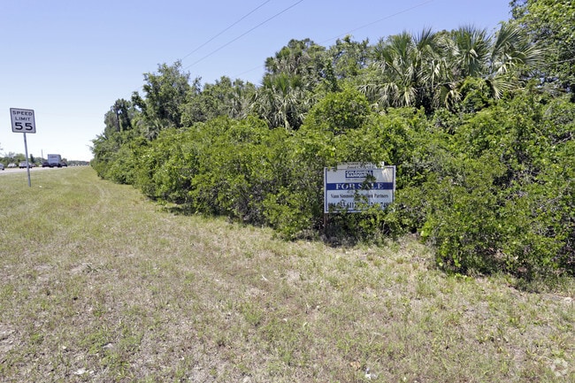
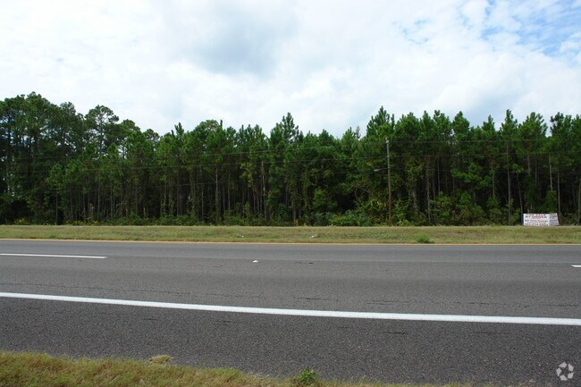
Property Record
200 Sr, Fernandina Beach, FL 32034

NEARBY LISTINGS FOR SALE OR LEASE
Property Detail
200 Sr
Jacksonville, FL
Piney Island
37-2N-28-5000-000A-0000
PT OF TRACT B PT OR 236/535 & OR 1253/1846 & PT OR 1201/1678 & OR 1429/1157 PINEY ISLAND PB 4/63 & 64
Miscellaneous
Nassau
AE
Florida
12089C0238G
a
2025
42.78 AC
2025
Nassau County
050203
Jacksonville (Florida)
DEMOGRAPHICS near 200 Sr
1 Mile
3 Mile
5 Mile
2024 Total Population
857
18,065
52,528
2029 Population
1,052
21,890
63,965
Pop Growth 2024-2029
+ 22.75%
+ 21.17%
+ 21.77%
Average Age
44
47
48
2024 Total Households
351
7,615
22,572
HH Growth 2024-2029
+ 23.93%
+ 22.38%
+ 23.02%
Median Household Inc
$91,703
$90,231
$86,467
Avg Household Size
2.40
2.30
2.30
2024 Avg HH Vehicles
2.00
2.00
2.00
Median Home Value
$508,333
$385,457
$384,081
Median Year Built
2010
2005
2000
Nearby Places
Map Layers
Map Styles
 Street
 Aerial
- Restaurants
- Banks
- Shops
- Fitness
- Groceries
PUBLIC TRANSPORTATION
AIRPORT
Jacksonville International
DRIVE
WALK
Distance
Jacksonville International
35 min
20.3 mi
Freight Ports
Jacksonville Port
DRIVE
WALK
Distance
Jacksonville Port
44 min
31.8 mi
SALE & LEASE HISTORY
LISTING DATE
SALE/LEASE

Sep 25, 2016
For Lease
Nearby Properties
Address
Land Use
TOTAL SIZE
Lot Size
Zoning
Address
Land Use
TOTAL SIZE
Lot Size
Zoning
97,988 SF
513.95 AC
I-1
Address
Land Use
TOTAL SIZE
Lot Size
Zoning
221,536 SF
11.16 AC
C-2
Address
Land Use
TOTAL SIZE
Lot Size
Zoning
99,805 SF
15.24 AC
C-1
Address
Land Use
TOTAL SIZE
Lot Size
Zoning
505,582 SF
146.44 AC
CON
Address
Land Use
TOTAL SIZE
Lot Size
Zoning
210,010 SF
19.36 AC
RG-1
Address
Land Use
TOTAL SIZE
Lot Size
Zoning
134,407 SF
2.77 AC
PUD
Address
Land Use
TOTAL SIZE
Lot Size
Zoning
Address
Land Use
TOTAL SIZE
Lot Size
Zoning
63,363 SF
10.41 AC
PUD
Address
Land Use
TOTAL SIZE
Lot Size
Zoning
109,630 SF
12.59 AC
C-2
Address
Land Use
TOTAL SIZE
Lot Size
Zoning
66,417 SF
8.75 AC
PUD
Address
Land Use
TOTAL SIZE
Lot Size
Zoning
163,686 SF
28.08 AC
CI
Address
Land Use
TOTAL SIZE
Lot Size
Zoning
21,240 SF
5.84 AC
C-2
Address
Land Use
TOTAL SIZE
Lot Size
Zoning
34,378 SF
12.91 AC
PI-1
Address
Land Use
TOTAL SIZE
Lot Size
Zoning
105,105 SF
2.65 AC
CG
Address
Land Use
TOTAL SIZE
Lot Size
Zoning
125,409 SF
8.44 AC
C-2
Address
Land Use
TOTAL SIZE
Lot Size
Zoning
145,581 SF
3 AC
CG
Address
Land Use
TOTAL SIZE
Lot Size
Zoning
59,770 SF
8.51 AC
GPU
Address
Land Use
TOTAL SIZE
Lot Size
Zoning
1,920 SF
18.38 AC
I-1
Address
Land Use
TOTAL SIZE
Lot Size
Zoning
54,600 SF
6.83 AC
RG-1
Address
Land Use
TOTAL SIZE
Lot Size
Zoning
44,933 SF
5.03 AC
PUD
Address
Land Use
TOTAL SIZE
Lot Size
Zoning
39,704 SF
3.68 AC
C-2
Address
Land Use
TOTAL SIZE
Lot Size
Zoning
89,600 SF
1.87 AC
CI
Address
Land Use
TOTAL SIZE
Lot Size
Zoning
44,734 SF
9.59 AC
OR
Address
Land Use
TOTAL SIZE
Lot Size
Zoning
91,292 SF
5.92 AC
CI
Address
Land Use
TOTAL SIZE
Lot Size
Zoning
30,044 SF
1.94 AC
I-1
Address
Land Use
TOTAL SIZE
Lot Size
Zoning
35,296 SF
6.72 AC
PUD
Address
Land Use
TOTAL SIZE
Lot Size
Zoning
32,449 SF
7.57 AC
CI
Address
Land Use
TOTAL SIZE
Lot Size
Zoning
48,460 SF
14.60 AC
PUD
Address
Land Use
TOTAL SIZE
Lot Size
Zoning
50,286 SF
4.39 AC
PUD
Address
Land Use
TOTAL SIZE
Lot Size
Zoning
The World's #1 Commercial Real Estate Marketplace
Connect with us
© 2025 CoStar Group
The information above has been obtained from sources believed reliable. While we do not doubt its accuracy we have not verified it and make no guarantee, warranty or representation about it. It is your responsibility to independently confirm its accuracy and completeness. Any projections, opinions, assumptions, or estimates used are for example only and do not represent the current or future performance of the property. The value of this transaction to you depends on tax and other factors which should be evaluated by your tax, financial, and legal advisors. You and your advisors should conduct a careful, independent investigation of the property to determine to your satisfaction the suitability of the property for your needs.