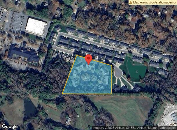
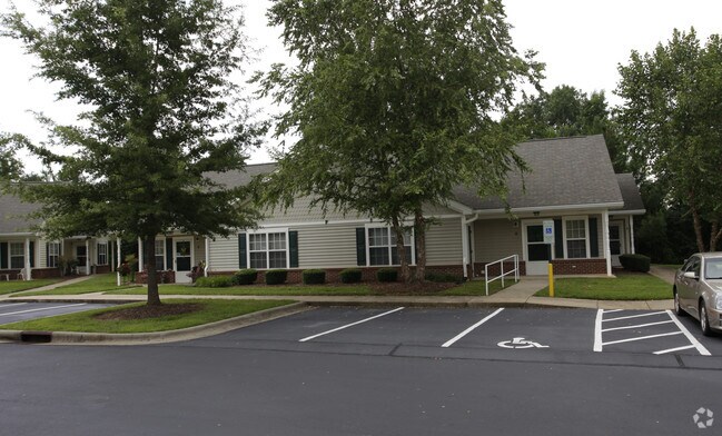
Property Record
200 T R Harris Dr, Shelby, NC 28150

NEARBY LISTINGS FOR SALE OR LEASE
-
-
View all Shelby listings for sale on LoopNet.com
Property Detail
200 T R Harris Dr
56626
#1 PB27-50FOREST GLEN
Officebuilding
Cleveland
X
North Carolina
3710254700J
78
2025
4 AC
2025
Cleveland County
950900
Charlotte
900 SF
Shelby, NC
DEMOGRAPHICS near 200 T R Harris Dr
1 Mile
3 Mile
5 Mile
2024 Total Population
2,808
18,587
36,358
2029 Population
2,932
19,522
38,013
Pop Growth 2024-2029
+ 4.42%
+ 5.03%
+ 4.55%
Average Age
43
42
42
2024 Total Households
1,271
7,805
15,157
HH Growth 2024-2029
+ 4.41%
+ 5.07%
+ 4.57%
Median Household Inc
$34,780
$40,989
$44,094
Avg Household Size
2.10
2.20
2.30
2024 Avg HH Vehicles
2.00
2.00
2.00
Median Home Value
$121,572
$147,569
$149,156
Median Year Built
1972
1973
1976
Nearby Places
Map Layers
Map Styles
 Street
 Aerial
- Restaurants
- Banks
- Shops
- Fitness
- Groceries
Nearby Properties
Address
Land Use
TOTAL SIZE
Lot Size
Zoning
Address
Land Use
TOTAL SIZE
Lot Size
Zoning
15.70 AC
RO
Address
Land Use
TOTAL SIZE
Lot Size
Zoning
92,278 SF
41.63 AC
R10
Address
Land Use
TOTAL SIZE
Lot Size
Zoning
12.80 AC
R10
Address
Land Use
TOTAL SIZE
Lot Size
Zoning
6,250 SF
18.80 AC
HI
Address
Land Use
TOTAL SIZE
Lot Size
Zoning
29,747 SF
21.06 AC
RO
Address
Land Use
TOTAL SIZE
Lot Size
Zoning
224,162 SF
15 AC
GBCU
Address
Land Use
TOTAL SIZE
Lot Size
Zoning
18,864 SF
10.65 AC
ROCU
Address
Land Use
TOTAL SIZE
Lot Size
Zoning
1,436 SF
8.02 AC
RO
Address
Land Use
TOTAL SIZE
Lot Size
Zoning
24,652 SF
3.72 AC
R10
Address
Land Use
TOTAL SIZE
Lot Size
Zoning
44,684 SF
4.44 AC
RO
Address
Land Use
TOTAL SIZE
Lot Size
Zoning
63,543 SF
24.07 AC
R20
Address
Land Use
TOTAL SIZE
Lot Size
Zoning
46,948 SF
2.06 AC
GB
Address
Land Use
TOTAL SIZE
Lot Size
Zoning
78,165 SF
8.02 AC
GB
Address
Land Use
TOTAL SIZE
Lot Size
Zoning
134,978 SF
14.50 AC
GB2CU
Address
Land Use
TOTAL SIZE
Lot Size
Zoning
43,540 SF
2.96 AC
GI
Address
Land Use
TOTAL SIZE
Lot Size
Zoning
36,511 SF
11.57 AC
GB2
Address
Land Use
TOTAL SIZE
Lot Size
Zoning
93.55 AC
R10
Address
Land Use
TOTAL SIZE
Lot Size
Zoning
40,074 SF
16 AC
R20
Address
Land Use
TOTAL SIZE
Lot Size
Zoning
24,255 SF
8.28 AC
GB2
Address
Land Use
TOTAL SIZE
Lot Size
Zoning
130 SF
6.14 AC
CB
Address
Land Use
TOTAL SIZE
Lot Size
Zoning
50,776 SF
15.10 AC
R20
Address
Land Use
TOTAL SIZE
Lot Size
Zoning
33,067 SF
3.10 AC
R6CU
Address
Land Use
TOTAL SIZE
Lot Size
Zoning
19,069 SF
12.69 AC
ROCU
Address
Land Use
TOTAL SIZE
Lot Size
Zoning
35,829 SF
4 AC
GB
Address
Land Use
TOTAL SIZE
Lot Size
Zoning
29,969 SF
9.28 AC
CPD
Address
Land Use
TOTAL SIZE
Lot Size
Zoning
49,947 SF
1 AC
GB
Address
Land Use
TOTAL SIZE
Lot Size
Zoning
19,665 SF
68.06 AC
GI
Address
Land Use
TOTAL SIZE
Lot Size
Zoning
2,585 SF
5.62 AC
RO
Address
Land Use
TOTAL SIZE
Lot Size
Zoning
23,500 SF
0.81 AC
RO
Address
Land Use
TOTAL SIZE
Lot Size
Zoning
27,800 SF
2.16 AC
RO
The World's #1 Commercial Real Estate Marketplace
Connect with us
© 2025 CoStar Group
The information above has been obtained from sources believed reliable. While we do not doubt its accuracy we have not verified it and make no guarantee, warranty or representation about it. It is your responsibility to independently confirm its accuracy and completeness. Any projections, opinions, assumptions, or estimates used are for example only and do not represent the current or future performance of the property. The value of this transaction to you depends on tax and other factors which should be evaluated by your tax, financial, and legal advisors. You and your advisors should conduct a careful, independent investigation of the property to determine to your satisfaction the suitability of the property for your needs.