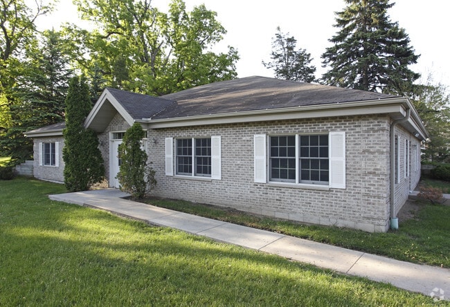
Property Record
200 Thompson Ave E, Saint Paul, MN 55118
NEARBY LISTINGS FOR SALE OR LEASE
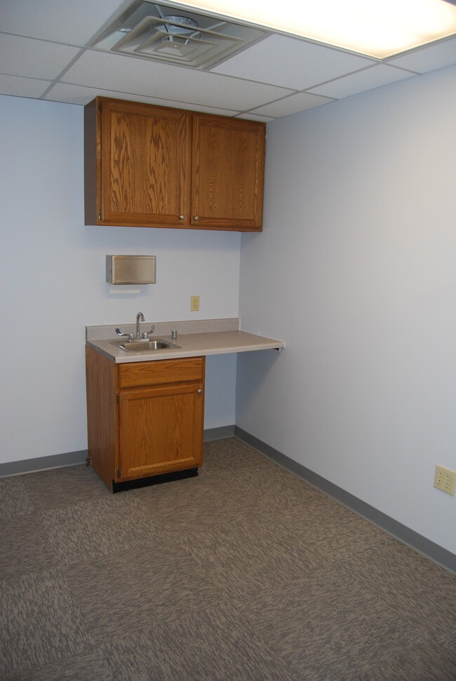
Property Detail
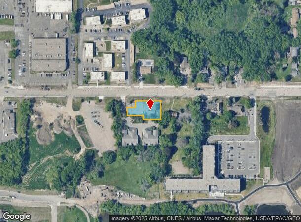
200 Thompson Ave E
Minneapolis-St. Paul-Bloomington, MN-WI
Andler & Olsons Addition
42-11560-02-012
1 2 PT OF LOT 1 BEG NE CORNER S ON EAST LINE 105 FT THEN W 97.5 FT N 20 FT W 90 FT N 50 FT E 45 FT N 35 FT TO N LINE E TO PT OF BEG ANDLER & OLSONS ADDITIONON
Commercialnec
Dakota
X
Minnesota
27037C0040E
1
2024
0.37 AC
2024
Suburban St Paul
060105
Minneapolis/St Paul
3,000 SF
DEMOGRAPHICS near 200 Thompson Ave E
1 Mile
3 Mile
5 Mile
2024 Total Population
14,037
73,143
245,872
2029 Population
14,500
74,031
244,344
Pop Growth 2024-2029
+ 3.30%
+ 1.21%
(0.62%)
Average Age
42
40
39
2024 Total Households
6,443
30,526
100,195
HH Growth 2024-2029
+ 3.57%
+ 1.36%
(0.57%)
Median Household Inc
$55,968
$71,828
$68,531
Avg Household Size
2.10
2.30
2.30
2024 Avg HH Vehicles
1.00
2.00
2.00
Median Home Value
$253,429
$272,155
$284,830
Median Year Built
1972
1968
1964
Nearby Places
Map Layers
Map Styles
 Street
 Aerial
- Restaurants
- Banks
- Shops
- Fitness
- Groceries
PUBLIC TRANSPORTATION
COMMUTER RAIL
DRIVE
WALK
Distance
8 min
3.6 mi
AIRPORT
Minneapolis-St Paul International/Wold-Chamberlain
DRIVE
WALK
Distance
Minneapolis-St Paul International/Wold-Chamberlain
18 min
9.7 mi
SALE & LEASE HISTORY
LISTING DATE
SALE/LEASE

Oct 25, 2018
For Sale
Jun 10, 2020
For Sale
Nearby Properties
Address
Land Use
TOTAL SIZE
Lot Size
Zoning
Address
Land Use
TOTAL SIZE
Lot Size
Zoning
63.12 AC
Address
Land Use
TOTAL SIZE
Lot Size
Zoning
Address
Land Use
TOTAL SIZE
Lot Size
Zoning
146,085 SF
46.83 AC
Address
Land Use
TOTAL SIZE
Lot Size
Zoning
329,070 SF
5.75 AC
Address
Land Use
TOTAL SIZE
Lot Size
Zoning
445,437 SF
7.80 AC
Address
Land Use
TOTAL SIZE
Lot Size
Zoning
265,736 SF
6.67 AC
Address
Land Use
TOTAL SIZE
Lot Size
Zoning
3.13 AC
Address
Land Use
TOTAL SIZE
Lot Size
Zoning
32,159 SF
448.26 AC
Address
Land Use
TOTAL SIZE
Lot Size
Zoning
247,470 SF
2.21 AC
Address
Land Use
TOTAL SIZE
Lot Size
Zoning
217,703 SF
3.51 AC
Address
Land Use
TOTAL SIZE
Lot Size
Zoning
293,970 SF
31.92 AC
Address
Land Use
TOTAL SIZE
Lot Size
Zoning
278,172 SF
1.97 AC
Address
Land Use
TOTAL SIZE
Lot Size
Zoning
282,178 SF
1.86 AC
Address
Land Use
TOTAL SIZE
Lot Size
Zoning
224,944 SF
3.15 AC
Address
Land Use
TOTAL SIZE
Lot Size
Zoning
37,846 SF
2.86 AC
Address
Land Use
TOTAL SIZE
Lot Size
Zoning
222,299 SF
1.61 AC
Address
Land Use
TOTAL SIZE
Lot Size
Zoning
228,050 SF
0.32 AC
Address
Land Use
TOTAL SIZE
Lot Size
Zoning
243,847 SF
5.24 AC
Address
Land Use
TOTAL SIZE
Lot Size
Zoning
245,570 SF
2.85 AC
Address
Land Use
TOTAL SIZE
Lot Size
Zoning
210,540 SF
5.35 AC
Address
Land Use
TOTAL SIZE
Lot Size
Zoning
156,636 SF
0.77 AC
Address
Land Use
TOTAL SIZE
Lot Size
Zoning
Address
Land Use
TOTAL SIZE
Lot Size
Zoning
163,985 SF
7.06 AC
Address
Land Use
TOTAL SIZE
Lot Size
Zoning
381,395 SF
15.31 AC
Address
Land Use
TOTAL SIZE
Lot Size
Zoning
163,561 SF
41.09 AC
Address
Land Use
TOTAL SIZE
Lot Size
Zoning
293,717 SF
33.30 AC
Address
Land Use
TOTAL SIZE
Lot Size
Zoning
482,008 SF
23.78 AC
Address
Land Use
TOTAL SIZE
Lot Size
Zoning
452,836 SF
17.81 AC
Address
Land Use
TOTAL SIZE
Lot Size
Zoning
Address
Land Use
TOTAL SIZE
Lot Size
Zoning
229,442 SF
9.50 AC
The World's #1 Commercial Real Estate Marketplace
Connect with us
© 2026 CoStar Group
The information above has been obtained from sources believed reliable. While we do not doubt its accuracy we have not verified it and make no guarantee, warranty or representation about it. It is your responsibility to independently confirm its accuracy and completeness. Any projections, opinions, assumptions, or estimates used are for example only and do not represent the current or future performance of the property. The value of this transaction to you depends on tax and other factors which should be evaluated by your tax, financial, and legal advisors. You and your advisors should conduct a careful, independent investigation of the property to determine to your satisfaction the suitability of the property for your needs.