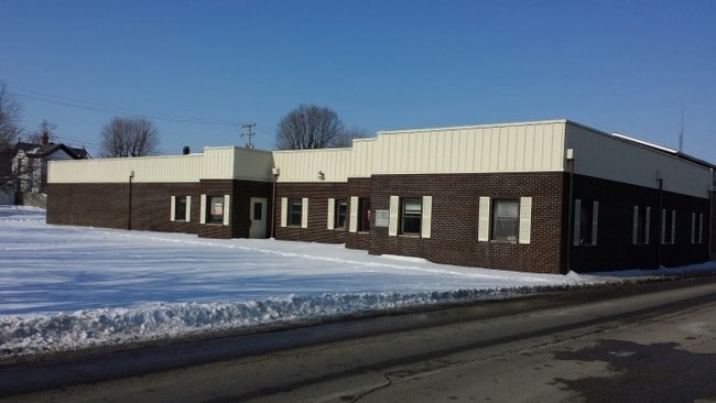
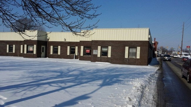
Property Record
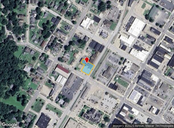
200 W 5Th St, Connersville, IN 47331
NEARBY LISTINGS FOR SALE OR LEASE
Property Detail
200 W 5Th St
21-05-25-120-005.000-003
HARLAN PT. LOTS # 97 & 98 510 WASHINGTON AVE.
Officebuilding
Fayette
X
Indiana
18177C0325E
97-98
0
0.31 AC
2024
Indiana South Area
954400
Other Market Areas
7,311 SF
Connersville, IN
DEMOGRAPHICS near 200 W 5Th St
1 Mile
3 Mile
5 Mile
2024 Total Population
7,053
16,427
19,212
2029 Population
7,096
16,381
19,126
Pop Growth 2024-2029
+ 0.61%
(0.28%)
(0.45%)
Average Age
41
42
42
2024 Total Households
2,936
6,981
8,094
HH Growth 2024-2029
+ 0.58%
(0.29%)
(0.46%)
Median Household Inc
$41,959
$44,315
$47,117
Avg Household Size
2.30
2.30
2.30
2024 Avg HH Vehicles
2.00
2.00
2.00
Median Home Value
$82,450
$83,891
$89,285
Median Year Built
1952
1957
1960
Nearby Places
Map Layers
Map Styles
 Street
 Aerial
- Restaurants
- Banks
- Shops
- Fitness
- Groceries
PUBLIC TRANSPORTATION
COMMUTER RAIL
DRIVE
WALK
Distance
2 min
11 min
0.6 mi
Nearby Properties
Address
Land Use
TOTAL SIZE
Lot Size
Zoning
Address
Land Use
TOTAL SIZE
Lot Size
Zoning
360 SF
4.24 AC
Address
Land Use
TOTAL SIZE
Lot Size
Zoning
51,312 SF
5.36 AC
Address
Land Use
TOTAL SIZE
Lot Size
Zoning
121,181 SF
6.75 AC
Address
Land Use
TOTAL SIZE
Lot Size
Zoning
93,579 SF
4.70 AC
Address
Land Use
TOTAL SIZE
Lot Size
Zoning
82,982 SF
7.03 AC
Address
Land Use
TOTAL SIZE
Lot Size
Zoning
36,986 SF
7.05 AC
Address
Land Use
TOTAL SIZE
Lot Size
Zoning
141,636 SF
22 AC
Address
Land Use
TOTAL SIZE
Lot Size
Zoning
31,228 SF
3.08 AC
Address
Land Use
TOTAL SIZE
Lot Size
Zoning
30,250 SF
3.38 AC
Address
Land Use
TOTAL SIZE
Lot Size
Zoning
1,478 SF
4.03 AC
R33
Address
Land Use
TOTAL SIZE
Lot Size
Zoning
16,908 SF
4.01 AC
R33
Address
Land Use
TOTAL SIZE
Lot Size
Zoning
79,772 SF
7.19 AC
Address
Land Use
TOTAL SIZE
Lot Size
Zoning
24,390 SF
2.62 AC
Address
Land Use
TOTAL SIZE
Lot Size
Zoning
30,166 SF
14 AC
MS
Address
Land Use
TOTAL SIZE
Lot Size
Zoning
12,746 SF
2.01 AC
Address
Land Use
TOTAL SIZE
Lot Size
Zoning
54,557 SF
2.27 AC
R-1
Address
Land Use
TOTAL SIZE
Lot Size
Zoning
25,000 SF
1.67 AC
Address
Land Use
TOTAL SIZE
Lot Size
Zoning
24,442 SF
27.36 AC
MS
Address
Land Use
TOTAL SIZE
Lot Size
Zoning
7,644 SF
4.70 AC
Address
Land Use
TOTAL SIZE
Lot Size
Zoning
37,716 SF
12.77 AC
Address
Land Use
TOTAL SIZE
Lot Size
Zoning
16,320 SF
1.25 AC
Address
Land Use
TOTAL SIZE
Lot Size
Zoning
15,191 SF
6 AC
MS
Address
Land Use
TOTAL SIZE
Lot Size
Zoning
12,399 SF
2.06 AC
Address
Land Use
TOTAL SIZE
Lot Size
Zoning
12,430 SF
2.06 AC
Address
Land Use
TOTAL SIZE
Lot Size
Zoning
9,384 SF
3.06 AC
GB
Address
Land Use
TOTAL SIZE
Lot Size
Zoning
11,488 SF
2.31 AC
Address
Land Use
TOTAL SIZE
Lot Size
Zoning
6,696 SF
0.68 AC
Address
Land Use
TOTAL SIZE
Lot Size
Zoning
11,730 SF
1.38 AC
Address
Land Use
TOTAL SIZE
Lot Size
Zoning
9,170 SF
3.04 AC
R-2
Address
Land Use
TOTAL SIZE
Lot Size
Zoning
12,464 SF
2.06 AC
PB
The World's #1 Commercial Real Estate Marketplace
Connect with us
© 2026 CoStar Group
The information above has been obtained from sources believed reliable. While we do not doubt its accuracy we have not verified it and make no guarantee, warranty or representation about it. It is your responsibility to independently confirm its accuracy and completeness. Any projections, opinions, assumptions, or estimates used are for example only and do not represent the current or future performance of the property. The value of this transaction to you depends on tax and other factors which should be evaluated by your tax, financial, and legal advisors. You and your advisors should conduct a careful, independent investigation of the property to determine to your satisfaction the suitability of the property for your needs.