Property Record
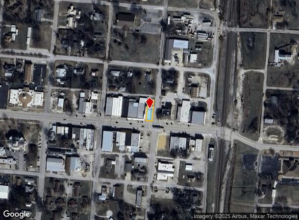
200 W Main St, Marietta, OK 73448
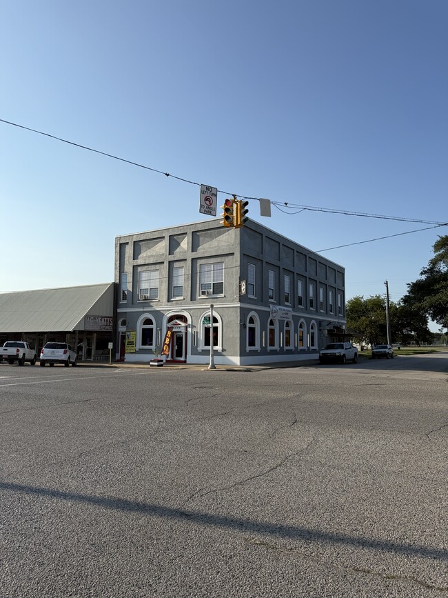
This Property Is For Sale
NEARBY LISTINGS FOR SALE OR LEASE
-
-
View all Marietta listings for sale on LoopNet.com
Property Detail
200 W Main St
Other Market Areas
Marietta City
1040-00-023-005-0-000-00
ALL LOT 5 BLK 23 MARIETTA CITY
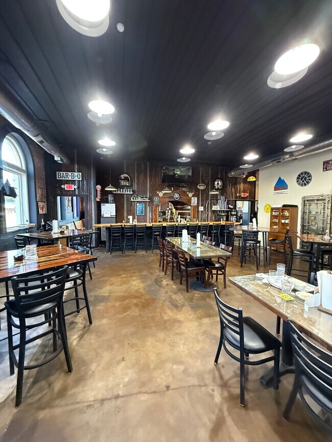
Restaurantbuilding
Love
2025
Oklahoma
2025
5
094100
0.13 AC
6,192 SF
Oklahoma East Area
DEMOGRAPHICS near 200 W Main St
1 mile
3 mile
5 mile
2024 Total Population
2,447
3,377
4,148
2029 Population
2,474
3,433
4,216
Pop Growth 2024-2029
+ 1.10%
+ 1.66%
+ 1.64%
Average Age
38
39
39
2024 Total Households
885
1,234
1,547
HH Growth 2024-2029
+ 0.90%
+ 1.46%
+ 1.49%
Median Household Inc
$41,920
$44,298
$47,500
Avg Household Size
2.70
2.60
2.60
2024 Avg HH Vehicles
2.00
2.00
2.00
Median Home Value
$91,176
$107,391
$121,754
Median Year Built
1972
1974
1975
Nearby Places
Map Layers
Map Styles
 Street
 Aerial
Transit
 Traffic
 Biking
Places
Listings with unknown addresses are not visible on the map
- Restaurants
- Banks
- Shops
- Fitness
- Groceries
Nearby Properties
Address
Land Use
TOTAL SIZE
Lot Size
Zoning
Address
Land Use
TOTAL SIZE
Lot Size
Zoning
60,000 SF
8.10 AC
C2
Address
Land Use
TOTAL SIZE
Lot Size
Zoning
6,951 SF
400.36 AC
R1
Address
Land Use
TOTAL SIZE
Lot Size
Zoning
3,402 SF
2.53 AC
C1
Address
Land Use
TOTAL SIZE
Lot Size
Zoning
1,008 SF
0.96 AC
C1
Address
Land Use
TOTAL SIZE
Lot Size
Zoning
17,560 SF
5.18 AC
C1
Address
Land Use
TOTAL SIZE
Lot Size
Zoning
159.13 AC
IP
Address
Land Use
TOTAL SIZE
Lot Size
Zoning
603,681 SF
85.64 AC
C2
Address
Land Use
TOTAL SIZE
Lot Size
Zoning
480 SF
20.34 AC
NP
Address
Land Use
TOTAL SIZE
Lot Size
Zoning
2,160 SF
0.12 AC
Address
Land Use
TOTAL SIZE
Lot Size
Zoning
16,660 SF
5.36 AC
C1
Address
Land Use
TOTAL SIZE
Lot Size
Zoning
373 SF
1.49 AC
C1
Address
Land Use
TOTAL SIZE
Lot Size
Zoning
22,440 SF
3 AC
C2
Address
Land Use
TOTAL SIZE
Lot Size
Zoning
4,158 SF
1.66 AC
C1
Address
Land Use
TOTAL SIZE
Lot Size
Zoning
84.53 AC
IP
Address
Land Use
TOTAL SIZE
Lot Size
Zoning
4,419 SF
8.02 AC
C1
Address
Land Use
TOTAL SIZE
Lot Size
Zoning
50 SF
2.55 AC
C1
Address
Land Use
TOTAL SIZE
Lot Size
Zoning
2,859 SF
14.87 AC
CR
Address
Land Use
TOTAL SIZE
Lot Size
Zoning
3,798 SF
0.86 AC
C1
Address
Land Use
TOTAL SIZE
Lot Size
Zoning
7,572 SF
1.09 AC
C2
Address
Land Use
TOTAL SIZE
Lot Size
Zoning
3,725 SF
13.33 AC
NP
Address
Land Use
TOTAL SIZE
Lot Size
Zoning
5,020 SF
50 AC
R1
Address
Land Use
TOTAL SIZE
Lot Size
Zoning
450 SF
0.65 AC
Address
Land Use
TOTAL SIZE
Lot Size
Zoning
6,351 SF
3 AC
C2
Address
Land Use
TOTAL SIZE
Lot Size
Zoning
6,000 SF
283.48 AC
IP
Address
Land Use
TOTAL SIZE
Lot Size
Zoning
5,776 SF
39.32 AC
R1
Address
Land Use
TOTAL SIZE
Lot Size
Zoning
4,271 SF
15.95 AC
R1
Address
Land Use
TOTAL SIZE
Lot Size
Zoning
480 SF
1.07 AC
C2
Address
Land Use
TOTAL SIZE
Lot Size
Zoning
3,223 SF
90 AC
NP
Address
Land Use
TOTAL SIZE
Lot Size
Zoning
1,927 SF
40 AC
R1
The World's #1 Commercial Real Estate Marketplace
Connect with us
© 2026 CoStar Group
The information above has been obtained from sources believed reliable. While we do not doubt its accuracy we have not verified it and make no guarantee, warranty or representation about it. It is your responsibility to independently confirm its accuracy and completeness. Any projections, opinions, assumptions, or estimates used are for example only and do not represent the current or future performance of the property. The value of this transaction to you depends on tax and other factors which should be evaluated by your tax, financial, and legal advisors. You and your advisors should conduct a careful, independent investigation of the property to determine to your satisfaction the suitability of the property for your needs.