Property Record
200 Washington St, Boxford, MA 01921
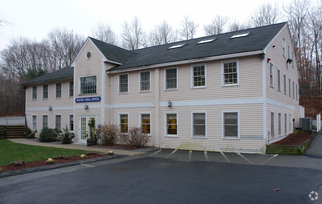


Property Detail
200 Washington St
BOXF-000009-000001-000011
Essex
Officebuilding
Massachusetts
AE The base floodplain where base flood elevations are provided. AE Zones are now used on new format FIRMs instead of A1-A30 Zones.
11
2025
1.27 AC
2025
Amesbury/Ipswich
213100
Boston
6,676 SF
Boston-Cambridge-Newton, MA-NH
NEARBY LISTINGS FOR SALE OR LEASE
DEMOGRAPHICS near 200 Washington St
1 mile
3 mile
5 mile
2025 Total Population
1,243
19,408
152,060
2030 Population
1,275
20,132
154,811
Pop Growth 2025-2030
+ 2.57%
+ 3.73%
+ 1.81%
Average Age
43
42
39
2025 Total Households
415
7,078
55,522
HH Growth 2025-2030
+ 2.65%
+ 3.77%
+ 1.96%
Median Household Inc
$156,250
$146,119
$89,860
Avg Household Size
2.90
2.70
2.60
2025 Avg HH Vehicles
3.00
2.00
2.00
Median Home Value
$833,976
$729,745
$580,331
Median Year Built
1976
1979
1964
Nearby Places
Map Layers
Map Styles
 Street
 Aerial
Transit
 Traffic
 Biking
Places
Listings with unknown addresses are not visible on the map
- Restaurants
- Banks
- Shops
- Fitness
- Groceries
PUBLIC TRANSPORTATION
COMMUTER RAIL
Lawrence (Haverhill Line - Massachusetts Bay Transportation Authority Commuter Rail (Purple Line))
Drive
Walk
Distance
Lawrence (Haverhill Line - Massachusetts Bay Transportation Authority Commuter Rail (Purple Line))
10 min
4.8 mi
Bradford (Haverhill Line - Massachusetts Bay Transportation Authority Commuter Rail (Purple Line))
Drive
Walk
Distance
Bradford (Haverhill Line - Massachusetts Bay Transportation Authority Commuter Rail (Purple Line))
11 min
5.5 mi
AIRPORT
General Edward Lawrence Logan International
Drive
Walk
Distance
General Edward Lawrence Logan International
48 min
30.5 mi
Manchester Boston Regional
Drive
Walk
Distance
Manchester Boston Regional
51 min
31.5 mi
Portsmouth International at Pease
Drive
Walk
Distance
Portsmouth International at Pease
51 min
35.9 mi
Freight Ports
Port of Boston
Drive
Walk
Distance
Port of Boston
49 min
31.4 mi
SALE & LEASE HISTORY
LISTING DATE
SALE/LEASE

Oct 07, 2025
For Sale
Nearby Properties
Address
Land Use
TOTAL SIZE
Lot Size
Zoning
Address
Land Use
TOTAL SIZE
Lot Size
Zoning
6,680 SF
84.07 AC
R2
Address
Land Use
TOTAL SIZE
Lot Size
Zoning
9.28 AC
I2
Address
Land Use
TOTAL SIZE
Lot Size
Zoning
9,966 SF
67.03 AC
R2
Address
Land Use
TOTAL SIZE
Lot Size
Zoning
8.59 AC
IS
Address
Land Use
TOTAL SIZE
Lot Size
Zoning
71,785 SF
29 AC
R4
Address
Land Use
TOTAL SIZE
Lot Size
Zoning
9,920 SF
3.24 AC
B2
Address
Land Use
TOTAL SIZE
Lot Size
Zoning
260,720 SF
57.68 AC
I2
Address
Land Use
TOTAL SIZE
Lot Size
Zoning
215,739 SF
8.45 AC
IS
Address
Land Use
TOTAL SIZE
Lot Size
Zoning
53.50 AC
C
Address
Land Use
TOTAL SIZE
Lot Size
Zoning
899 SF
11.92 AC
IS
Address
Land Use
TOTAL SIZE
Lot Size
Zoning
72,528 SF
15 AC
R2
Address
Land Use
TOTAL SIZE
Lot Size
Zoning
21,360 SF
9.98 AC
R4
Address
Land Use
TOTAL SIZE
Lot Size
Zoning
76,842 SF
12.38 AC
Address
Land Use
TOTAL SIZE
Lot Size
Zoning
90,300 SF
2.86 AC
I
Address
Land Use
TOTAL SIZE
Lot Size
Zoning
165,518 SF
16.20 AC
I2
Address
Land Use
TOTAL SIZE
Lot Size
Zoning
58,912 SF
1.79 AC
R4
Address
Land Use
TOTAL SIZE
Lot Size
Zoning
4.56 AC
I2
Address
Land Use
TOTAL SIZE
Lot Size
Zoning
62,381 SF
7.85 AC
R5
Address
Land Use
TOTAL SIZE
Lot Size
Zoning
9,480 SF
153.15 AC
R2
Address
Land Use
TOTAL SIZE
Lot Size
Zoning
8,649 SF
47 AC
Address
Land Use
TOTAL SIZE
Lot Size
Zoning
50,094 SF
3.02 AC
IS
Address
Land Use
TOTAL SIZE
Lot Size
Zoning
6,966 SF
11.56 AC
R5
Address
Land Use
TOTAL SIZE
Lot Size
Zoning
31,307 SF
7.35 AC
GB
Address
Land Use
TOTAL SIZE
Lot Size
Zoning
56,884 SF
5.08 AC
R4
Address
Land Use
TOTAL SIZE
Lot Size
Zoning
3.16 AC
Address
Land Use
TOTAL SIZE
Lot Size
Zoning
28,810 SF
3.58 AC
R1
Address
Land Use
TOTAL SIZE
Lot Size
Zoning
55.15 AC
Address
Land Use
TOTAL SIZE
Lot Size
Zoning
576 SF
13.68 AC
R4
Address
Land Use
TOTAL SIZE
Lot Size
Zoning
13,411 SF
1.32 AC
B2
Address
Land Use
TOTAL SIZE
Lot Size
Zoning
7,921 SF
36.20 AC
R1
The World's #1 Commercial Real Estate Marketplace
Connect with us
© 2026 CoStar Group
The information above has been obtained from sources believed reliable. While we do not doubt its accuracy we have not verified it and make no guarantee, warranty or representation about it. It is your responsibility to independently confirm its accuracy and completeness. Any projections, opinions, assumptions, or estimates used are for example only and do not represent the current or future performance of the property. The value of this transaction to you depends on tax and other factors which should be evaluated by your tax, financial, and legal advisors. You and your advisors should conduct a careful, independent investigation of the property to determine to your satisfaction the suitability of the property for your needs.