Property Record
200 West Rd, Ellington, CT 06029
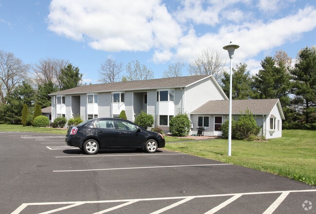

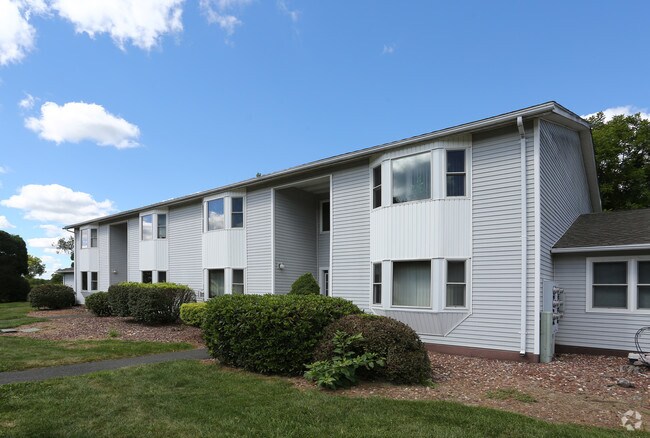
Property Detail
200 West Rd
ELLI-000055-000001
Capitol
Apartmenthouse100plusunits
Connecticut
C
19.38 AC
2025
Ellington/Somers/Stafford/Union
2025
Hartford
535101
Hartford-West Hartford-East Hartford, CT
NEARBY LISTINGS FOR SALE OR LEASE
DEMOGRAPHICS near 200 West Rd
1 mile
3 mile
5 mile
2025 Total Population
2,022
26,621
57,929
2030 Population
2,115
27,257
59,239
Pop Growth 2025-2030
+ 4.60%
+ 2.39%
+ 2.26%
Average Age
41
40
42
2025 Total Households
891
11,657
24,718
HH Growth 2025-2030
+ 4.71%
+ 2.44%
+ 2.34%
Median Household Inc
$107,456
$87,177
$97,767
Avg Household Size
2.20
2.20
2.30
2025 Avg HH Vehicles
2.00
2.00
2.00
Median Home Value
$408,772
$322,845
$333,430
Median Year Built
1985
1970
1975
Nearby Places
Map Layers
Map Styles
 Street
 Aerial
Layers
 Traffic
 Biking
Places
Listings with unknown addresses are not visible on the map
- Restaurants
- Banks
- Shops
- Fitness
- Groceries
PUBLIC TRANSPORTATION
AIRPORT
Bradley International
Drive
Walk
Distance
Bradley International
39 min
17.5 mi
Freight Ports
Port of New Haven
Drive
Walk
Distance
Port of New Haven
71 min
53.9 mi
Nearby Properties
Address
Land Use
TOTAL SIZE
Lot Size
Zoning
Address
Land Use
TOTAL SIZE
Lot Size
Zoning
3,200 SF
31.39 AC
INDUST
Address
Land Use
TOTAL SIZE
Lot Size
Zoning
52.04 AC
MF
Address
Land Use
TOTAL SIZE
Lot Size
Zoning
71.60 AC
MF
Address
Land Use
TOTAL SIZE
Lot Size
Zoning
40 AC
MF
Address
Land Use
TOTAL SIZE
Lot Size
Zoning
59.25 AC
C
Address
Land Use
TOTAL SIZE
Lot Size
Zoning
33.41 AC
MF
Address
Land Use
TOTAL SIZE
Lot Size
Zoning
7.95 AC
DBR
Address
Land Use
TOTAL SIZE
Lot Size
Zoning
29.97 AC
PC
Address
Land Use
TOTAL SIZE
Lot Size
Zoning
85,470 SF
14.11 AC
R
Address
Land Use
TOTAL SIZE
Lot Size
Zoning
47.78 AC
RAR
Address
Land Use
TOTAL SIZE
Lot Size
Zoning
24.66 AC
C
Address
Land Use
TOTAL SIZE
Lot Size
Zoning
85.13 AC
RW
Address
Land Use
TOTAL SIZE
Lot Size
Zoning
80,487 SF
11.41 AC
DMF
Address
Land Use
TOTAL SIZE
Lot Size
Zoning
31.50 AC
PRD
Address
Land Use
TOTAL SIZE
Lot Size
Zoning
15.84 AC
R
Address
Land Use
TOTAL SIZE
Lot Size
Zoning
13.44 AC
RC
Address
Land Use
TOTAL SIZE
Lot Size
Zoning
20.27 AC
MF
Address
Land Use
TOTAL SIZE
Lot Size
Zoning
10.30 AC
PRD
Address
Land Use
TOTAL SIZE
Lot Size
Zoning
73,280 SF
0.52 AC
DBR
Address
Land Use
TOTAL SIZE
Lot Size
Zoning
77,212 SF
19.60 AC
R
Address
Land Use
TOTAL SIZE
Lot Size
Zoning
10.35 AC
PRD
Address
Land Use
TOTAL SIZE
Lot Size
Zoning
12.23 AC
C
Address
Land Use
TOTAL SIZE
Lot Size
Zoning
63,564 SF
7.52 AC
COMMER
Address
Land Use
TOTAL SIZE
Lot Size
Zoning
87,198 SF
6.44 AC
PND
Address
Land Use
TOTAL SIZE
Lot Size
Zoning
18.84 AC
MF
Address
Land Use
TOTAL SIZE
Lot Size
Zoning
6.30 AC
PRD
Address
Land Use
TOTAL SIZE
Lot Size
Zoning
45,495 SF
16.68 AC
R
Address
Land Use
TOTAL SIZE
Lot Size
Zoning
5.06 AC
PRD
Address
Land Use
TOTAL SIZE
Lot Size
Zoning
53,040 SF
1.25 AC
PND
The World's #1 Commercial Real Estate Marketplace
Connect with us
© 2026 CoStar Group
The information above has been obtained from sources believed reliable. While we do not doubt its accuracy we have not verified it and make no guarantee, warranty or representation about it. It is your responsibility to independently confirm its accuracy and completeness. Any projections, opinions, assumptions, or estimates used are for example only and do not represent the current or future performance of the property. The value of this transaction to you depends on tax and other factors which should be evaluated by your tax, financial, and legal advisors. You and your advisors should conduct a careful, independent investigation of the property to determine to your satisfaction the suitability of the property for your needs.