Property Record
200 Wise Ferry Rd, Lexington, SC 29072

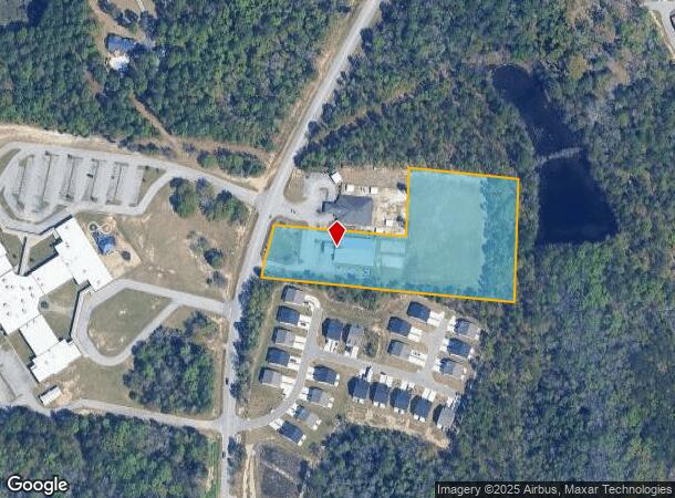

This Property Is For Sale
Current Lease Availabilities
NEARBY LISTINGS FOR SALE OR LEASE
-
-
View all Lexington listings for lease on LoopNet.com
Property Detail
200 Wise Ferry Rd
004200-03-325
PARCEL 2
Restaurantbuilding
Lexington
X
South Carolina
45063C0231J
3.95 AC
2025
Lexington
2024
Columbia
021028
Columbia, SC
7,308 SF
DEMOGRAPHICS near 200 Wise Ferry Rd
1 mile
3 mile
5 mile
2024 Total Population
3,801
31,271
63,372
2029 Population
4,143
34,096
69,147
Pop Growth 2024-2029
+ 9.00%
+ 9.03%
+ 9.11%
Average Age
37
39
40
2024 Total Households
1,403
11,433
23,969
HH Growth 2024-2029
+ 9.27%
+ 9.26%
+ 9.34%
Median Household Inc
$78,282
$92,296
$86,025
Avg Household Size
2.70
2.70
2.60
2024 Avg HH Vehicles
2.00
2.00
2.00
Median Home Value
$235,051
$256,699
$252,118
Median Year Built
2005
2002
1999
Nearby Places
Map Layers
Map Styles
 Street
 Aerial
Transit
 Traffic
 Biking
Places
Listings with unknown addresses are not visible on the map
- Restaurants
- Banks
- Shops
- Fitness
- Groceries
PUBLIC TRANSPORTATION
AIRPORT
Columbia Metro
Drive
Walk
Distance
Columbia Metro
33 min
15.7 mi
Freight Ports
North Charleston Terminal
Drive
Walk
Distance
North Charleston Terminal
135 min
113.6 mi
Nearby Properties
Address
Land Use
TOTAL SIZE
Lot Size
Zoning
Address
Land Use
TOTAL SIZE
Lot Size
Zoning
37,722 SF
6.41 AC
GC
Address
Land Use
TOTAL SIZE
Lot Size
Zoning
45,171 SF
8.38 AC
ID
Address
Land Use
TOTAL SIZE
Lot Size
Zoning
9,792 SF
7.47 AC
HDR
Address
Land Use
TOTAL SIZE
Lot Size
Zoning
58,086 SF
7.61 AC
ID
Address
Land Use
TOTAL SIZE
Lot Size
Zoning
96,585 SF
2.62 AC
ID
Address
Land Use
TOTAL SIZE
Lot Size
Zoning
41,883 SF
21.77 AC
ID
Address
Land Use
TOTAL SIZE
Lot Size
Zoning
49,494 SF
9.98 AC
ID
Address
Land Use
TOTAL SIZE
Lot Size
Zoning
3,574 SF
0.53 AC
ID
Address
Land Use
TOTAL SIZE
Lot Size
Zoning
78,665 SF
7.58 AC
GC
Address
Land Use
TOTAL SIZE
Lot Size
Zoning
41,266 SF
6.31 AC
RD
Address
Land Use
TOTAL SIZE
Lot Size
Zoning
2,599 SF
0.39 AC
ID
Address
Land Use
TOTAL SIZE
Lot Size
Zoning
2,254 SF
0.16 AC
RD
Address
Land Use
TOTAL SIZE
Lot Size
Zoning
15,343 SF
1.30 AC
GC
Address
Land Use
TOTAL SIZE
Lot Size
Zoning
2,289 SF
0.16 AC
RD
Address
Land Use
TOTAL SIZE
Lot Size
Zoning
18,300 SF
3.33 AC
RD
Address
Land Use
TOTAL SIZE
Lot Size
Zoning
1,911 SF
0.16 AC
RD
Address
Land Use
TOTAL SIZE
Lot Size
Zoning
2,253 SF
0.16 AC
RD
Address
Land Use
TOTAL SIZE
Lot Size
Zoning
3,810 SF
1.58 AC
ID
Address
Land Use
TOTAL SIZE
Lot Size
Zoning
59,201 SF
7.76 AC
GC
Address
Land Use
TOTAL SIZE
Lot Size
Zoning
79.51 AC
GC
Address
Land Use
TOTAL SIZE
Lot Size
Zoning
86,573 SF
4.92 AC
Address
Land Use
TOTAL SIZE
Lot Size
Zoning
1,378 SF
125.89 AC
RD
Address
Land Use
TOTAL SIZE
Lot Size
Zoning
30,555 SF
3.20 AC
GC
Address
Land Use
TOTAL SIZE
Lot Size
Zoning
14,287 SF
3.09 AC
GC
Address
Land Use
TOTAL SIZE
Lot Size
Zoning
52,296 SF
2.75 AC
GC
Address
Land Use
TOTAL SIZE
Lot Size
Zoning
34,204 SF
5.27 AC
LC
Address
Land Use
TOTAL SIZE
Lot Size
Zoning
50,982 SF
6.15 AC
GC
Address
Land Use
TOTAL SIZE
Lot Size
Zoning
24,198 SF
1.34 AC
GC
Address
Land Use
TOTAL SIZE
Lot Size
Zoning
37,874 SF
3.77 AC
GC
Address
Land Use
TOTAL SIZE
Lot Size
Zoning
21,177 SF
2.58 AC
GC
The World's #1 Commercial Real Estate Marketplace
Connect with us
© 2026 CoStar Group
The information above has been obtained from sources believed reliable. While we do not doubt its accuracy we have not verified it and make no guarantee, warranty or representation about it. It is your responsibility to independently confirm its accuracy and completeness. Any projections, opinions, assumptions, or estimates used are for example only and do not represent the current or future performance of the property. The value of this transaction to you depends on tax and other factors which should be evaluated by your tax, financial, and legal advisors. You and your advisors should conduct a careful, independent investigation of the property to determine to your satisfaction the suitability of the property for your needs.