Property Record
2000 2Nd St, Richlands, VA 24641

Property Detail
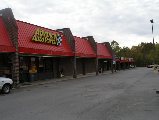
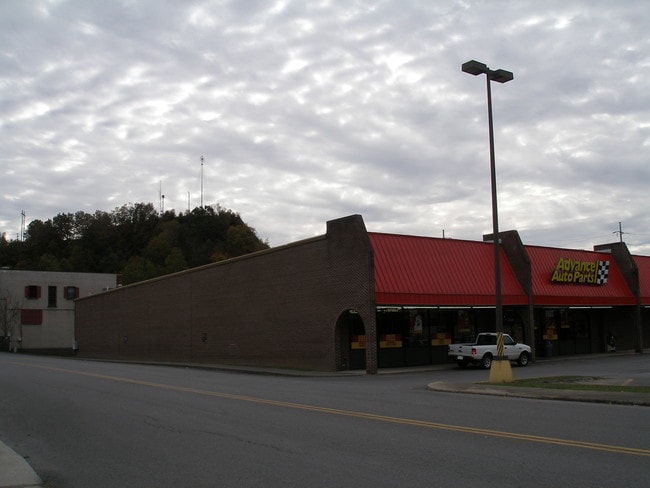
2000 2Nd St
105A5A-0016
PARCEL ON SOUTHSIDE OF SECOND ST. IN RICHLANDS (OLD RICHLANDS HIGH PROP)
Stripcommercialcenter
TAZEWELL
AE The base floodplain where base flood elevations are provided. AE Zones are now used on new format FIRMs instead of A1-A30 Zones.
Virginia
2025
2.06 AC
2025
Virginia Regional
020900
Other Market Areas
37,210 SF
Bluefield, WV-VA
NEARBY LISTINGS FOR SALE OR LEASE
DEMOGRAPHICS near 2000 2Nd St
1 mile
3 mile
5 mile
2025 Total Population
4,011
7,659
11,327
2030 Population
4,029
7,499
10,944
Pop Growth 2025-2030
+ 0.45%
(2.09%)
(3.38%)
Average Age
43
43
44
2025 Total Households
1,831
3,438
5,010
HH Growth 2025-2030
+ 0.55%
(2.01%)
(3.25%)
Median Household Inc
$40,385
$39,658
$40,057
Avg Household Size
2.20
2.20
2.20
2025 Avg HH Vehicles
2.00
2.00
2.00
Median Home Value
$109,497
$119,054
$129,615
Median Year Built
1967
1971
1973
Nearby Places
Map Layers
Map Styles
 Street
 Aerial
Layers
 Traffic
 Biking
Places
Listings with unknown addresses are not visible on the map
- Restaurants
- Banks
- Shops
- Fitness
- Groceries
SALE & LEASE HISTORY
LISTING DATE
SALE/LEASE

Sep 23, 2016
For Sale
Sep 19, 2018
For Sale
Aug 31, 2020
For Sale
Nearby Properties
Address
Land Use
TOTAL SIZE
Lot Size
Zoning
Address
Land Use
TOTAL SIZE
Lot Size
Zoning
Address
Land Use
TOTAL SIZE
Lot Size
Zoning
14.53 AC
Address
Land Use
TOTAL SIZE
Lot Size
Zoning
13.90 AC
Address
Land Use
TOTAL SIZE
Lot Size
Zoning
Address
Land Use
TOTAL SIZE
Lot Size
Zoning
40,608 SF
10 AC
Address
Land Use
TOTAL SIZE
Lot Size
Zoning
15.86 AC
Address
Land Use
TOTAL SIZE
Lot Size
Zoning
1.05 AC
Address
Land Use
TOTAL SIZE
Lot Size
Zoning
41,816 SF
3.67 AC
Address
Land Use
TOTAL SIZE
Lot Size
Zoning
31,655 SF
5.95 AC
Address
Land Use
TOTAL SIZE
Lot Size
Zoning
Address
Land Use
TOTAL SIZE
Lot Size
Zoning
95,790 SF
8.02 AC
Address
Land Use
TOTAL SIZE
Lot Size
Zoning
13.67 AC
Address
Land Use
TOTAL SIZE
Lot Size
Zoning
4,400 SF
6.45 AC
Address
Land Use
TOTAL SIZE
Lot Size
Zoning
187,140 SF
41.06 AC
Address
Land Use
TOTAL SIZE
Lot Size
Zoning
14,786 SF
1.97 AC
Address
Land Use
TOTAL SIZE
Lot Size
Zoning
9.64 AC
Address
Land Use
TOTAL SIZE
Lot Size
Zoning
163,985 SF
13.60 AC
Address
Land Use
TOTAL SIZE
Lot Size
Zoning
17,040 SF
4 AC
Address
Land Use
TOTAL SIZE
Lot Size
Zoning
3,172 SF
26.40 AC
Address
Land Use
TOTAL SIZE
Lot Size
Zoning
20,800 SF
0.32 AC
Address
Land Use
TOTAL SIZE
Lot Size
Zoning
14,672 SF
0.28 AC
Address
Land Use
TOTAL SIZE
Lot Size
Zoning
37,210 SF
2.06 AC
Address
Land Use
TOTAL SIZE
Lot Size
Zoning
6,016 SF
4.14 AC
Address
Land Use
TOTAL SIZE
Lot Size
Zoning
20,519 SF
2.22 AC
Address
Land Use
TOTAL SIZE
Lot Size
Zoning
16,180 SF
2.58 AC
Address
Land Use
TOTAL SIZE
Lot Size
Zoning
27,004 SF
3.35 AC
Address
Land Use
TOTAL SIZE
Lot Size
Zoning
11,200 SF
3.34 AC
Address
Land Use
TOTAL SIZE
Lot Size
Zoning
14,164 SF
0.43 AC
Address
Land Use
TOTAL SIZE
Lot Size
Zoning
23,304 SF
27.73 AC
Address
Land Use
TOTAL SIZE
Lot Size
Zoning
12,500 SF
2.72 AC
The World's #1 Commercial Real Estate Marketplace
Connect with us
© 2026 CoStar Group
The information above has been obtained from sources believed reliable. While we do not doubt its accuracy we have not verified it and make no guarantee, warranty or representation about it. It is your responsibility to independently confirm its accuracy and completeness. Any projections, opinions, assumptions, or estimates used are for example only and do not represent the current or future performance of the property. The value of this transaction to you depends on tax and other factors which should be evaluated by your tax, financial, and legal advisors. You and your advisors should conduct a careful, independent investigation of the property to determine to your satisfaction the suitability of the property for your needs.