Property Record
2000 36Th Ave, Oakland, CA 94601
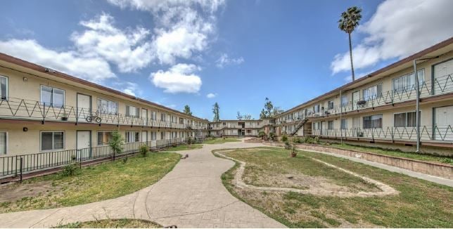


Property Detail
2000 36Th Ave
032-2084-022-02
LOT: 00002 BLK: 0022 AR: 0032 PAGE: 2084
Multifamilydwelling
Alameda
RES
California
B and X Area of moderate flood hazard, usually the area between the limits of the 100-year and 500-year floods.
1.19 AC
2024
Harrington
2025
East Bay/Oakland
407101
Oakland-Fremont-Berkeley, CA
30,368 SF
NEARBY LISTINGS FOR SALE OR LEASE
DEMOGRAPHICS near 2000 36Th Ave
1 mile
3 mile
5 mile
2025 Total Population
57,225
270,166
518,225
2030 Population
56,714
269,034
518,793
Pop Growth 2025-2030
(0.89%)
(0.42%)
+ 0.11%
Average Age
38
41
41
2025 Total Households
17,447
99,451
197,419
HH Growth 2025-2030
(0.99%)
(0.44%)
+ 0.21%
Median Household Inc
$67,641
$95,166
$102,625
Avg Household Size
3.00
2.60
2.50
2025 Avg HH Vehicles
2.00
2.00
2.00
Median Home Value
$748,250
$969,351
$984,899
Median Year Built
1949
1949
1956
Nearby Places
Map Layers
Map Styles
 Street
 Aerial
Layers
 Traffic
 Biking
Places
Listings with unknown addresses are not visible on the map
- Restaurants
- Banks
- Shops
- Fitness
- Groceries
PUBLIC TRANSPORTATION
TRANSIT/SUBWAY
Fruitvale (Berryessa/North San Jose to Daly City - Bay Area Rapid Transit (BART), Berryessa/North San Jose to Richmond - Bay Area Rapid Transit (BART), Daly City to Berryessa/North San Jose - Bay Area Rapid Transit (BART), Daly City to Dublin/Pleasanton - Bay Area Rapid Transit (BART), Richmond to Berryessa/North San Jose - Bay Area Rapid Transit (BART))
Drive
Walk
Distance
Fruitvale (Berryessa/North San Jose to Daly City - Bay Area Rapid Transit (BART), Berryessa/North San Jose to Richmond - Bay Area Rapid Transit (BART), Daly City to Berryessa/North San Jose - Bay Area Rapid Transit (BART), Daly City to Dublin/Pleasanton - Bay Area Rapid Transit (BART), Richmond to Berryessa/North San Jose - Bay Area Rapid Transit (BART))
2 min
13 min
0.7 mi
COMMUTER RAIL
Oakland (Capitol Corridor - Amtrak, Coast Starlight - Amtrak, San Joaquins - Amtrak)
Drive
Walk
Distance
Oakland (Capitol Corridor - Amtrak, Coast Starlight - Amtrak, San Joaquins - Amtrak)
7 min
4.3 mi
Emeryville (Capitol Corridor - Capitol Corridor Joint Powers Authority)
Drive
Walk
Distance
Emeryville (Capitol Corridor - Capitol Corridor Joint Powers Authority)
12 min
7.7 mi
AIRPORT
Metro Oakland International
Drive
Walk
Distance
Metro Oakland International
11 min
6.4 mi
San Francisco International
Drive
Walk
Distance
San Francisco International
40 min
26.7 mi
Freight Ports
Port of Oakland
Drive
Walk
Distance
Port of Oakland
9 min
4.7 mi
SALE & LEASE HISTORY
LISTING DATE
SALE/LEASE

Dec 03, 2019
For Sale
Aug 22, 2018
For Sale
Nearby Properties
Address
Land Use
TOTAL SIZE
Lot Size
Zoning
Address
Land Use
TOTAL SIZE
Lot Size
Zoning
Address
Land Use
TOTAL SIZE
Lot Size
Zoning
546,164 SF
6.02 AC
Address
Land Use
TOTAL SIZE
Lot Size
Zoning
2.05 AC
Address
Land Use
TOTAL SIZE
Lot Size
Zoning
371,504 SF
4.08 AC
Address
Land Use
TOTAL SIZE
Lot Size
Zoning
534,208 SF
23.18 AC
Address
Land Use
TOTAL SIZE
Lot Size
Zoning
273,623 SF
1.44 AC
Address
Land Use
TOTAL SIZE
Lot Size
Zoning
297,617 SF
1.54 AC
Address
Land Use
TOTAL SIZE
Lot Size
Zoning
525,864 SF
16.53 AC
Address
Land Use
TOTAL SIZE
Lot Size
Zoning
344,249 SF
1.38 AC
Address
Land Use
TOTAL SIZE
Lot Size
Zoning
180,959 SF
9.38 AC
Address
Land Use
TOTAL SIZE
Lot Size
Zoning
336,680 SF
9.93 AC
M40
Address
Land Use
TOTAL SIZE
Lot Size
Zoning
133,636 SF
5.46 AC
Address
Land Use
TOTAL SIZE
Lot Size
Zoning
284,255 SF
5.07 AC
Address
Land Use
TOTAL SIZE
Lot Size
Zoning
320,001 SF
37.56 AC
Address
Land Use
TOTAL SIZE
Lot Size
Zoning
165,042 SF
13.50 AC
Address
Land Use
TOTAL SIZE
Lot Size
Zoning
169,558 SF
1.65 AC
Address
Land Use
TOTAL SIZE
Lot Size
Zoning
200,238 SF
9.28 AC
Address
Land Use
TOTAL SIZE
Lot Size
Zoning
Address
Land Use
TOTAL SIZE
Lot Size
Zoning
133,678 SF
4.33 AC
Address
Land Use
TOTAL SIZE
Lot Size
Zoning
136,127 SF
8.21 AC
Address
Land Use
TOTAL SIZE
Lot Size
Zoning
141,044 SF
1.38 AC
M1
Address
Land Use
TOTAL SIZE
Lot Size
Zoning
129,726 SF
5.38 AC
Address
Land Use
TOTAL SIZE
Lot Size
Zoning
0.94 AC
Address
Land Use
TOTAL SIZE
Lot Size
Zoning
197,321 SF
16.52 AC
Address
Land Use
TOTAL SIZE
Lot Size
Zoning
213,600 SF
10.60 AC
Address
Land Use
TOTAL SIZE
Lot Size
Zoning
1,189,534 SF
26.64 AC
Address
Land Use
TOTAL SIZE
Lot Size
Zoning
204,006 SF
6.39 AC
M40
Address
Land Use
TOTAL SIZE
Lot Size
Zoning
165,638 SF
4.06 AC
Address
Land Use
TOTAL SIZE
Lot Size
Zoning
132,446 SF
4.34 AC
Address
Land Use
TOTAL SIZE
Lot Size
Zoning
6.81 AC
The World's #1 Commercial Real Estate Marketplace
Connect with us
© 2026 CoStar Group
The information above has been obtained from sources believed reliable. While we do not doubt its accuracy we have not verified it and make no guarantee, warranty or representation about it. It is your responsibility to independently confirm its accuracy and completeness. Any projections, opinions, assumptions, or estimates used are for example only and do not represent the current or future performance of the property. The value of this transaction to you depends on tax and other factors which should be evaluated by your tax, financial, and legal advisors. You and your advisors should conduct a careful, independent investigation of the property to determine to your satisfaction the suitability of the property for your needs.