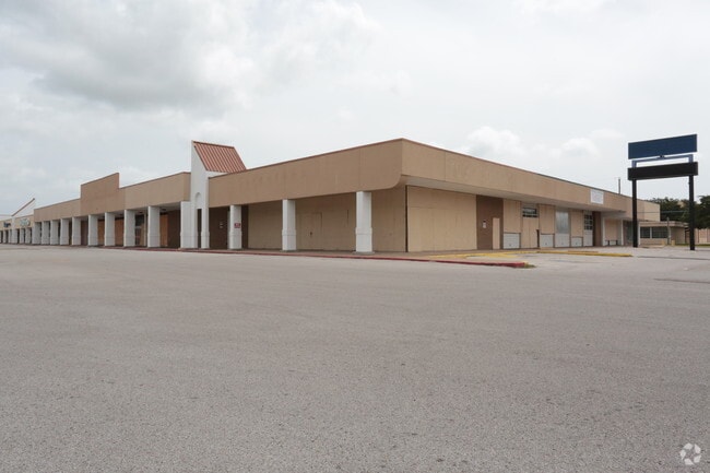
Property Record
2000 9Th Ave N, Texas City, TX 77590


NEARBY LISTINGS FOR SALE OR LEASE
Property Detail
2000 9Th Ave N
Houston-The Woodlands-Sugar Land, TX
Wells, J B Survey
0205-0032-0000-000
ABST 205 J B WELLS SUR TRACT 32, 11.5191 ACRES
Commercialnec
Galveston
X
Texas
48167C0268G
32
2024
11.52 AC
2025
NASA/Clear Lake
722300
Houston
130,615 SF
DEMOGRAPHICS near 2000 9Th Ave N
1 Mile
3 Mile
5 Mile
2024 Total Population
12,875
34,396
57,469
2029 Population
13,476
36,048
60,421
Pop Growth 2024-2029
+ 4.67%
+ 4.80%
+ 5.14%
Average Age
38
39
40
2024 Total Households
4,544
12,966
21,793
HH Growth 2024-2029
+ 4.84%
+ 5.04%
+ 5.40%
Median Household Inc
$57,495
$54,318
$56,938
Avg Household Size
2.70
2.60
2.50
2024 Avg HH Vehicles
2.00
2.00
2.00
Median Home Value
$138,321
$152,347
$161,637
Median Year Built
1966
1973
1975
Nearby Places
Map Layers
Map Styles
 Street
 Aerial
- Restaurants
- Banks
- Shops
- Fitness
- Groceries
PUBLIC TRANSPORTATION
AIRPORT
William P Hobby
DRIVE
WALK
Distance
William P Hobby
44 min
30.3 mi
Freight Ports
Port of Galveston
DRIVE
WALK
Distance
Port of Galveston
20 min
15.0 mi
SALE & LEASE HISTORY
LISTING DATE
SALE/LEASE

Sep 25, 2016
For Lease
Jan 29, 2020
For Sale
Dec 19, 2019
For Sale
Nearby Properties
Address
Land Use
TOTAL SIZE
Lot Size
Zoning
Address
Land Use
TOTAL SIZE
Lot Size
Zoning
Address
Land Use
TOTAL SIZE
Lot Size
Zoning
Address
Land Use
TOTAL SIZE
Lot Size
Zoning
700,740 SF
31.58 AC
A
Address
Land Use
TOTAL SIZE
Lot Size
Zoning
Address
Land Use
TOTAL SIZE
Lot Size
Zoning
Address
Land Use
TOTAL SIZE
Lot Size
Zoning
Address
Land Use
TOTAL SIZE
Lot Size
Zoning
Address
Land Use
TOTAL SIZE
Lot Size
Zoning
Address
Land Use
TOTAL SIZE
Lot Size
Zoning
Address
Land Use
TOTAL SIZE
Lot Size
Zoning
Address
Land Use
TOTAL SIZE
Lot Size
Zoning
Address
Land Use
TOTAL SIZE
Lot Size
Zoning
206,560 SF
7.08 AC
Address
Land Use
TOTAL SIZE
Lot Size
Zoning
191,320 SF
9.16 AC
Address
Land Use
TOTAL SIZE
Lot Size
Zoning
Address
Land Use
TOTAL SIZE
Lot Size
Zoning
109,000 SF
43 AC
Address
Land Use
TOTAL SIZE
Lot Size
Zoning
205,260 SF
10.38 AC
Address
Land Use
TOTAL SIZE
Lot Size
Zoning
161,960 SF
8.32 AC
Address
Land Use
TOTAL SIZE
Lot Size
Zoning
171,099 SF
9.99 AC
Address
Land Use
TOTAL SIZE
Lot Size
Zoning
Address
Land Use
TOTAL SIZE
Lot Size
Zoning
Address
Land Use
TOTAL SIZE
Lot Size
Zoning
168,850 SF
10.28 AC
C
Address
Land Use
TOTAL SIZE
Lot Size
Zoning
99,550 SF
9.34 AC
E
Address
Land Use
TOTAL SIZE
Lot Size
Zoning
97,358 SF
6.43 AC
Address
Land Use
TOTAL SIZE
Lot Size
Zoning
46,563 SF
6.46 AC
F
Address
Land Use
TOTAL SIZE
Lot Size
Zoning
114,410 SF
55.31 AC
Address
Land Use
TOTAL SIZE
Lot Size
Zoning
86,894 SF
9.38 AC
A
Address
Land Use
TOTAL SIZE
Lot Size
Zoning
Address
Land Use
TOTAL SIZE
Lot Size
Zoning
120,396 SF
7 AC
Address
Land Use
TOTAL SIZE
Lot Size
Zoning
141,440 SF
6.55 AC
C
Address
Land Use
TOTAL SIZE
Lot Size
Zoning
29,342 SF
0.33 AC
E
The World's #1 Commercial Real Estate Marketplace
Connect with us
© 2025 CoStar Group
The information above has been obtained from sources believed reliable. While we do not doubt its accuracy we have not verified it and make no guarantee, warranty or representation about it. It is your responsibility to independently confirm its accuracy and completeness. Any projections, opinions, assumptions, or estimates used are for example only and do not represent the current or future performance of the property. The value of this transaction to you depends on tax and other factors which should be evaluated by your tax, financial, and legal advisors. You and your advisors should conduct a careful, independent investigation of the property to determine to your satisfaction the suitability of the property for your needs.