Property Record
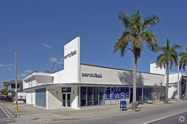
2000 Biscayne Blvd, Miami, FL 33137


Property Detail
2000 Biscayne Blvd
01-3231-001-0120
CORAL PARK PB 2-66 LOT 13 & LOT 15 7 LOTS 17 & 17-A & 19 & E22FT OF LOT 19-A PER PB 4-106 LESS PORT LOT 15 & 17 PER DEED BOOK 1736-81 & LESS S8FT & EXT AREA OF CURVE IN SE COR FOR R/W LOT SIZE 30116 SQ FT M/L
Multifamilydwelling
Miami-Dade
6600
Florida
AE The base floodplain where base flood elevations are provided. AE Zones are now used on new format FIRMs instead of A1-A30 Zones.
7,13,
2024
0.69 AC
2025
Biscayne Corridor
002702
South Florida
669,245 SF
Miami-Miami Beach-Kendall, FL
NEARBY LISTINGS FOR SALE OR LEASE
DEMOGRAPHICS near 2000 Biscayne Blvd
1 mile
3 mile
5 mile
2025 Total Population
52,203
295,256
575,432
2030 Population
58,478
322,423
627,351
Pop Growth 2025-2030
+ 12.02%
+ 9.20%
+ 9.02%
Average Age
37
40
41
2025 Total Households
26,627
132,005
249,328
HH Growth 2025-2030
+ 12.18%
+ 9.45%
+ 9.37%
Median Household Inc
$99,757
$71,224
$67,029
Avg Household Size
1.90
2.10
2.20
2025 Avg HH Vehicles
1.00
1.00
1.00
Median Home Value
$649,309
$639,424
$631,985
Median Year Built
2007
1993
1976
Nearby Places
Map Layers
Map Styles
 Street
 Aerial
Layers
 Traffic
 Biking
Places
Listings with unknown addresses are not visible on the map
- Restaurants
- Banks
- Shops
- Fitness
- Groceries
PUBLIC TRANSPORTATION
TRANSIT/SUBWAY
Adrienne Arsht Center (Metromover Omni Loop - Miami-Dade Transit (Metrorail/Metromover))
Drive
Walk
Distance
Adrienne Arsht Center (Metromover Omni Loop - Miami-Dade Transit (Metrorail/Metromover))
3 min
10 min
0.5 mi
School Board (Metromover Omni Loop - Miami-Dade Transit (Metrorail/Metromover))
Drive
Walk
Distance
School Board (Metromover Omni Loop - Miami-Dade Transit (Metrorail/Metromover))
3 min
14 min
0.7 mi
Eleventh Street (Metromover Omni Loop - Miami-Dade Transit (Metrorail/Metromover))
Drive
Walk
Distance
Eleventh Street (Metromover Omni Loop - Miami-Dade Transit (Metrorail/Metromover))
4 min
17 min
0.8 mi
Park West (Metromover Omni Loop - Miami-Dade Transit (Metrorail/Metromover))
Drive
Walk
Distance
Park West (Metromover Omni Loop - Miami-Dade Transit (Metrorail/Metromover))
5 min
20 min
1.0 mi
COMMUTER RAIL
Hialeah Market (Tri-County Commuter - South Florida Regional Transportation Authority (Tri-Rail))
Drive
Walk
Distance
Hialeah Market (Tri-County Commuter - South Florida Regional Transportation Authority (Tri-Rail))
13 min
6.1 mi
Miami Airport (Tri-County Commuter - South Florida Regional Transportation Authority (Tri-Rail))
Drive
Walk
Distance
Miami Airport (Tri-County Commuter - South Florida Regional Transportation Authority (Tri-Rail))
16 min
7.4 mi
AIRPORT
Miami International
Drive
Walk
Distance
Miami International
25 min
11.5 mi
Fort Lauderdale/Hollywood International
Drive
Walk
Distance
Fort Lauderdale/Hollywood International
34 min
22.6 mi
Nearby Properties
Address
Land Use
TOTAL SIZE
Lot Size
Zoning
Address
Land Use
TOTAL SIZE
Lot Size
Zoning
1,050,691 SF
0.83 AC
6408
Address
Land Use
TOTAL SIZE
Lot Size
Zoning
4,758,614 SF
810.91 AC
8000
Address
Land Use
TOTAL SIZE
Lot Size
Zoning
955,966 SF
38.91 AC
9600
Address
Land Use
TOTAL SIZE
Lot Size
Zoning
2,559,318 SF
2.21 AC
6407
Address
Land Use
TOTAL SIZE
Lot Size
Zoning
2,039,308 SF
2.46 AC
6401
Address
Land Use
TOTAL SIZE
Lot Size
Zoning
928,000 SF
14.30 AC
8000
Address
Land Use
TOTAL SIZE
Lot Size
Zoning
1,110,657 SF
3.83 AC
6407
Address
Land Use
TOTAL SIZE
Lot Size
Zoning
16.13 AC
6100
Address
Land Use
TOTAL SIZE
Lot Size
Zoning
1,346,294 SF
1.89 AC
6408
Address
Land Use
TOTAL SIZE
Lot Size
Zoning
2,403,353 SF
7.37 AC
6100
Address
Land Use
TOTAL SIZE
Lot Size
Zoning
1,938,271 SF
6.62 AC
6402
Address
Land Use
TOTAL SIZE
Lot Size
Zoning
1,162,113 SF
1.92 AC
6407
Address
Land Use
TOTAL SIZE
Lot Size
Zoning
1,075,124 SF
1.61 AC
6405
Address
Land Use
TOTAL SIZE
Lot Size
Zoning
1,544,491 SF
0.97 AC
6401
Address
Land Use
TOTAL SIZE
Lot Size
Zoning
782,686 SF
0.06 AC
6401
Address
Land Use
TOTAL SIZE
Lot Size
Zoning
1,657,362 SF
1.15 AC
6401
Address
Land Use
TOTAL SIZE
Lot Size
Zoning
1,072,012 SF
1.78 AC
6407
Address
Land Use
TOTAL SIZE
Lot Size
Zoning
244,533 SF
3.53 AC
6600
Address
Land Use
TOTAL SIZE
Lot Size
Zoning
694,863 SF
1.90 AC
6407
Address
Land Use
TOTAL SIZE
Lot Size
Zoning
694,939 SF
1.22 AC
4100
Address
Land Use
TOTAL SIZE
Lot Size
Zoning
656,821 SF
2.06 AC
6407
Address
Land Use
TOTAL SIZE
Lot Size
Zoning
303,989 SF
1.47 AC
6600
Address
Land Use
TOTAL SIZE
Lot Size
Zoning
416,675 SF
6.48 AC
6401
Address
Land Use
TOTAL SIZE
Lot Size
Zoning
256,089 SF
20.35 AC
7600
Address
Land Use
TOTAL SIZE
Lot Size
Zoning
1,004,006 SF
0.92 AC
6401
Address
Land Use
TOTAL SIZE
Lot Size
Zoning
2.50 AC
6407
Address
Land Use
TOTAL SIZE
Lot Size
Zoning
585,775 SF
1.86 AC
6101
Address
Land Use
TOTAL SIZE
Lot Size
Zoning
868,860 SF
2.14 AC
6402
Address
Land Use
TOTAL SIZE
Lot Size
Zoning
491,308 SF
0.14 AC
6401
Address
Land Use
TOTAL SIZE
Lot Size
Zoning
903,993 SF
0.60 AC
6412
The World's #1 Commercial Real Estate Marketplace
Connect with us
© 2026 CoStar Group
The information above has been obtained from sources believed reliable. While we do not doubt its accuracy we have not verified it and make no guarantee, warranty or representation about it. It is your responsibility to independently confirm its accuracy and completeness. Any projections, opinions, assumptions, or estimates used are for example only and do not represent the current or future performance of the property. The value of this transaction to you depends on tax and other factors which should be evaluated by your tax, financial, and legal advisors. You and your advisors should conduct a careful, independent investigation of the property to determine to your satisfaction the suitability of the property for your needs.