Property Record
2000 E Algonquin Rd, Algonquin, IL 60102
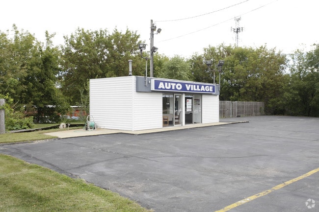

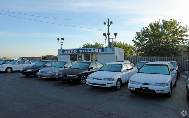
Property Detail
2000 E Algonquin Rd
Chicago-Naperville-Elgin, IL-IN
DOC 2017R0017190 LT 1 EDGETOWN ACRES MEMO: REYES, WILLIAM EDGAR/ DE REYES, OLGA VILLANUEVA DIAZ TR
19-35-400-002
McHenry
Commercialnec
Illinois
B and X Area of moderate flood hazard, usually the area between the limits of the 100-year and 500-year floods.
1
2024
0.51 AC
2024
Far Northwest
871404
Chicago
384 SF
NEARBY LISTINGS FOR SALE OR LEASE
DEMOGRAPHICS near 2000 E Algonquin Rd
1 mile
3 mile
5 mile
2024 Total Population
8,432
50,387
126,420
2029 Population
8,481
50,718
127,855
Pop Growth 2024-2029
+ 0.58%
+ 0.66%
+ 1.14%
Average Age
42
39
40
2024 Total Households
3,299
16,898
44,488
HH Growth 2024-2029
+ 0.55%
+ 0.70%
+ 1.18%
Median Household Inc
$106,853
$100,125
$102,524
Avg Household Size
2.50
2.90
2.80
2024 Avg HH Vehicles
2.00
2.00
2.00
Median Home Value
$275,205
$277,637
$295,636
Median Year Built
1993
1982
1987
Nearby Places
Map Layers
Map Styles
 Street
 Aerial
Transit
 Traffic
 Biking
Places
Listings with unknown addresses are not visible on the map
- Restaurants
- Banks
- Shops
- Fitness
- Groceries
PUBLIC TRANSPORTATION
COMMUTER RAIL
Fox River Grove Station (Union Pacific Northwest Line - Northeast Illinois Regional Commuter Railroad (Metra))
Drive
Walk
Distance
Fox River Grove Station (Union Pacific Northwest Line - Northeast Illinois Regional Commuter Railroad (Metra))
15 min
5.6 mi
Cary Station (Union Pacific Northwest Line - Northeast Illinois Regional Commuter Railroad (Metra))
Drive
Walk
Distance
Cary Station (Union Pacific Northwest Line - Northeast Illinois Regional Commuter Railroad (Metra))
13 min
5.8 mi
AIRPORT
Chicago O'Hare International
Drive
Walk
Distance
Chicago O'Hare International
39 min
28.3 mi
Nearby Properties
Address
Land Use
TOTAL SIZE
Lot Size
Zoning
Address
Land Use
TOTAL SIZE
Lot Size
Zoning
183,924 SF
0.80 AC
Address
Land Use
TOTAL SIZE
Lot Size
Zoning
211,680 SF
11.60 AC
Address
Land Use
TOTAL SIZE
Lot Size
Zoning
211,680 SF
11.34 AC
Address
Land Use
TOTAL SIZE
Lot Size
Zoning
23.38 AC
Address
Land Use
TOTAL SIZE
Lot Size
Zoning
9,614 SF
1.42 AC
Address
Land Use
TOTAL SIZE
Lot Size
Zoning
56,900 SF
5.93 AC
Address
Land Use
TOTAL SIZE
Lot Size
Zoning
106,488 SF
5.60 AC
Address
Land Use
TOTAL SIZE
Lot Size
Zoning
Address
Land Use
TOTAL SIZE
Lot Size
Zoning
35,452 SF
105.76 AC
Address
Land Use
TOTAL SIZE
Lot Size
Zoning
106,488 SF
6.64 AC
Address
Land Use
TOTAL SIZE
Lot Size
Zoning
85,364 SF
5.57 AC
Address
Land Use
TOTAL SIZE
Lot Size
Zoning
229.01 AC
Address
Land Use
TOTAL SIZE
Lot Size
Zoning
61,955 SF
7.48 AC
Address
Land Use
TOTAL SIZE
Lot Size
Zoning
103,155 SF
10.72 AC
Address
Land Use
TOTAL SIZE
Lot Size
Zoning
64,728 SF
5.16 AC
Address
Land Use
TOTAL SIZE
Lot Size
Zoning
75,399 SF
4.82 AC
Address
Land Use
TOTAL SIZE
Lot Size
Zoning
64,728 SF
2 AC
Address
Land Use
TOTAL SIZE
Lot Size
Zoning
Address
Land Use
TOTAL SIZE
Lot Size
Zoning
63,216 SF
2.98 AC
Address
Land Use
TOTAL SIZE
Lot Size
Zoning
39,271 SF
4.07 AC
Address
Land Use
TOTAL SIZE
Lot Size
Zoning
49,992 SF
2 AC
Address
Land Use
TOTAL SIZE
Lot Size
Zoning
49,828 SF
1.37 AC
Address
Land Use
TOTAL SIZE
Lot Size
Zoning
72,994 SF
4.58 AC
Address
Land Use
TOTAL SIZE
Lot Size
Zoning
30.05 AC
Address
Land Use
TOTAL SIZE
Lot Size
Zoning
30,454 SF
2.79 AC
Address
Land Use
TOTAL SIZE
Lot Size
Zoning
12,082 SF
1.69 AC
Address
Land Use
TOTAL SIZE
Lot Size
Zoning
Address
Land Use
TOTAL SIZE
Lot Size
Zoning
44,832 SF
1 AC
Address
Land Use
TOTAL SIZE
Lot Size
Zoning
42,880 SF
4.37 AC
Address
Land Use
TOTAL SIZE
Lot Size
Zoning
10,832 SF
1.45 AC
The World's #1 Commercial Real Estate Marketplace
Connect with us
© 2026 CoStar Group
The information above has been obtained from sources believed reliable. While we do not doubt its accuracy we have not verified it and make no guarantee, warranty or representation about it. It is your responsibility to independently confirm its accuracy and completeness. Any projections, opinions, assumptions, or estimates used are for example only and do not represent the current or future performance of the property. The value of this transaction to you depends on tax and other factors which should be evaluated by your tax, financial, and legal advisors. You and your advisors should conduct a careful, independent investigation of the property to determine to your satisfaction the suitability of the property for your needs.