Property Record
Manville St, Tea, SD 57064
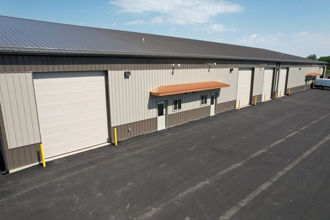

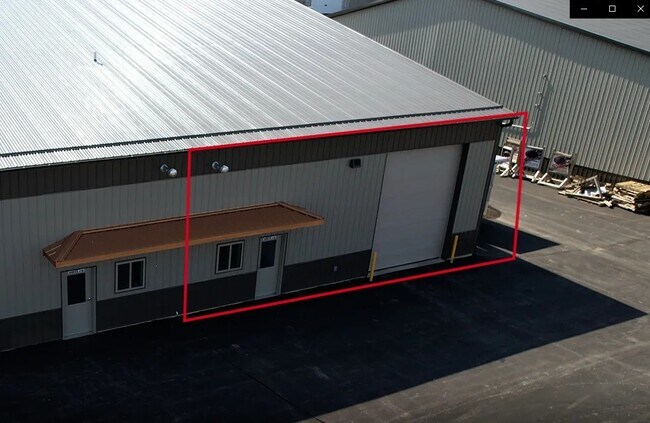
Property Detail
Manville St
Sioux Falls, SD-MN
LANDMARK INDUSTRIAL PARK ADD - TRACT 10 SW14 GOVT LOT 2 - 30-100-50 -
100.50.30.H010
LINCOLN
Commercialnec
South Dakota
I-1 LIGHT
2
B and X Area of moderate flood hazard, usually the area between the limits of the 100-year and 500-year floods.
1.95 AC
2025
Sioux Falls
2024
Other Market Areas
010115
NEARBY LISTINGS FOR SALE OR LEASE
DEMOGRAPHICS near Manville St
1 mile
3 mile
5 mile
2025 Total Population
621
17,583
63,322
2030 Population
709
19,858
69,485
Pop Growth 2025-2030
+ 14.17%
+ 12.94%
+ 9.73%
Average Age
34
35
37
2025 Total Households
208
6,269
25,095
HH Growth 2025-2030
+ 14.42%
+ 13.19%
+ 9.75%
Median Household Inc
$121,153
$102,813
$86,036
Avg Household Size
3.00
2.80
2.50
2025 Avg HH Vehicles
2.00
2.00
2.00
Median Home Value
$387,878
$370,906
$339,458
Median Year Built
2009
2009
2004
Nearby Places
Map Layers
Map Styles
 Street
 Aerial
Transit
 Traffic
 Biking
Places
Listings with unknown addresses are not visible on the map
- Restaurants
- Banks
- Shops
- Fitness
- Groceries
PUBLIC TRANSPORTATION
AIRPORT
Joe Foss Field
Drive
Walk
Distance
Joe Foss Field
22 min
13.5 mi
SALE & LEASE HISTORY
LISTING DATE
SALE/LEASE

Oct 02, 2025
For Lease
Nov 08, 2023
For Lease
May 21, 2025
For Lease
Nearby Properties
Address
Land Use
TOTAL SIZE
Lot Size
Zoning
Address
Land Use
TOTAL SIZE
Lot Size
Zoning
9.57 AC
MUNICIPALI
Address
Land Use
TOTAL SIZE
Lot Size
Zoning
8.65 AC
MUNICIPALI
Address
Land Use
TOTAL SIZE
Lot Size
Zoning
9.56 AC
MUNICIPALI
Address
Land Use
TOTAL SIZE
Lot Size
Zoning
6.51 AC
MUNICIPALI
Address
Land Use
TOTAL SIZE
Lot Size
Zoning
11.80 AC
I-1 LIGHT
Address
Land Use
TOTAL SIZE
Lot Size
Zoning
4.25 AC
MUNICIPALI
Address
Land Use
TOTAL SIZE
Lot Size
Zoning
126.55 AC
PD PLANNED
Address
Land Use
TOTAL SIZE
Lot Size
Zoning
4.39 AC
MUNICIPALI
Address
Land Use
TOTAL SIZE
Lot Size
Zoning
4.53 AC
MUNICIPALI
Address
Land Use
TOTAL SIZE
Lot Size
Zoning
8.28 AC
MUNICIPALI
Address
Land Use
TOTAL SIZE
Lot Size
Zoning
3.82 AC
MUNICIPALI
Address
Land Use
TOTAL SIZE
Lot Size
Zoning
5.43 AC
MUNICIPALI
Address
Land Use
TOTAL SIZE
Lot Size
Zoning
11.26 AC
MUNICIPALI
Address
Land Use
TOTAL SIZE
Lot Size
Zoning
3.56 AC
MUNICIPALI
Address
Land Use
TOTAL SIZE
Lot Size
Zoning
4.62 AC
MUNICIPALI
Address
Land Use
TOTAL SIZE
Lot Size
Zoning
7 AC
I-1 LIGHT
Address
Land Use
TOTAL SIZE
Lot Size
Zoning
2.68 AC
MUNICIPALI
Address
Land Use
TOTAL SIZE
Lot Size
Zoning
5.14 AC
MUNICIPALI
Address
Land Use
TOTAL SIZE
Lot Size
Zoning
2.50 AC
MUNICIPALI
Address
Land Use
TOTAL SIZE
Lot Size
Zoning
2.48 AC
MUNICIPALI
Address
Land Use
TOTAL SIZE
Lot Size
Zoning
4.04 AC
C COMMERCI
Address
Land Use
TOTAL SIZE
Lot Size
Zoning
2.47 AC
MUNICIPALI
Address
Land Use
TOTAL SIZE
Lot Size
Zoning
1.56 AC
MUNICIPALI
Address
Land Use
TOTAL SIZE
Lot Size
Zoning
18.09 AC
MUNICIPALI
Address
Land Use
TOTAL SIZE
Lot Size
Zoning
2.94 AC
MUNICIPALI
Address
Land Use
TOTAL SIZE
Lot Size
Zoning
5.43 AC
MUNICIPALI
Address
Land Use
TOTAL SIZE
Lot Size
Zoning
2.11 AC
MUNICIPALI
Address
Land Use
TOTAL SIZE
Lot Size
Zoning
3.02 AC
MUNICIPALI
Address
Land Use
TOTAL SIZE
Lot Size
Zoning
9.50 AC
MUNICIPALI
Address
Land Use
TOTAL SIZE
Lot Size
Zoning
7.60 AC
MUNICIPALI
The World's #1 Commercial Real Estate Marketplace
Connect with us
© 2026 CoStar Group
The information above has been obtained from sources believed reliable. While we do not doubt its accuracy we have not verified it and make no guarantee, warranty or representation about it. It is your responsibility to independently confirm its accuracy and completeness. Any projections, opinions, assumptions, or estimates used are for example only and do not represent the current or future performance of the property. The value of this transaction to you depends on tax and other factors which should be evaluated by your tax, financial, and legal advisors. You and your advisors should conduct a careful, independent investigation of the property to determine to your satisfaction the suitability of the property for your needs.