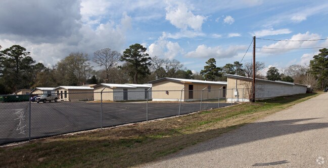
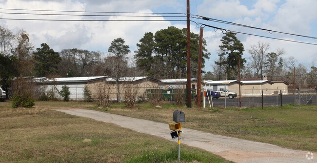
Property Record
2000 Fm 2854 Rd, Conroe, TX 77304

Property Detail
2000 Fm 2854 Rd
0289-03-01810
A0289 JAMES DENWARD, TRACT 18-A, ACRES 1.964
Commercialnec
Montgomery
1
Texas
B and X Area of moderate flood hazard, usually the area between the limits of the 100-year and 500-year floods.
1.96 AC
2024
Conroe
2025
Houston
693600
Houston-Pasadena-The Woodlands, TX
25,040 SF
NEARBY LISTINGS FOR SALE OR LEASE
DEMOGRAPHICS near 2000 Fm 2854 Rd
1 mile
3 mile
5 mile
2025 Total Population
4,429
52,191
119,190
2030 Population
5,199
61,174
140,850
Pop Growth 2025-2030
+ 17.39%
+ 17.21%
+ 18.17%
Average Age
38
37
37
2025 Total Households
1,813
19,914
42,934
HH Growth 2025-2030
+ 17.98%
+ 18.38%
+ 18.99%
Median Household Inc
$87,804
$66,460
$82,441
Avg Household Size
2.40
2.50
2.70
2025 Avg HH Vehicles
2.00
2.00
2.00
Median Home Value
$363,999
$336,502
$356,594
Median Year Built
2008
2004
2010
Nearby Places
Map Layers
Map Styles
 Street
 Aerial
Transit
 Traffic
 Biking
Places
Listings with unknown addresses are not visible on the map
- Restaurants
- Banks
- Shops
- Fitness
- Groceries
PUBLIC TRANSPORTATION
AIRPORT
George Bush Intcntl/Houston
Drive
Walk
Distance
George Bush Intcntl/Houston
42 min
33.0 mi
Freight Ports
Port of Houston
Drive
Walk
Distance
Port of Houston
65 min
48.7 mi
Nearby Properties
Address
Land Use
TOTAL SIZE
Lot Size
Zoning
Address
Land Use
TOTAL SIZE
Lot Size
Zoning
470,259 SF
27.98 AC
1
Address
Land Use
TOTAL SIZE
Lot Size
Zoning
353,247 SF
14.38 AC
Address
Land Use
TOTAL SIZE
Lot Size
Zoning
354,000 SF
13.81 AC
Address
Land Use
TOTAL SIZE
Lot Size
Zoning
308,438 SF
14.35 AC
Address
Land Use
TOTAL SIZE
Lot Size
Zoning
361,388 SF
16.32 AC
Address
Land Use
TOTAL SIZE
Lot Size
Zoning
304,482 SF
12.15 AC
Address
Land Use
TOTAL SIZE
Lot Size
Zoning
262,925 SF
12.16 AC
Address
Land Use
TOTAL SIZE
Lot Size
Zoning
294,336 SF
20.39 AC
Address
Land Use
TOTAL SIZE
Lot Size
Zoning
284,451 SF
13.66 AC
1
Address
Land Use
TOTAL SIZE
Lot Size
Zoning
204,716 SF
15.51 AC
Address
Land Use
TOTAL SIZE
Lot Size
Zoning
206,841 SF
23.44 AC
Address
Land Use
TOTAL SIZE
Lot Size
Zoning
258,100 SF
12.04 AC
1
Address
Land Use
TOTAL SIZE
Lot Size
Zoning
168,926 SF
9.12 AC
Address
Land Use
TOTAL SIZE
Lot Size
Zoning
195,956 SF
1.76 AC
1
Address
Land Use
TOTAL SIZE
Lot Size
Zoning
229,345 SF
12.36 AC
1
Address
Land Use
TOTAL SIZE
Lot Size
Zoning
276,238 SF
21.48 AC
Address
Land Use
TOTAL SIZE
Lot Size
Zoning
134,935 SF
10.50 AC
1
Address
Land Use
TOTAL SIZE
Lot Size
Zoning
250,716 SF
11.17 AC
1
Address
Land Use
TOTAL SIZE
Lot Size
Zoning
211,275 SF
12.58 AC
Address
Land Use
TOTAL SIZE
Lot Size
Zoning
235,826 SF
15.29 AC
Address
Land Use
TOTAL SIZE
Lot Size
Zoning
134,621 SF
26.37 AC
Address
Land Use
TOTAL SIZE
Lot Size
Zoning
191,006 SF
9.19 AC
Address
Land Use
TOTAL SIZE
Lot Size
Zoning
142,800 SF
7.82 AC
Address
Land Use
TOTAL SIZE
Lot Size
Zoning
136,300 SF
9.08 AC
1
Address
Land Use
TOTAL SIZE
Lot Size
Zoning
89,298 SF
9.22 AC
Address
Land Use
TOTAL SIZE
Lot Size
Zoning
590,471 SF
32.21 AC
Address
Land Use
TOTAL SIZE
Lot Size
Zoning
197,533 SF
58.31 AC
Address
Land Use
TOTAL SIZE
Lot Size
Zoning
100,800 SF
8.60 AC
Address
Land Use
TOTAL SIZE
Lot Size
Zoning
157,996 SF
9 AC
Address
Land Use
TOTAL SIZE
Lot Size
Zoning
175,476 SF
8.03 AC
1
The World's #1 Commercial Real Estate Marketplace
Connect with us
© 2026 CoStar Group
The information above has been obtained from sources believed reliable. While we do not doubt its accuracy we have not verified it and make no guarantee, warranty or representation about it. It is your responsibility to independently confirm its accuracy and completeness. Any projections, opinions, assumptions, or estimates used are for example only and do not represent the current or future performance of the property. The value of this transaction to you depends on tax and other factors which should be evaluated by your tax, financial, and legal advisors. You and your advisors should conduct a careful, independent investigation of the property to determine to your satisfaction the suitability of the property for your needs.