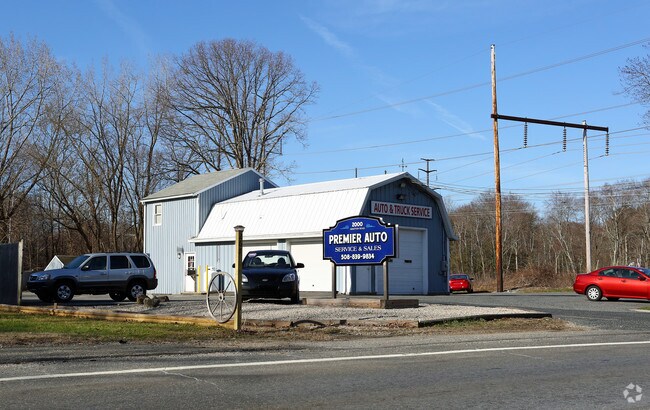
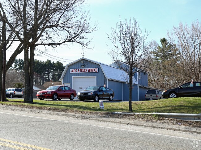
Property Record
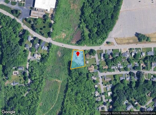
2000 Grafton Rd, Millbury, MA 01527
NEARBY LISTINGS FOR SALE OR LEASE
Property Detail
2000 Grafton Rd
Autorepair
Worcester
X
Massachusetts
25027C0826E
0.65 AC
2025
Worcester Metro
2025
Boston
737300
Worcester, MA-CT
1,896 SF
MILB-000007-000000-000013
DEMOGRAPHICS near 2000 Grafton Rd
1 Mile
3 Mile
5 Mile
2024 Total Population
4,750
44,143
179,595
2029 Population
4,740
44,072
178,302
Pop Growth 2024-2029
(0.21%)
(0.16%)
(0.72%)
Average Age
42
41
38
2024 Total Households
1,866
17,830
70,173
HH Growth 2024-2029
(0.27%)
(0.13%)
(0.68%)
Median Household Inc
$108,164
$92,451
$71,412
Avg Household Size
2.50
2.40
2.40
2024 Avg HH Vehicles
2.00
2.00
2.00
Median Home Value
$403,931
$370,174
$379,541
Median Year Built
1974
1971
1961
Nearby Places
Map Layers
Map Styles
 Street
 Aerial
- Restaurants
- Banks
- Shops
- Fitness
- Groceries
PUBLIC TRANSPORTATION
COMMUTER RAIL
Grafton (Framingham/Worcester Line - Massachusetts Bay Transportation Authority Commuter Rail (Purple Line))
DRIVE
WALK
Distance
Grafton (Framingham/Worcester Line - Massachusetts Bay Transportation Authority Commuter Rail (Purple Line))
7 min
3.4 mi
Worcester (Framingham/Worcester Line - Massachusetts Bay Transportation Authority Commuter Rail (Purple Line))
DRIVE
WALK
Distance
Worcester (Framingham/Worcester Line - Massachusetts Bay Transportation Authority Commuter Rail (Purple Line))
8 min
4.6 mi
AIRPORT
Worcester Regional
DRIVE
WALK
Distance
Worcester Regional
20 min
10.4 mi
Freight Ports
Port of Boston
DRIVE
WALK
Distance
Port of Boston
55 min
41.4 mi
Nearby Properties
Address
Land Use
TOTAL SIZE
Lot Size
Zoning
Address
Land Use
TOTAL SIZE
Lot Size
Zoning
46.50 AC
R4
Address
Land Use
TOTAL SIZE
Lot Size
Zoning
43.07 AC
COM BU
Address
Land Use
TOTAL SIZE
Lot Size
Zoning
176,316 SF
19.57 AC
RL-7
Address
Land Use
TOTAL SIZE
Lot Size
Zoning
591,515 SF
33.04 AC
MG-1
Address
Land Use
TOTAL SIZE
Lot Size
Zoning
210,168 SF
45.75 AC
RL-7
Address
Land Use
TOTAL SIZE
Lot Size
Zoning
27.89 AC
RL-7
Address
Land Use
TOTAL SIZE
Lot Size
Zoning
64.46 AC
RS-7
Address
Land Use
TOTAL SIZE
Lot Size
Zoning
78.19 AC
RL-7
Address
Land Use
TOTAL SIZE
Lot Size
Zoning
7,700 SF
80.72 AC
ML-.5
Address
Land Use
TOTAL SIZE
Lot Size
Zoning
Address
Land Use
TOTAL SIZE
Lot Size
Zoning
134,896 SF
15.10 AC
LIM IN
Address
Land Use
TOTAL SIZE
Lot Size
Zoning
53.52 AC
RL-7
Address
Land Use
TOTAL SIZE
Lot Size
Zoning
93,092 SF
162.83 AC
OLI
Address
Land Use
TOTAL SIZE
Lot Size
Zoning
55.79 AC
R4
Address
Land Use
TOTAL SIZE
Lot Size
Zoning
40.46 AC
R4
Address
Land Use
TOTAL SIZE
Lot Size
Zoning
133,482 SF
15.80 AC
BG-2
Address
Land Use
TOTAL SIZE
Lot Size
Zoning
18.10 AC
I1
Address
Land Use
TOTAL SIZE
Lot Size
Zoning
115,564 SF
9.33 AC
RL-7
Address
Land Use
TOTAL SIZE
Lot Size
Zoning
Address
Land Use
TOTAL SIZE
Lot Size
Zoning
82,843 SF
15.70 AC
R4
Address
Land Use
TOTAL SIZE
Lot Size
Zoning
19.76 AC
BL-1
Address
Land Use
TOTAL SIZE
Lot Size
Zoning
57,288 SF
11.95 AC
CB
Address
Land Use
TOTAL SIZE
Lot Size
Zoning
47.94 AC
RL-7
Address
Land Use
TOTAL SIZE
Lot Size
Zoning
84,672 SF
17.85 AC
COM BU
Address
Land Use
TOTAL SIZE
Lot Size
Zoning
1,628 SF
7.06 AC
Address
Land Use
TOTAL SIZE
Lot Size
Zoning
71,622 SF
33.28 AC
Address
Land Use
TOTAL SIZE
Lot Size
Zoning
96,000 SF
Address
Land Use
TOTAL SIZE
Lot Size
Zoning
103,460 SF
8.41 AC
I2
Address
Land Use
TOTAL SIZE
Lot Size
Zoning
43,542 SF
20.90 AC
R2
Address
Land Use
TOTAL SIZE
Lot Size
Zoning
8.19 AC
MG-.5
The World's #1 Commercial Real Estate Marketplace
Connect with us
© 2025 CoStar Group
The information above has been obtained from sources believed reliable. While we do not doubt its accuracy we have not verified it and make no guarantee, warranty or representation about it. It is your responsibility to independently confirm its accuracy and completeness. Any projections, opinions, assumptions, or estimates used are for example only and do not represent the current or future performance of the property. The value of this transaction to you depends on tax and other factors which should be evaluated by your tax, financial, and legal advisors. You and your advisors should conduct a careful, independent investigation of the property to determine to your satisfaction the suitability of the property for your needs.