Property Record
2000 Moss St, Lafayette, LA 70501
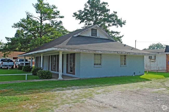


Property Detail
2000 Moss St
Lafayette, LA
P LOTS 28 29 BLK 3 ROLLS ROYCE (1969-541880 PLAT) PAR OF GRO BETWEEN ABOVE LOTS AND MOSS ST (1965-469766 PLAT)
6039018
Lafayette
Commercialnec
Louisiana
B and X Area of moderate flood hazard, usually the area between the limits of the 100-year and 500-year floods.
28-29
2025
0.30 AC
2025
Greater Lafayette
001202
Lafayette
1,768 SF
NEARBY LISTINGS FOR SALE OR LEASE
DEMOGRAPHICS near 2000 Moss St
1 mile
3 mile
5 mile
2025 Total Population
8,590
49,737
92,196
2030 Population
9,012
52,213
96,485
Pop Growth 2025-2030
+ 4.91%
+ 4.98%
+ 4.65%
Average Age
39
40
39
2025 Total Households
3,293
20,474
38,712
HH Growth 2025-2030
+ 4.98%
+ 5.11%
+ 4.70%
Median Household Inc
$38,922
$39,828
$49,846
Avg Household Size
2.50
2.30
2.20
2025 Avg HH Vehicles
1.00
1.00
2.00
Median Home Value
$140,126
$169,000
$212,848
Median Year Built
1973
1973
1977
Nearby Places
Map Layers
Map Styles
 Street
 Aerial
Transit
 Traffic
 Biking
Places
Listings with unknown addresses are not visible on the map
- Restaurants
- Banks
- Shops
- Fitness
- Groceries
PUBLIC TRANSPORTATION
COMMUTER RAIL
Lafayette Amtrak Station (Sunset Limited - Amtrak)
Drive
Walk
Distance
Lafayette Amtrak Station (Sunset Limited - Amtrak)
4 min
2.0 mi
AIRPORT
Lafayette Regional/Paul Fournet Field
Drive
Walk
Distance
Lafayette Regional/Paul Fournet Field
8 min
3.5 mi
Freight Ports
Port of Iberia
Drive
Walk
Distance
Port of Iberia
34 min
25.5 mi
Nearby Properties
Address
Land Use
TOTAL SIZE
Lot Size
Zoning
Address
Land Use
TOTAL SIZE
Lot Size
Zoning
51,132 SF
11.07 AC
Address
Land Use
TOTAL SIZE
Lot Size
Zoning
231,380 SF
4.20 AC
Address
Land Use
TOTAL SIZE
Lot Size
Zoning
10.80 AC
Address
Land Use
TOTAL SIZE
Lot Size
Zoning
119,726 SF
25.22 AC
Address
Land Use
TOTAL SIZE
Lot Size
Zoning
96.54 AC
Address
Land Use
TOTAL SIZE
Lot Size
Zoning
221,760 SF
0.67 AC
Address
Land Use
TOTAL SIZE
Lot Size
Zoning
182,700 SF
25.62 AC
Address
Land Use
TOTAL SIZE
Lot Size
Zoning
92,556 SF
10.75 AC
Address
Land Use
TOTAL SIZE
Lot Size
Zoning
423,600 SF
24.16 AC
Address
Land Use
TOTAL SIZE
Lot Size
Zoning
84,009 SF
6.90 AC
Address
Land Use
TOTAL SIZE
Lot Size
Zoning
47,249 SF
22.17 AC
Address
Land Use
TOTAL SIZE
Lot Size
Zoning
123,164 SF
2.11 AC
Address
Land Use
TOTAL SIZE
Lot Size
Zoning
203,442 SF
39.38 AC
Address
Land Use
TOTAL SIZE
Lot Size
Zoning
87,868 SF
3.02 AC
Address
Land Use
TOTAL SIZE
Lot Size
Zoning
120,500 SF
20 AC
Address
Land Use
TOTAL SIZE
Lot Size
Zoning
164,478 SF
40 AC
Address
Land Use
TOTAL SIZE
Lot Size
Zoning
77,245 SF
24.08 AC
Address
Land Use
TOTAL SIZE
Lot Size
Zoning
95,667 SF
4.30 AC
Address
Land Use
TOTAL SIZE
Lot Size
Zoning
69,500 SF
29.03 AC
Address
Land Use
TOTAL SIZE
Lot Size
Zoning
150,000 SF
1 AC
Address
Land Use
TOTAL SIZE
Lot Size
Zoning
22,335 SF
30.61 AC
Address
Land Use
TOTAL SIZE
Lot Size
Zoning
47,310 SF
3.80 AC
Address
Land Use
TOTAL SIZE
Lot Size
Zoning
26,943 SF
4.30 AC
Address
Land Use
TOTAL SIZE
Lot Size
Zoning
2,774 SF
51.89 AC
Address
Land Use
TOTAL SIZE
Lot Size
Zoning
162,100 SF
3.04 AC
Address
Land Use
TOTAL SIZE
Lot Size
Zoning
142,882 SF
9.75 AC
Address
Land Use
TOTAL SIZE
Lot Size
Zoning
19,041 SF
14.76 AC
Address
Land Use
TOTAL SIZE
Lot Size
Zoning
164,152 SF
3.31 AC
Address
Land Use
TOTAL SIZE
Lot Size
Zoning
60,332 SF
13.67 AC
Address
Land Use
TOTAL SIZE
Lot Size
Zoning
10,684 SF
18 AC
The World's #1 Commercial Real Estate Marketplace
Connect with us
© 2026 CoStar Group
The information above has been obtained from sources believed reliable. While we do not doubt its accuracy we have not verified it and make no guarantee, warranty or representation about it. It is your responsibility to independently confirm its accuracy and completeness. Any projections, opinions, assumptions, or estimates used are for example only and do not represent the current or future performance of the property. The value of this transaction to you depends on tax and other factors which should be evaluated by your tax, financial, and legal advisors. You and your advisors should conduct a careful, independent investigation of the property to determine to your satisfaction the suitability of the property for your needs.