Property Record
2000 Overhead Bridge Rd Ne, Cleveland, TN 37311
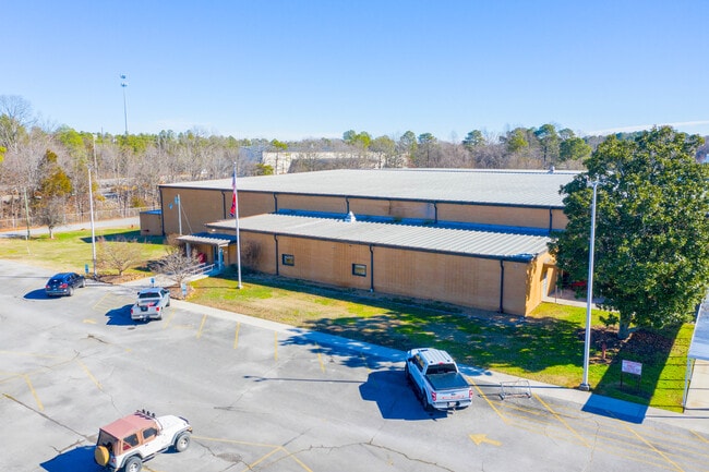
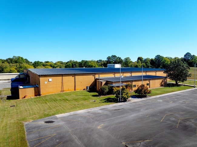
This Property Is For Sale
Current Lease Availabilities
NEARBY LISTINGS FOR SALE OR LEASE
Property Detail
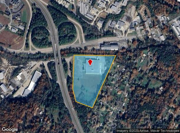
2000 Overhead Bridge Rd Ne
050J-E-003.01
Cleveland Surveying Co
Industrialgeneral
ATTN REAL ESTATE DEPT
X
Bradley
47011C0136E
Tennessee
2024
16.57 AC
2025
Tennessee East Area
010300
Other Market Areas
96,378 SF
Cleveland, TN
DEMOGRAPHICS near 2000 Overhead Bridge Rd Ne
1 Mile
3 Mile
5 Mile
2024 Total Population
4,666
44,066
79,125
2029 Population
4,983
46,524
83,465
Pop Growth 2024-2029
+ 6.79%
+ 5.58%
+ 5.48%
Average Age
37
39
40
2024 Total Households
1,847
17,295
30,767
HH Growth 2024-2029
+ 6.82%
+ 5.82%
+ 5.66%
Median Household Inc
$41,550
$47,028
$53,241
Avg Household Size
2.40
2.40
2.50
2024 Avg HH Vehicles
2.00
2.00
2.00
Median Home Value
$217,051
$202,289
$210,697
Median Year Built
1991
1980
1984
Nearby Places
- Restaurants
- Banks
- Shops
- Fitness
- Groceries
PUBLIC TRANSPORTATION
AIRPORT
Lovell Field
DRIVE
WALK
Distance
Lovell Field
39 min
27.7 mi
Freight Ports
Georgia Ports - Savannah
DRIVE
WALK
Distance
Georgia Ports - Savannah
420 min
367.2 mi
Nearby Properties
Address
Land Use
TOTAL SIZE
Lot Size
Zoning
Address
Land Use
TOTAL SIZE
Lot Size
Zoning
400,000 SF
123.44 AC
IH
Address
Land Use
TOTAL SIZE
Lot Size
Zoning
357,110 SF
52.96 AC
FAR
Address
Land Use
TOTAL SIZE
Lot Size
Zoning
267,460 SF
8.30 AC
IL
Address
Land Use
TOTAL SIZE
Lot Size
Zoning
118,230 SF
37 AC
FAR
Address
Land Use
TOTAL SIZE
Lot Size
Zoning
68,425 SF
20 AC
MU
Address
Land Use
TOTAL SIZE
Lot Size
Zoning
93,264 SF
10.20 AC
CH
Address
Land Use
TOTAL SIZE
Lot Size
Zoning
68,785 SF
8.70 AC
R1
Address
Land Use
TOTAL SIZE
Lot Size
Zoning
356,920 SF
26.42 AC
IL
Address
Land Use
TOTAL SIZE
Lot Size
Zoning
620,857 SF
34.28 AC
IH
Address
Land Use
TOTAL SIZE
Lot Size
Zoning
65,382 SF
63.70 AC
FAR
Address
Land Use
TOTAL SIZE
Lot Size
Zoning
74,392 SF
15.69 AC
MU
Address
Land Use
TOTAL SIZE
Lot Size
Zoning
203,778 SF
13.46 AC
R3
Address
Land Use
TOTAL SIZE
Lot Size
Zoning
170,518 SF
4.96 AC
CH
Address
Land Use
TOTAL SIZE
Lot Size
Zoning
416,503 SF
61.92 AC
CH
Address
Land Use
TOTAL SIZE
Lot Size
Zoning
50,400 SF
1.04 AC
CBD
Address
Land Use
TOTAL SIZE
Lot Size
Zoning
196,358 SF
16.50 AC
A
Address
Land Use
TOTAL SIZE
Lot Size
Zoning
74,229 SF
1 AC
R1
Address
Land Use
TOTAL SIZE
Lot Size
Zoning
421,180 SF
27.10 AC
IL
Address
Land Use
TOTAL SIZE
Lot Size
Zoning
48,494 SF
4.70 AC
R3
Address
Land Use
TOTAL SIZE
Lot Size
Zoning
82,628 SF
9.50 AC
R3
Address
Land Use
TOTAL SIZE
Lot Size
Zoning
96,527 SF
5.15 AC
CH
Address
Land Use
TOTAL SIZE
Lot Size
Zoning
423,535 SF
56.59 AC
IH
Address
Land Use
TOTAL SIZE
Lot Size
Zoning
66,331 SF
10.87 AC
IL
Address
Land Use
TOTAL SIZE
Lot Size
Zoning
56,725 SF
13.10 AC
R1
Address
Land Use
TOTAL SIZE
Lot Size
Zoning
44.30 AC
IH
Address
Land Use
TOTAL SIZE
Lot Size
Zoning
203,751 SF
18.81 AC
CH
Address
Land Use
TOTAL SIZE
Lot Size
Zoning
30,526 SF
0.92 AC
CBD
Address
Land Use
TOTAL SIZE
Lot Size
Zoning
122,596 SF
5.98 AC
PUD
Address
Land Use
TOTAL SIZE
Lot Size
Zoning
136,793 SF
61.89 AC
CH
Address
Land Use
TOTAL SIZE
Lot Size
Zoning
37,430 SF
5.75 AC
CH
The World's #1 Commercial Real Estate Marketplace
Connect with us
© 2025 CoStar Group
The information above has been obtained from sources believed reliable. While we do not doubt its accuracy we have not verified it and make no guarantee, warranty or representation about it. It is your responsibility to independently confirm its accuracy and completeness. Any projections, opinions, assumptions, or estimates used are for example only and do not represent the current or future performance of the property. The value of this transaction to you depends on tax and other factors which should be evaluated by your tax, financial, and legal advisors. You and your advisors should conduct a careful, independent investigation of the property to determine to your satisfaction the suitability of the property for your needs.