Property Record
2000 Queen Ave Se, Albany, OR 97322


NEARBY LISTINGS FOR SALE OR LEASE
Property Detail
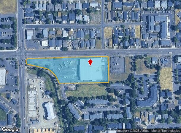
2000 Queen Ave Se
Albany, OR
Partition Plat 2023-068
0775870
11S03W08CD
Commercialnec
Linn
X
Oregon
41043C0527G
1
2025
3.30 AC
2025
Linn County
020602
Portland
42,376 SF
DEMOGRAPHICS near 2000 Queen Ave Se
1 Mile
3 Mile
5 Mile
2024 Total Population
19,057
53,461
65,384
2029 Population
19,891
55,923
68,517
Pop Growth 2024-2029
+ 4.38%
+ 4.61%
+ 4.79%
Average Age
38
40
40
2024 Total Households
7,486
21,143
25,449
HH Growth 2024-2029
+ 4.53%
+ 4.74%
+ 4.94%
Median Household Inc
$58,632
$65,429
$72,073
Avg Household Size
2.40
2.40
2.50
2024 Avg HH Vehicles
2.00
2.00
2.00
Median Home Value
$288,857
$312,631
$336,164
Median Year Built
1977
1978
1981
Nearby Places
Map Layers
Map Styles
 Street
 Aerial
- Restaurants
- Banks
- Shops
- Fitness
- Groceries
PUBLIC TRANSPORTATION
COMMUTER RAIL
DRIVE
WALK
Distance
5 min
2.1 mi
AIRPORT
Mahlon Sweet Field
DRIVE
WALK
Distance
Mahlon Sweet Field
60 min
41.4 mi
SALE & LEASE HISTORY
LISTING DATE
SALE/LEASE

Sep 22, 2017
For Lease
Jun 12, 2019
For Sale
Apr 17, 2018
For Lease
Nearby Properties
Address
Land Use
TOTAL SIZE
Lot Size
Zoning
Address
Land Use
TOTAL SIZE
Lot Size
Zoning
1.94 AC
Address
Land Use
TOTAL SIZE
Lot Size
Zoning
19.77 AC
RS-5
Address
Land Use
TOTAL SIZE
Lot Size
Zoning
34.91 AC
LI
Address
Land Use
TOTAL SIZE
Lot Size
Zoning
41.22 AC
LI
Address
Land Use
TOTAL SIZE
Lot Size
Zoning
46.43 AC
GI
Address
Land Use
TOTAL SIZE
Lot Size
Zoning
84,415 SF
70.68 AC
RS-6.5
Address
Land Use
TOTAL SIZE
Lot Size
Zoning
2,025 SF
16.52 AC
MUC
Address
Land Use
TOTAL SIZE
Lot Size
Zoning
18.57 AC
RC
Address
Land Use
TOTAL SIZE
Lot Size
Zoning
33,540 SF
2.19 AC
ES
Address
Land Use
TOTAL SIZE
Lot Size
Zoning
23,340 SF
10.60 AC
CC
Address
Land Use
TOTAL SIZE
Lot Size
Zoning
28.17 AC
HI
Address
Land Use
TOTAL SIZE
Lot Size
Zoning
58,202 SF
5.14 AC
RM
Address
Land Use
TOTAL SIZE
Lot Size
Zoning
20.04 AC
LI
Address
Land Use
TOTAL SIZE
Lot Size
Zoning
3.75 AC
OP
Address
Land Use
TOTAL SIZE
Lot Size
Zoning
13.01 AC
RC
Address
Land Use
TOTAL SIZE
Lot Size
Zoning
67,716 SF
6.90 AC
LI
Address
Land Use
TOTAL SIZE
Lot Size
Zoning
15.63 AC
RM
Address
Land Use
TOTAL SIZE
Lot Size
Zoning
43.06 AC
RS-6.5
Address
Land Use
TOTAL SIZE
Lot Size
Zoning
84,000 SF
8.99 AC
RC
Address
Land Use
TOTAL SIZE
Lot Size
Zoning
14.42 AC
RS-5
Address
Land Use
TOTAL SIZE
Lot Size
Zoning
50,648 SF
8.35 AC
RS-6.5
Address
Land Use
TOTAL SIZE
Lot Size
Zoning
45,543 SF
24.28 AC
LI
Address
Land Use
TOTAL SIZE
Lot Size
Zoning
11.01 AC
CC
Address
Land Use
TOTAL SIZE
Lot Size
Zoning
666 SF
6.32 AC
RM
Address
Land Use
TOTAL SIZE
Lot Size
Zoning
11,296 SF
1.36 AC
HM
Address
Land Use
TOTAL SIZE
Lot Size
Zoning
3,591 SF
2.15 AC
RM
Address
Land Use
TOTAL SIZE
Lot Size
Zoning
15.15 AC
RM
Address
Land Use
TOTAL SIZE
Lot Size
Zoning
151,290 SF
5.45 AC
RM
Address
Land Use
TOTAL SIZE
Lot Size
Zoning
194,166 SF
10.14 AC
RS-10
Address
Land Use
TOTAL SIZE
Lot Size
Zoning
19,950 SF
11.11 AC
RC
The World's #1 Commercial Real Estate Marketplace
Connect with us
© 2026 CoStar Group
The information above has been obtained from sources believed reliable. While we do not doubt its accuracy we have not verified it and make no guarantee, warranty or representation about it. It is your responsibility to independently confirm its accuracy and completeness. Any projections, opinions, assumptions, or estimates used are for example only and do not represent the current or future performance of the property. The value of this transaction to you depends on tax and other factors which should be evaluated by your tax, financial, and legal advisors. You and your advisors should conduct a careful, independent investigation of the property to determine to your satisfaction the suitability of the property for your needs.