Property Record
2000 Rio De Janeiro Ave, Punta Gorda, FL 33983


NEARBY LISTINGS FOR SALE OR LEASE
Property Detail
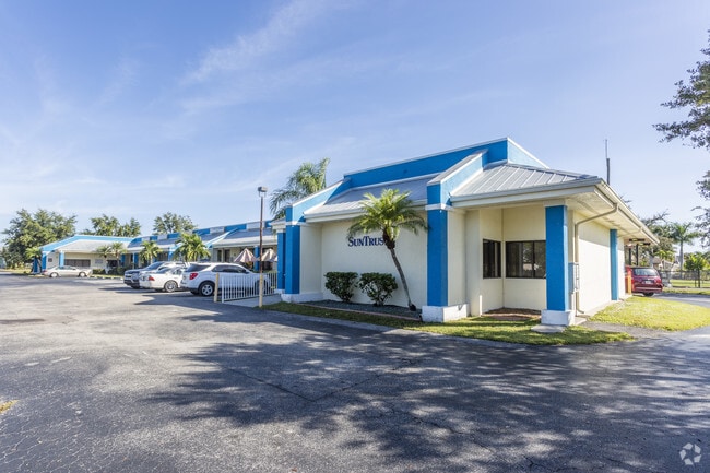
2000 Rio De Janeiro Ave
Punta Gorda, FL
Punta Gorda Isles
402316129001
PUNTA GORDA ISLES SEC 23 TRACT I 1.45 AC. M/L 729/332 743/1827 755/354 800/691 914/1719-20 969/1937-41 E1007/807 E1010/926 2095/1353 2939/1134 2974/1384 3011/1 3065/2185 3229/2077 CT3717/434 3817/1811 4062/1824
Commercialnec
Charlotte
X
Florida
12015C0070G
729
2024
1.45 AC
2025
Charlotte County
020101
Southwest Florida
16,544 SF
DEMOGRAPHICS near 2000 Rio De Janeiro Ave
1 Mile
3 Mile
5 Mile
2024 Total Population
6,306
27,603
64,245
2029 Population
7,605
33,233
76,555
Pop Growth 2024-2029
+ 20.60%
+ 20.40%
+ 19.16%
Average Age
50
53
51
2024 Total Households
2,847
12,967
29,059
HH Growth 2024-2029
+ 20.93%
+ 20.75%
+ 19.54%
Median Household Inc
$52,828
$60,219
$54,194
Avg Household Size
2.10
2.10
2.10
2024 Avg HH Vehicles
2.00
2.00
2.00
Median Home Value
$240,961
$241,906
$222,518
Median Year Built
1993
1995
1988
Nearby Places
Map Layers
Map Styles
 Street
 Aerial
- Restaurants
- Banks
- Shops
- Fitness
- Groceries
PUBLIC TRANSPORTATION
AIRPORT
Punta Gorda
DRIVE
WALK
Distance
Punta Gorda
15 min
8.3 mi
Freight Ports
Port Manatee
DRIVE
WALK
Distance
Port Manatee
82 min
67.7 mi
SALE & LEASE HISTORY
LISTING DATE
SALE/LEASE

Jan 22, 2018
For Lease
Nearby Properties
Address
Land Use
TOTAL SIZE
Lot Size
Zoning
Address
Land Use
TOTAL SIZE
Lot Size
Zoning
202,009 SF
20.89 AC
PD
Address
Land Use
TOTAL SIZE
Lot Size
Zoning
204,731 SF
16.11 AC
PD
Address
Land Use
TOTAL SIZE
Lot Size
Zoning
229,973 SF
21.33 AC
PD
Address
Land Use
TOTAL SIZE
Lot Size
Zoning
121,585 SF
696.03 AC
RE1
Address
Land Use
TOTAL SIZE
Lot Size
Zoning
249,777 SF
48 AC
RMF10
Address
Land Use
TOTAL SIZE
Lot Size
Zoning
254.31 AC
PD
Address
Land Use
TOTAL SIZE
Lot Size
Zoning
217,784 SF
38.63 AC
PD
Address
Land Use
TOTAL SIZE
Lot Size
Zoning
139,109 SF
23.44 AC
CG
Address
Land Use
TOTAL SIZE
Lot Size
Zoning
73,222 SF
5.14 AC
PD
Address
Land Use
TOTAL SIZE
Lot Size
Zoning
41,148 SF
155.85 AC
RSF-3
Address
Land Use
TOTAL SIZE
Lot Size
Zoning
83,180 SF
9.31 AC
PD
Address
Land Use
TOTAL SIZE
Lot Size
Zoning
95,547 SF
14.06 AC
PD
Address
Land Use
TOTAL SIZE
Lot Size
Zoning
125.54 AC
PD
Address
Land Use
TOTAL SIZE
Lot Size
Zoning
35,951 SF
24.23 AC
PD
Address
Land Use
TOTAL SIZE
Lot Size
Zoning
27,082 SF
2.05 AC
PD
Address
Land Use
TOTAL SIZE
Lot Size
Zoning
84,500 SF
5.59 AC
CG
Address
Land Use
TOTAL SIZE
Lot Size
Zoning
86,773 SF
5.07 AC
IG
Address
Land Use
TOTAL SIZE
Lot Size
Zoning
116,186 SF
20.02 AC
RMF10
Address
Land Use
TOTAL SIZE
Lot Size
Zoning
23,798 SF
1.71 AC
PD
Address
Land Use
TOTAL SIZE
Lot Size
Zoning
98,552 SF
11.42 AC
CG
Address
Land Use
TOTAL SIZE
Lot Size
Zoning
51,248 SF
15.96 AC
PD
Address
Land Use
TOTAL SIZE
Lot Size
Zoning
82.27 AC
PD
Address
Land Use
TOTAL SIZE
Lot Size
Zoning
2,148 SF
121.95 AC
PD
Address
Land Use
TOTAL SIZE
Lot Size
Zoning
21.61 AC
PD
Address
Land Use
TOTAL SIZE
Lot Size
Zoning
81,226 SF
11.40 AC
OMI
Address
Land Use
TOTAL SIZE
Lot Size
Zoning
12,977 SF
2.29 AC
PD
Address
Land Use
TOTAL SIZE
Lot Size
Zoning
13,642 SF
2.55 AC
PD
Address
Land Use
TOTAL SIZE
Lot Size
Zoning
34,983 SF
18.79 AC
RE1
Address
Land Use
TOTAL SIZE
Lot Size
Zoning
11,773 SF
1.55 AC
PD
Address
Land Use
TOTAL SIZE
Lot Size
Zoning
7.81 AC
PD
The World's #1 Commercial Real Estate Marketplace
Connect with us
© 2025 CoStar Group
The information above has been obtained from sources believed reliable. While we do not doubt its accuracy we have not verified it and make no guarantee, warranty or representation about it. It is your responsibility to independently confirm its accuracy and completeness. Any projections, opinions, assumptions, or estimates used are for example only and do not represent the current or future performance of the property. The value of this transaction to you depends on tax and other factors which should be evaluated by your tax, financial, and legal advisors. You and your advisors should conduct a careful, independent investigation of the property to determine to your satisfaction the suitability of the property for your needs.