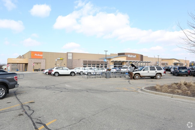
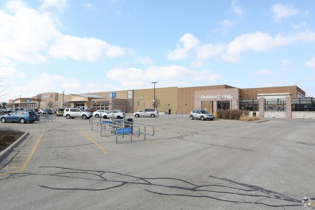
Property Record
2000 S West Ave, Waukesha, WI 53189


NEARBY LISTINGS FOR SALE OR LEASE
Property Detail
2000 S West Ave
Milwaukee-Waukesha, WI
Sunset Heights Sub
WAKC-1353-424
LOT 1 & OUTLOT 1 CSM NO 10488 (V100 CSM P87) REDIV PT LOT 1 BLK 13 SUNSET HEIGHTS SUB PT SW1/4, NW1/4, NE1/4 & SE1/4 SEC 15 T6N R19E 24.38 AC DOC NO 3533979
Commercialnec
Waukesha
AE
Wisconsin
55133C0326H
1
2024
24.37 AC
2024
Central Waukesha
202303
Milwaukee/Madison
187,050 SF
DEMOGRAPHICS near 2000 S West Ave
1 Mile
3 Mile
5 Mile
2024 Total Population
8,100
59,755
95,063
2029 Population
8,336
61,883
98,343
Pop Growth 2024-2029
+ 2.91%
+ 3.56%
+ 3.45%
Average Age
38
39
41
2024 Total Households
3,177
25,140
39,917
HH Growth 2024-2029
+ 2.90%
+ 3.75%
+ 3.56%
Median Household Inc
$71,425
$75,086
$78,951
Avg Household Size
2.50
2.30
2.30
2024 Avg HH Vehicles
2.00
2.00
2.00
Median Home Value
$243,194
$258,851
$276,505
Median Year Built
1975
1976
1978
Nearby Places
Map Layers
Map Styles
 Street
 Aerial
- Restaurants
- Banks
- Shops
- Fitness
- Groceries
PUBLIC TRANSPORTATION
AIRPORT
General Mitchell International
DRIVE
WALK
Distance
General Mitchell International
36 min
23.6 mi
Freight Ports
Port Milwaukee
DRIVE
WALK
Distance
Port Milwaukee
36 min
25.4 mi
Nearby Properties
Address
Land Use
TOTAL SIZE
Lot Size
Zoning
Address
Land Use
TOTAL SIZE
Lot Size
Zoning
21.73 AC
M-1
Address
Land Use
TOTAL SIZE
Lot Size
Zoning
23.09 AC
B-1(PUD),C
Address
Land Use
TOTAL SIZE
Lot Size
Zoning
71.18 AC
M-2
Address
Land Use
TOTAL SIZE
Lot Size
Zoning
68,591 SF
2.97 AC
RM-3(PUD)
Address
Land Use
TOTAL SIZE
Lot Size
Zoning
6.56 AC
I-1
Address
Land Use
TOTAL SIZE
Lot Size
Zoning
19 AC
RM-2
Address
Land Use
TOTAL SIZE
Lot Size
Zoning
110,992 SF
12.15 AC
RM-1(PUD)
Address
Land Use
TOTAL SIZE
Lot Size
Zoning
61,299 SF
6.59 AC
RM-2(PUD)
Address
Land Use
TOTAL SIZE
Lot Size
Zoning
28,942 SF
2.31 AC
B-3(22.52)
Address
Land Use
TOTAL SIZE
Lot Size
Zoning
79,529 SF
23.85 AC
I-1
Address
Land Use
TOTAL SIZE
Lot Size
Zoning
29.41 AC
B-5(PUD)
Address
Land Use
TOTAL SIZE
Lot Size
Zoning
4.21 AC
B-5(PUD)
Address
Land Use
TOTAL SIZE
Lot Size
Zoning
24,981 SF
1.79 AC
B-3(22.52)
Address
Land Use
TOTAL SIZE
Lot Size
Zoning
102,333 SF
11.99 AC
B-5(PUD)
Address
Land Use
TOTAL SIZE
Lot Size
Zoning
11.11 AC
B-5
Address
Land Use
TOTAL SIZE
Lot Size
Zoning
0.81 AC
B-2
Address
Land Use
TOTAL SIZE
Lot Size
Zoning
47,353 SF
5.41 AC
RM-2(PUD)
Address
Land Use
TOTAL SIZE
Lot Size
Zoning
111,624 SF
12.91 AC
RM-3(PUD)
Address
Land Use
TOTAL SIZE
Lot Size
Zoning
10.31 AC
B-5
Address
Land Use
TOTAL SIZE
Lot Size
Zoning
1.74 AC
RM-3(PUD)
Address
Land Use
TOTAL SIZE
Lot Size
Zoning
16.10 AC
M-2
Address
Land Use
TOTAL SIZE
Lot Size
Zoning
4.50 AC
B-5(PUD)
Address
Land Use
TOTAL SIZE
Lot Size
Zoning
24,684 SF
1.56 AC
RM-3(PUD)
Address
Land Use
TOTAL SIZE
Lot Size
Zoning
132,634 SF
9.25 AC
B-5(PUD)
Address
Land Use
TOTAL SIZE
Lot Size
Zoning
9.63 AC
B-5(PUD)
Address
Land Use
TOTAL SIZE
Lot Size
Zoning
25,317 SF
3.79 AC
RM-2(PUD),
Address
Land Use
TOTAL SIZE
Lot Size
Zoning
11.32 AC
M2
Address
Land Use
TOTAL SIZE
Lot Size
Zoning
11.60 AC
M-3
Address
Land Use
TOTAL SIZE
Lot Size
Zoning
20,758 SF
0.93 AC
B-3(22.52)
The World's #1 Commercial Real Estate Marketplace
Connect with us
© 2026 CoStar Group
The information above has been obtained from sources believed reliable. While we do not doubt its accuracy we have not verified it and make no guarantee, warranty or representation about it. It is your responsibility to independently confirm its accuracy and completeness. Any projections, opinions, assumptions, or estimates used are for example only and do not represent the current or future performance of the property. The value of this transaction to you depends on tax and other factors which should be evaluated by your tax, financial, and legal advisors. You and your advisors should conduct a careful, independent investigation of the property to determine to your satisfaction the suitability of the property for your needs.