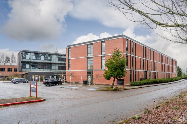
Property Record
2000 Tower St, Everett, WA 98201


Property Detail
2000 Tower St
290517-002-018-00
SECTION 17 TOWNSHIP 29 RANGE 05 QUARTER NW - BEG NXN E LN LOMBARD AVE & N LN SWALWELLS 4TH ADD TH N ON E LN LOMBARD PROD FOR 285FT TH ANG LEFT 67*12 02 FOR 416.79FT TH ANG LEFT 22*46 57 FOR 440.77FT TO E LN OF PLAT OF 1ST ADD TO LEGION PARK TH ANG LE
University
Snohomish
R-2
Washington
B and X Area of moderate flood hazard, usually the area between the limits of the 100-year and 500-year floods.
3
0
22.70 AC
2026
Everett CBD
040100
Seattle/Puget Sound
177,625 SF
Seattle-Tacoma-Bellevue, WA
NEARBY LISTINGS FOR SALE OR LEASE
DEMOGRAPHICS near 2000 Tower St
1 mile
3 mile
5 mile
2025 Total Population
10,837
33,569
117,592
2030 Population
11,307
34,878
122,490
Pop Growth 2025-2030
+ 4.34%
+ 3.90%
+ 4.17%
Average Age
41
41
39
2025 Total Households
4,599
15,068
45,516
HH Growth 2025-2030
+ 4.46%
+ 4.15%
+ 4.31%
Median Household Inc
$73,547
$72,094
$92,440
Avg Household Size
2.20
2.10
2.50
2025 Avg HH Vehicles
2.00
2.00
2.00
Median Home Value
$641,717
$555,943
$640,522
Median Year Built
1957
1961
1983
Nearby Places
Map Layers
Map Styles
 Street
 Aerial
Layers
 Traffic
 Biking
Places
Listings with unknown addresses are not visible on the map
- Restaurants
- Banks
- Shops
- Fitness
- Groceries
PUBLIC TRANSPORTATION
COMMUTER RAIL
Everett Station (Sounder South Line - Central Puget Sound Regional Transit Authority Rail (Link Light Rail/Sounder))
Drive
Walk
Distance
Everett Station (Sounder South Line - Central Puget Sound Regional Transit Authority Rail (Link Light Rail/Sounder))
8 min
2.7 mi
Mukilteo Station (Sounder South Line - Central Puget Sound Regional Transit Authority Rail (Link Light Rail/Sounder))
Drive
Walk
Distance
Mukilteo Station (Sounder South Line - Central Puget Sound Regional Transit Authority Rail (Link Light Rail/Sounder))
19 min
9.1 mi
AIRPORT
Seattle Paine Field International
Drive
Walk
Distance
Seattle Paine Field International
20 min
10.8 mi
Freight Ports
Port of Everett
Drive
Walk
Distance
Port of Everett
6 min
2.6 mi
Nearby Properties
Address
Land Use
TOTAL SIZE
Lot Size
Zoning
Address
Land Use
TOTAL SIZE
Lot Size
Zoning
61.99 AC
FE
Address
Land Use
TOTAL SIZE
Lot Size
Zoning
651,084 SF
1.10 AC
R-2
Address
Land Use
TOTAL SIZE
Lot Size
Zoning
372,084 SF
4.18 AC
R-2
Address
Land Use
TOTAL SIZE
Lot Size
Zoning
647,181 SF
3.53 AC
UR4
Address
Land Use
TOTAL SIZE
Lot Size
Zoning
640,282 SF
2.75 AC
MU
Address
Land Use
TOTAL SIZE
Lot Size
Zoning
339,059 SF
1.19 AC
MU
Address
Land Use
TOTAL SIZE
Lot Size
Zoning
53.95 AC
MU
Address
Land Use
TOTAL SIZE
Lot Size
Zoning
367,153 SF
0.14 AC
F6
Address
Land Use
TOTAL SIZE
Lot Size
Zoning
234,485 SF
16.71 AC
HI
Address
Land Use
TOTAL SIZE
Lot Size
Zoning
5,956 SF
1.04 AC
MU
Address
Land Use
TOTAL SIZE
Lot Size
Zoning
204,314 SF
9.68 AC
HI
Address
Land Use
TOTAL SIZE
Lot Size
Zoning
186,258 SF
2.76 AC
MU
Address
Land Use
TOTAL SIZE
Lot Size
Zoning
130,353 SF
28.73 AC
UR3
Address
Land Use
TOTAL SIZE
Lot Size
Zoning
7,436 SF
5.06 AC
MU
Address
Land Use
TOTAL SIZE
Lot Size
Zoning
249,940 SF
1.72 AC
R-2
Address
Land Use
TOTAL SIZE
Lot Size
Zoning
182,739 SF
4.77 AC
MU
Address
Land Use
TOTAL SIZE
Lot Size
Zoning
47.29 AC
FY
Address
Land Use
TOTAL SIZE
Lot Size
Zoning
285,572 SF
1.73 AC
UR3
Address
Land Use
TOTAL SIZE
Lot Size
Zoning
78,467 SF
1.04 AC
MU
Address
Land Use
TOTAL SIZE
Lot Size
Zoning
263,226 SF
4.22 AC
UR4
Address
Land Use
TOTAL SIZE
Lot Size
Zoning
151,385 SF
9.25 AC
UR4
Address
Land Use
TOTAL SIZE
Lot Size
Zoning
98,584 SF
1.91 AC
MU
Address
Land Use
TOTAL SIZE
Lot Size
Zoning
141,051 SF
0.82 AC
UR4
Address
Land Use
TOTAL SIZE
Lot Size
Zoning
284,455 SF
1.37 AC
MU
Address
Land Use
TOTAL SIZE
Lot Size
Zoning
138,084 SF
8.94 AC
UR4
Address
Land Use
TOTAL SIZE
Lot Size
Zoning
7.70 AC
UR4
Address
Land Use
TOTAL SIZE
Lot Size
Zoning
270,984 SF
0.80 AC
MU
Address
Land Use
TOTAL SIZE
Lot Size
Zoning
71,972 SF
1.93 AC
MU
The World's #1 Commercial Real Estate Marketplace
Connect with us
© 2026 CoStar Group
The information above has been obtained from sources believed reliable. While we do not doubt its accuracy we have not verified it and make no guarantee, warranty or representation about it. It is your responsibility to independently confirm its accuracy and completeness. Any projections, opinions, assumptions, or estimates used are for example only and do not represent the current or future performance of the property. The value of this transaction to you depends on tax and other factors which should be evaluated by your tax, financial, and legal advisors. You and your advisors should conduct a careful, independent investigation of the property to determine to your satisfaction the suitability of the property for your needs.