Property Record
2000 Van Horn Rd, Trenton, MI 48183


NEARBY LISTINGS FOR SALE OR LEASE
Property Detail
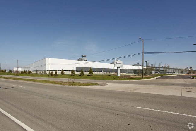
2000 Van Horn Rd
Detroit-Warren-Dearborn, MI
Fairgrove
54-015-99-0001-000
19Q1 19W1 24E1 PART OF SEC 19 T4S R11 E AND SEC 24 T4S R10E BEG AT A PT. ON THE S LINE OF SAID SEC 24 DISTANT S 89D 56M 30S W 433.71 FT FROM THE S E COR OF SEC 24 AND PROCEEDING TH ALONG SAID S LINE S 89D 56M 30S 2155.02 FT AND S 88D 30M W 99.7 FT TH
Industrialgeneral
Wayne
X
Michigan
26163C0414E
0001
2025
137.23 AC
2025
Downriver South
982301
Detroit
2,651,867 SF
DEMOGRAPHICS near 2000 Van Horn Rd
1 Mile
3 Mile
5 Mile
2024 Total Population
6,052
42,866
101,862
2029 Population
5,793
41,063
97,708
Pop Growth 2024-2029
(4.28%)
(4.21%)
(4.08%)
Average Age
43
45
43
2024 Total Households
2,655
18,449
42,498
HH Growth 2024-2029
(4.37%)
(4.24%)
(4.10%)
Median Household Inc
$72,015
$82,232
$75,473
Avg Household Size
2.20
2.30
2.40
2024 Avg HH Vehicles
2.00
2.00
2.00
Median Home Value
$174,604
$213,745
$200,921
Median Year Built
1959
1971
1972
Nearby Places
Map Layers
Map Styles
 Street
 Aerial
- Restaurants
- Banks
- Shops
- Fitness
- Groceries
PUBLIC TRANSPORTATION
AIRPORT
Detroit Metro Wayne County
DRIVE
WALK
Distance
Detroit Metro Wayne County
25 min
15.5 mi
Windsor International
DRIVE
WALK
Distance
Windsor International
50 min
31.0 mi
Freight Ports
Port of Toledo
DRIVE
WALK
Distance
Port of Toledo
57 min
42.4 mi
Nearby Properties
Address
Land Use
TOTAL SIZE
Lot Size
Zoning
Address
Land Use
TOTAL SIZE
Lot Size
Zoning
2,193,696 SF
182.23 AC
Address
Land Use
TOTAL SIZE
Lot Size
Zoning
155,600 SF
83.84 AC
R1
Address
Land Use
TOTAL SIZE
Lot Size
Zoning
235,489 SF
23.47 AC
Address
Land Use
TOTAL SIZE
Lot Size
Zoning
150,224 SF
15.45 AC
RM-1
Address
Land Use
TOTAL SIZE
Lot Size
Zoning
122,430 SF
22.24 AC
Address
Land Use
TOTAL SIZE
Lot Size
Zoning
209,221 SF
21.80 AC
Address
Land Use
TOTAL SIZE
Lot Size
Zoning
211,389 SF
41.38 AC
Address
Land Use
TOTAL SIZE
Lot Size
Zoning
42.98 AC
Address
Land Use
TOTAL SIZE
Lot Size
Zoning
178,682 SF
19.23 AC
Address
Land Use
TOTAL SIZE
Lot Size
Zoning
92,397 SF
12.63 AC
PUD
Address
Land Use
TOTAL SIZE
Lot Size
Zoning
125,828 SF
8.17 AC
B-2 COM
Address
Land Use
TOTAL SIZE
Lot Size
Zoning
2,160 SF
334.88 AC
I1
Address
Land Use
TOTAL SIZE
Lot Size
Zoning
143,496 SF
3.73 AC
RM-2
Address
Land Use
TOTAL SIZE
Lot Size
Zoning
61,784 SF
6.78 AC
Address
Land Use
TOTAL SIZE
Lot Size
Zoning
169,192 SF
11.90 AC
R1
Address
Land Use
TOTAL SIZE
Lot Size
Zoning
59,427 SF
5.50 AC
Address
Land Use
TOTAL SIZE
Lot Size
Zoning
68,409 SF
64.56 AC
Address
Land Use
TOTAL SIZE
Lot Size
Zoning
196,714 SF
20.43 AC
Address
Land Use
TOTAL SIZE
Lot Size
Zoning
2,368 SF
32.58 AC
Address
Land Use
TOTAL SIZE
Lot Size
Zoning
48,760 SF
4.86 AC
Address
Land Use
TOTAL SIZE
Lot Size
Zoning
18,678 SF
3.10 AC
R1-ONE
Address
Land Use
TOTAL SIZE
Lot Size
Zoning
2,816 SF
86.70 AC
RESIDE
Address
Land Use
TOTAL SIZE
Lot Size
Zoning
58,149 SF
11.40 AC
B2-COM
Address
Land Use
TOTAL SIZE
Lot Size
Zoning
62,039 SF
Address
Land Use
TOTAL SIZE
Lot Size
Zoning
44,733 SF
10.51 AC
Address
Land Use
TOTAL SIZE
Lot Size
Zoning
54,064 SF
5.05 AC
B-2
Address
Land Use
TOTAL SIZE
Lot Size
Zoning
131,935 SF
6.71 AC
RM1-MUL
Address
Land Use
TOTAL SIZE
Lot Size
Zoning
144,188 SF
8.56 AC
RM1-MUL
Address
Land Use
TOTAL SIZE
Lot Size
Zoning
48,288 SF
22.34 AC
The World's #1 Commercial Real Estate Marketplace
Connect with us
© 2026 CoStar Group
The information above has been obtained from sources believed reliable. While we do not doubt its accuracy we have not verified it and make no guarantee, warranty or representation about it. It is your responsibility to independently confirm its accuracy and completeness. Any projections, opinions, assumptions, or estimates used are for example only and do not represent the current or future performance of the property. The value of this transaction to you depends on tax and other factors which should be evaluated by your tax, financial, and legal advisors. You and your advisors should conduct a careful, independent investigation of the property to determine to your satisfaction the suitability of the property for your needs.