Property Record
2000 W Intl Airport Rd, Anchorage, AK 99502
Current Lease Availabilities
NEARBY LISTINGS FOR SALE OR LEASE
Property Detail
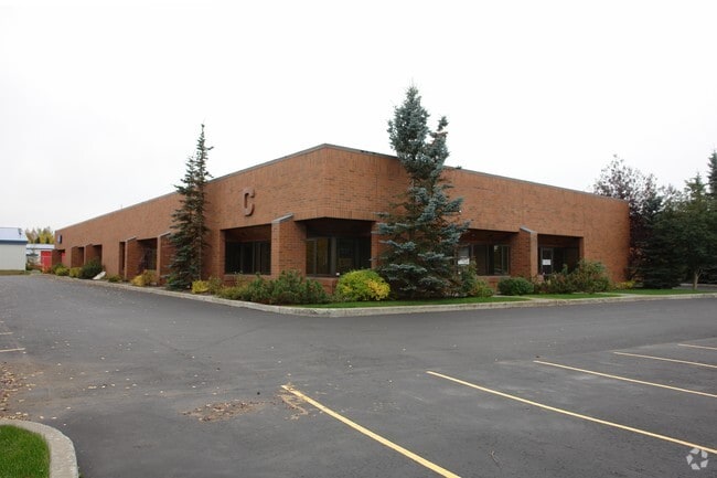
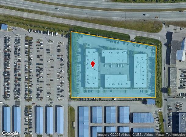
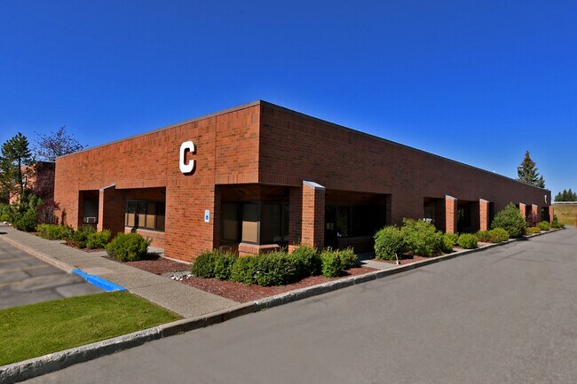
2000 W Intl Airport Rd
01052111000
International East #1
Officebuilding
INTERNATIONAL EAST #1 TR 5
X
Anchorage
0200050741D
Alaska
2024
4.39 AC
2025
W Tudor/Dimond-15
002302
Anchorage
18,144 SF
Anchorage, AK
DEMOGRAPHICS near 2000 W Intl Airport Rd
1 Mile
3 Mile
5 Mile
2024 Total Population
7,773
86,139
160,267
2029 Population
7,641
85,010
157,946
Pop Growth 2024-2029
(1.70%)
(1.31%)
(1.45%)
Average Age
39
38
38
2024 Total Households
3,145
35,316
63,434
HH Growth 2024-2029
(1.78%)
(1.35%)
(1.48%)
Median Household Inc
$84,966
$85,917
$84,651
Avg Household Size
2.40
2.30
2.40
2024 Avg HH Vehicles
2.00
2.00
2.00
Median Home Value
$293,543
$343,240
$336,884
Median Year Built
1973
1978
1980
Nearby Places
Map Layers
Map Styles
 Street
 Aerial
- Restaurants
- Banks
- Shops
- Fitness
- Groceries
PUBLIC TRANSPORTATION
AIRPORT
Ted Stevens Anchorage International
DRIVE
WALK
Distance
Ted Stevens Anchorage International
8 min
2.6 mi
Merrill Field
DRIVE
WALK
Distance
Merrill Field
14 min
6.5 mi
Freight Ports
Port of Anchorage
DRIVE
WALK
Distance
Port of Anchorage
15 min
6.6 mi
Nearby Properties
Address
Land Use
TOTAL SIZE
Lot Size
Zoning
Address
Land Use
TOTAL SIZE
Lot Size
Zoning
91,034 SF
63.70 AC
TR
Address
Land Use
TOTAL SIZE
Lot Size
Zoning
171,692 SF
23.09 AC
I1
Address
Land Use
TOTAL SIZE
Lot Size
Zoning
117,702 SF
9.85 AC
B3SL
Address
Land Use
TOTAL SIZE
Lot Size
Zoning
134,626 SF
16.91 AC
PLI
Address
Land Use
TOTAL SIZE
Lot Size
Zoning
381,477 SF
33.30 AC
B3
Address
Land Use
TOTAL SIZE
Lot Size
Zoning
195,079 SF
44.79 AC
PLI
Address
Land Use
TOTAL SIZE
Lot Size
Zoning
267,442 SF
61.04 AC
PLI
Address
Land Use
TOTAL SIZE
Lot Size
Zoning
61,127 SF
3.04 AC
B3
Address
Land Use
TOTAL SIZE
Lot Size
Zoning
121,359 SF
4.35 AC
B3SL
Address
Land Use
TOTAL SIZE
Lot Size
Zoning
124,058 SF
18.15 AC
B3
Address
Land Use
TOTAL SIZE
Lot Size
Zoning
56,747 SF
6.89 AC
B3SL
Address
Land Use
TOTAL SIZE
Lot Size
Zoning
66,354 SF
44.23 AC
I2
Address
Land Use
TOTAL SIZE
Lot Size
Zoning
242,189 SF
21.83 AC
I2
Address
Land Use
TOTAL SIZE
Lot Size
Zoning
168,640 SF
3.38 AC
I2
Address
Land Use
TOTAL SIZE
Lot Size
Zoning
84,157 SF
3.41 AC
B3
Address
Land Use
TOTAL SIZE
Lot Size
Zoning
341,267 SF
5.51 AC
TR
Address
Land Use
TOTAL SIZE
Lot Size
Zoning
112,874 SF
6.61 AC
ROSL
Address
Land Use
TOTAL SIZE
Lot Size
Zoning
217,754 SF
14.42 AC
I1
Address
Land Use
TOTAL SIZE
Lot Size
Zoning
171,800 SF
1.67 AC
B3
Address
Land Use
TOTAL SIZE
Lot Size
Zoning
19,638 SF
0.97 AC
B3
Address
Land Use
TOTAL SIZE
Lot Size
Zoning
79,766 SF
4.15 AC
B3
Address
Land Use
TOTAL SIZE
Lot Size
Zoning
145,475 SF
18.05 AC
B3
Address
Land Use
TOTAL SIZE
Lot Size
Zoning
103,442 SF
3.50 AC
B3
Address
Land Use
TOTAL SIZE
Lot Size
Zoning
68,191 SF
5.39 AC
B3
Address
Land Use
TOTAL SIZE
Lot Size
Zoning
164,774 SF
29.26 AC
PLI
Address
Land Use
TOTAL SIZE
Lot Size
Zoning
56,520 SF
3.81 AC
B3
Address
Land Use
TOTAL SIZE
Lot Size
Zoning
31,780 SF
16.44 AC
R3
Address
Land Use
TOTAL SIZE
Lot Size
Zoning
114,395 SF
3.10 AC
B3
Address
Land Use
TOTAL SIZE
Lot Size
Zoning
192,295 SF
15.53 AC
B3
Address
Land Use
TOTAL SIZE
Lot Size
Zoning
116,420 SF
14.86 AC
B3
The World's #1 Commercial Real Estate Marketplace
Connect with us
© 2026 CoStar Group
The information above has been obtained from sources believed reliable. While we do not doubt its accuracy we have not verified it and make no guarantee, warranty or representation about it. It is your responsibility to independently confirm its accuracy and completeness. Any projections, opinions, assumptions, or estimates used are for example only and do not represent the current or future performance of the property. The value of this transaction to you depends on tax and other factors which should be evaluated by your tax, financial, and legal advisors. You and your advisors should conduct a careful, independent investigation of the property to determine to your satisfaction the suitability of the property for your needs.