Property Record
2000 W Spring Creek Pkwy, Plano, TX 75023
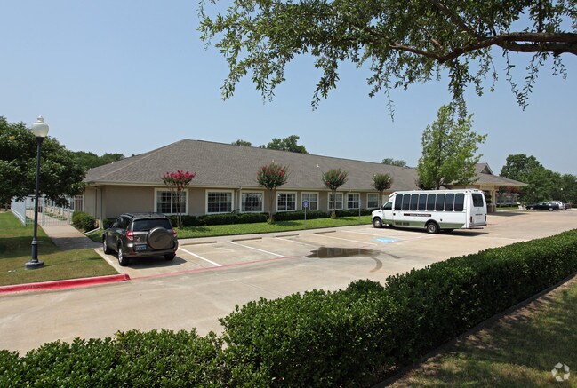

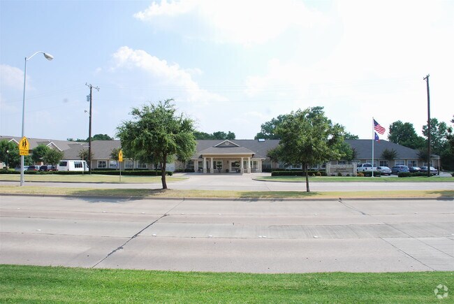

Property Detail
2000 W Spring Creek Pkwy
Dallas-Fort Worth-Arlington, TX
SOUTHBAY ADDITION, BLK A, LOT 1
R-3863-00A-0010-1
COLLIN
Commercialnec
Texas
B and X Area of moderate flood hazard, usually the area between the limits of the 100-year and 500-year floods.
1
2025
2.35 AC
2025
Plano
031628
Dallas/Ft Worth
26,520 SF
NEARBY LISTINGS FOR SALE OR LEASE
-
-
View all Plano listings for sale on LoopNet.com
DEMOGRAPHICS near 2000 W Spring Creek Pkwy
1 mile
3 mile
5 mile
2025 Total Population
17,046
140,621
368,012
2030 Population
19,266
158,778
417,028
Pop Growth 2025-2030
+ 13.02%
+ 12.91%
+ 13.32%
Average Age
43
41
40
2025 Total Households
6,508
52,394
141,047
HH Growth 2025-2030
+ 13.21%
+ 13.17%
+ 13.68%
Median Household Inc
$122,543
$115,001
$110,874
Avg Household Size
2.50
2.60
2.50
2025 Avg HH Vehicles
2.00
2.00
2.00
Median Home Value
$415,416
$460,435
$491,102
Median Year Built
1982
1988
1994
Nearby Places
Map Layers
Map Styles
 Street
 Aerial
Transit
 Traffic
 Biking
Places
Listings with unknown addresses are not visible on the map
- Restaurants
- Banks
- Shops
- Fitness
- Groceries
PUBLIC TRANSPORTATION
AIRPORT
Dallas Love Field
Drive
Walk
Distance
Dallas Love Field
34 min
25.0 mi
Dallas-Fort Worth International
Drive
Walk
Distance
Dallas-Fort Worth International
39 min
28.2 mi
Nearby Properties
Address
Land Use
TOTAL SIZE
Lot Size
Zoning
Address
Land Use
TOTAL SIZE
Lot Size
Zoning
606,071 SF
64.75 AC
SFR
Address
Land Use
TOTAL SIZE
Lot Size
Zoning
528,996 SF
26.35 AC
R
Address
Land Use
TOTAL SIZE
Lot Size
Zoning
442,484 SF
APTS
Address
Land Use
TOTAL SIZE
Lot Size
Zoning
617,776 SF
97.53 AC
A
Address
Land Use
TOTAL SIZE
Lot Size
Zoning
308,854 SF
16.62 AC
Address
Land Use
TOTAL SIZE
Lot Size
Zoning
445,959 SF
4.55 AC
MF-E
Address
Land Use
TOTAL SIZE
Lot Size
Zoning
64.94 AC
Address
Land Use
TOTAL SIZE
Lot Size
Zoning
408,256 SF
27.66 AC
MF-M
Address
Land Use
TOTAL SIZE
Lot Size
Zoning
400,049 SF
34.67 AC
MF-L
Address
Land Use
TOTAL SIZE
Lot Size
Zoning
457,656 SF
23.19 AC
MF-H
Address
Land Use
TOTAL SIZE
Lot Size
Zoning
297,331 SF
3.77 AC
Address
Land Use
TOTAL SIZE
Lot Size
Zoning
216,665 SF
12.17 AC
Address
Land Use
TOTAL SIZE
Lot Size
Zoning
253,268 SF
4.54 AC
LC
Address
Land Use
TOTAL SIZE
Lot Size
Zoning
213,415 SF
16.94 AC
Address
Land Use
TOTAL SIZE
Lot Size
Zoning
381,372 SF
18.72 AC
MF-3
Address
Land Use
TOTAL SIZE
Lot Size
Zoning
291,184 SF
21.03 AC
MF-M
Address
Land Use
TOTAL SIZE
Lot Size
Zoning
361,316 SF
20.96 AC
MF-H
Address
Land Use
TOTAL SIZE
Lot Size
Zoning
334,313 SF
22.10 AC
Address
Land Use
TOTAL SIZE
Lot Size
Zoning
299,442 SF
25.48 AC
PD-329 COM
Address
Land Use
TOTAL SIZE
Lot Size
Zoning
238,481 SF
17.23 AC
SFR
Address
Land Use
TOTAL SIZE
Lot Size
Zoning
289,620 SF
18.21 AC
MF-M
Address
Land Use
TOTAL SIZE
Lot Size
Zoning
237,395 SF
19.43 AC
Address
Land Use
TOTAL SIZE
Lot Size
Zoning
363,466 SF
22.42 AC
MF-H
Address
Land Use
TOTAL SIZE
Lot Size
Zoning
317,830 SF
21.44 AC
MF-M
Address
Land Use
TOTAL SIZE
Lot Size
Zoning
351,845 SF
16 AC
MF-3
Address
Land Use
TOTAL SIZE
Lot Size
Zoning
332,500 SF
22.99 AC
MF-M
Address
Land Use
TOTAL SIZE
Lot Size
Zoning
271,907 SF
19.59 AC
MF-M
Address
Land Use
TOTAL SIZE
Lot Size
Zoning
249,571 SF
14.46 AC
MF-M
Address
Land Use
TOTAL SIZE
Lot Size
Zoning
280,335 SF
18.24 AC
MF-2
Address
Land Use
TOTAL SIZE
Lot Size
Zoning
244,036 SF
13.06 AC
MF-M
The World's #1 Commercial Real Estate Marketplace
Connect with us
© 2026 CoStar Group
The information above has been obtained from sources believed reliable. While we do not doubt its accuracy we have not verified it and make no guarantee, warranty or representation about it. It is your responsibility to independently confirm its accuracy and completeness. Any projections, opinions, assumptions, or estimates used are for example only and do not represent the current or future performance of the property. The value of this transaction to you depends on tax and other factors which should be evaluated by your tax, financial, and legal advisors. You and your advisors should conduct a careful, independent investigation of the property to determine to your satisfaction the suitability of the property for your needs.