Property Record
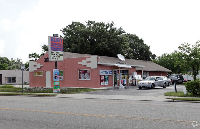
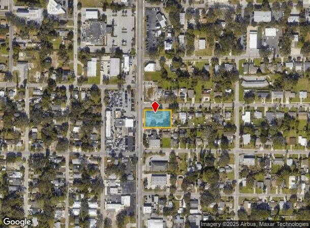
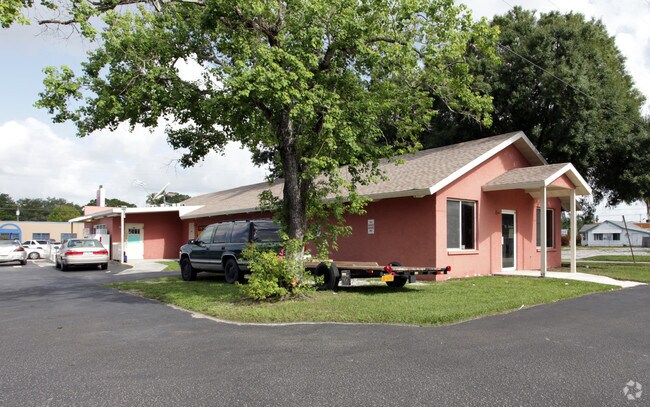
2001 9Th St W, Bradenton, FL 34205
NEARBY LISTINGS FOR SALE OR LEASE
Property Detail
2001 9Th St W
North Port-Bradenton-Sarasota, FL
Orange Estates
45071-0000-8
LOTS 28,29,30 ORANGE ESTATES PI#45071.0000/8
Storemultistory
Manatee
X
Florida
12081C0302F
28
2024
0.51 AC
2025
Manatee
000103
Tampa/St Petersburg
2,980 SF
DEMOGRAPHICS near 2001 9Th St W
1 Mile
3 Mile
5 Mile
2024 Total Population
17,094
113,654
219,189
2029 Population
19,916
133,108
256,072
Pop Growth 2024-2029
+ 16.51%
+ 17.12%
+ 16.83%
Average Age
41
43
44
2024 Total Households
6,384
46,630
91,054
HH Growth 2024-2029
+ 15.88%
+ 16.42%
+ 16.11%
Median Household Inc
$38,966
$45,111
$51,281
Avg Household Size
2.40
2.30
2.30
2024 Avg HH Vehicles
1.00
2.00
2.00
Median Home Value
$140,980
$168,992
$223,180
Median Year Built
1970
1976
1980
Nearby Places
Map Layers
Map Styles
 Street
 Aerial
- Restaurants
- Banks
- Shops
- Fitness
- Groceries
PUBLIC TRANSPORTATION
AIRPORT
Sarasota/Bradenton International
DRIVE
WALK
Distance
Sarasota/Bradenton International
14 min
6.9 mi
St Pete-Clearwater International
DRIVE
WALK
Distance
St Pete-Clearwater International
49 min
36.5 mi
Tampa International
DRIVE
WALK
Distance
Tampa International
60 min
45.8 mi
Freight Ports
Port Manatee
DRIVE
WALK
Distance
Port Manatee
22 min
12.6 mi
SALE & LEASE HISTORY
LISTING DATE
SALE/LEASE

Feb 21, 2018
For Sale
Nearby Properties
Address
Land Use
TOTAL SIZE
Lot Size
Zoning
Address
Land Use
TOTAL SIZE
Lot Size
Zoning
595,475 SF
16.90 AC
BR_T5
Address
Land Use
TOTAL SIZE
Lot Size
Zoning
349,711 SF
49.51 AC
BR_SD1
Address
Land Use
TOTAL SIZE
Lot Size
Zoning
405,843 SF
9.09 AC
BR_T5
Address
Land Use
TOTAL SIZE
Lot Size
Zoning
456,263 SF
28.02 AC
BR_R-3
Address
Land Use
TOTAL SIZE
Lot Size
Zoning
277,678 SF
7.80 AC
BR_T4-O, B
Address
Land Use
TOTAL SIZE
Lot Size
Zoning
314,018 SF
28.20 AC
BR_R-3
Address
Land Use
TOTAL SIZE
Lot Size
Zoning
98,722 SF
10.24 AC
PL_P
Address
Land Use
TOTAL SIZE
Lot Size
Zoning
432,078 SF
1.64 AC
BR_T6
Address
Land Use
TOTAL SIZE
Lot Size
Zoning
169,485 SF
7.87 AC
PD-MU
Address
Land Use
TOTAL SIZE
Lot Size
Zoning
318,507 SF
10.47 AC
BR_T4R,BR_
Address
Land Use
TOTAL SIZE
Lot Size
Zoning
2,401,721 SF
142.14 AC
PD-UI
Address
Land Use
TOTAL SIZE
Lot Size
Zoning
247,280 SF
17.72 AC
PD-R
Address
Land Use
TOTAL SIZE
Lot Size
Zoning
294,609 SF
19.15 AC
RMF9
Address
Land Use
TOTAL SIZE
Lot Size
Zoning
257,072 SF
10.07 AC
BR_T5
Address
Land Use
TOTAL SIZE
Lot Size
Zoning
214,906 SF
20.71 AC
BR_R-1
Address
Land Use
TOTAL SIZE
Lot Size
Zoning
500,923 SF
47.91 AC
Address
Land Use
TOTAL SIZE
Lot Size
Zoning
397,863 SF
21.60 AC
GC GENERA
Address
Land Use
TOTAL SIZE
Lot Size
Zoning
541,781 SF
3.48 AC
BR_T5
Address
Land Use
TOTAL SIZE
Lot Size
Zoning
318,680 SF
1.31 AC
BR_FBC,BR_
Address
Land Use
TOTAL SIZE
Lot Size
Zoning
247,592 SF
13.39 AC
GC,RMF-6
Address
Land Use
TOTAL SIZE
Lot Size
Zoning
198,036 SF
8.32 AC
GC GENERA
Address
Land Use
TOTAL SIZE
Lot Size
Zoning
115,400 SF
22.55 AC
LM LIGHT M
Address
Land Use
TOTAL SIZE
Lot Size
Zoning
185,617 SF
13.68 AC
BR_R-2
Address
Land Use
TOTAL SIZE
Lot Size
Zoning
187,000 SF
9.18 AC
Address
Land Use
TOTAL SIZE
Lot Size
Zoning
187,000 SF
8.93 AC
Address
Land Use
TOTAL SIZE
Lot Size
Zoning
166,810 SF
3.16 AC
BR_T4-O
Address
Land Use
TOTAL SIZE
Lot Size
Zoning
276,469 SF
10.90 AC
PD-MU
Address
Land Use
TOTAL SIZE
Lot Size
Zoning
163,582 SF
8.61 AC
PL_P
Address
Land Use
TOTAL SIZE
Lot Size
Zoning
901,196 SF
48.54 AC
LM LIGHT M
Address
Land Use
TOTAL SIZE
Lot Size
Zoning
196,346 SF
33.03 AC
BR_R-1
The World's #1 Commercial Real Estate Marketplace
Connect with us
© 2026 CoStar Group
The information above has been obtained from sources believed reliable. While we do not doubt its accuracy we have not verified it and make no guarantee, warranty or representation about it. It is your responsibility to independently confirm its accuracy and completeness. Any projections, opinions, assumptions, or estimates used are for example only and do not represent the current or future performance of the property. The value of this transaction to you depends on tax and other factors which should be evaluated by your tax, financial, and legal advisors. You and your advisors should conduct a careful, independent investigation of the property to determine to your satisfaction the suitability of the property for your needs.