Property Record
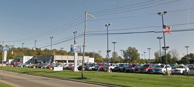
2001 Adj E Mcgalliard Rd, Muncie, IN 47303


Property Detail
2001 Adj E Mcgalliard Rd
Muncie, IN
PT FRAC NW QTR S02 T20 R10 7.570 AC
18-11-02-100-010.000-003
DELAWARE
Commercialacreage
Indiana
AE The base floodplain where base flood elevations are provided. AE Zones are now used on new format FIRMs instead of A1-A30 Zones.
3.20 AC
2025
Muncie/Delaware County
2025
Indianapolis
002000
NEARBY LISTINGS FOR SALE OR LEASE
DEMOGRAPHICS near 2001 Adj E Mcgalliard Rd
1 mile
3 mile
5 mile
2025 Total Population
3,297
51,692
85,195
2030 Population
3,237
54,577
87,545
Pop Growth 2025-2030
(1.82%)
+ 5.58%
+ 2.76%
Average Age
41
34
37
2025 Total Households
1,446
20,076
34,709
HH Growth 2025-2030
(2.28%)
+ 5.96%
+ 2.83%
Median Household Inc
$40,458
$40,492
$47,797
Avg Household Size
2.10
2.10
2.20
2025 Avg HH Vehicles
1.00
2.00
2.00
Median Home Value
$72,003
$102,521
$121,668
Median Year Built
1968
1968
1967
Nearby Places
Map Layers
Map Styles
 Street
 Aerial
Layers
 Traffic
 Biking
Places
Listings with unknown addresses are not visible on the map
- Restaurants
- Banks
- Shops
- Fitness
- Groceries
SALE & LEASE HISTORY
LISTING DATE
SALE/LEASE

Sep 24, 2016
For Sale
Jan 06, 2017
For Sale
Nearby Properties
Address
Land Use
TOTAL SIZE
Lot Size
Zoning
Address
Land Use
TOTAL SIZE
Lot Size
Zoning
212,625 SF
34.32 AC
Address
Land Use
TOTAL SIZE
Lot Size
Zoning
37,168 SF
24.56 AC
Address
Land Use
TOTAL SIZE
Lot Size
Zoning
112,553 SF
17.17 AC
Address
Land Use
TOTAL SIZE
Lot Size
Zoning
127,495 SF
25 AC
Address
Land Use
TOTAL SIZE
Lot Size
Zoning
82,160 SF
14.32 AC
Address
Land Use
TOTAL SIZE
Lot Size
Zoning
24,036 SF
7.21 AC
Address
Land Use
TOTAL SIZE
Lot Size
Zoning
77,145 SF
10.45 AC
Address
Land Use
TOTAL SIZE
Lot Size
Zoning
9,280 SF
19.77 AC
Address
Land Use
TOTAL SIZE
Lot Size
Zoning
2,125 SF
51.91 AC
Address
Land Use
TOTAL SIZE
Lot Size
Zoning
231,752 SF
6.64 AC
Address
Land Use
TOTAL SIZE
Lot Size
Zoning
17,240 SF
10.56 AC
Address
Land Use
TOTAL SIZE
Lot Size
Zoning
367,525 SF
1.36 AC
Address
Land Use
TOTAL SIZE
Lot Size
Zoning
170,740 SF
2.30 AC
Address
Land Use
TOTAL SIZE
Lot Size
Zoning
92,340 SF
9.22 AC
Address
Land Use
TOTAL SIZE
Lot Size
Zoning
1,418 SF
0.91 AC
Address
Land Use
TOTAL SIZE
Lot Size
Zoning
181,950 SF
0.45 AC
Address
Land Use
TOTAL SIZE
Lot Size
Zoning
40,050 SF
9.05 AC
Address
Land Use
TOTAL SIZE
Lot Size
Zoning
184,825 SF
26.23 AC
Address
Land Use
TOTAL SIZE
Lot Size
Zoning
108,480 SF
2.61 AC
Address
Land Use
TOTAL SIZE
Lot Size
Zoning
142,628 SF
13.07 AC
Address
Land Use
TOTAL SIZE
Lot Size
Zoning
9,000 SF
43.70 AC
Address
Land Use
TOTAL SIZE
Lot Size
Zoning
40,698 SF
0.99 AC
Address
Land Use
TOTAL SIZE
Lot Size
Zoning
277,137 SF
2.25 AC
Address
Land Use
TOTAL SIZE
Lot Size
Zoning
92,044 SF
21.84 AC
Address
Land Use
TOTAL SIZE
Lot Size
Zoning
88,495 SF
8.93 AC
Address
Land Use
TOTAL SIZE
Lot Size
Zoning
57,399 SF
16.87 AC
Address
Land Use
TOTAL SIZE
Lot Size
Zoning
91,000 SF
10.58 AC
Address
Land Use
TOTAL SIZE
Lot Size
Zoning
45,870 SF
2.75 AC
Address
Land Use
TOTAL SIZE
Lot Size
Zoning
138,880 SF
0.70 AC
Address
Land Use
TOTAL SIZE
Lot Size
Zoning
93,444 SF
8.28 AC
The World's #1 Commercial Real Estate Marketplace
Connect with us
© 2026 CoStar Group
The information above has been obtained from sources believed reliable. While we do not doubt its accuracy we have not verified it and make no guarantee, warranty or representation about it. It is your responsibility to independently confirm its accuracy and completeness. Any projections, opinions, assumptions, or estimates used are for example only and do not represent the current or future performance of the property. The value of this transaction to you depends on tax and other factors which should be evaluated by your tax, financial, and legal advisors. You and your advisors should conduct a careful, independent investigation of the property to determine to your satisfaction the suitability of the property for your needs.