Property Record
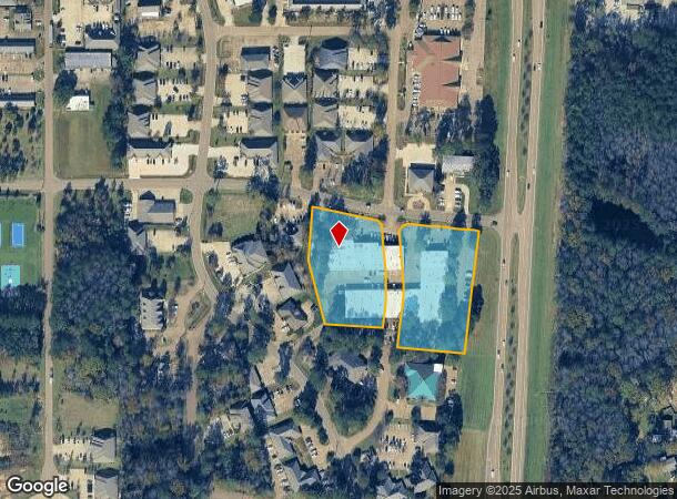
2001 Airport Rd N, Flowood, MS 39232


NEARBY LISTINGS FOR SALE OR LEASE
Property Detail
2001 Airport Rd N
Jackson, MS
Woodline Drive
F10J-000015-00910
ALL LOTS 91, 92, 93, 104, 107, & 108 & A PART OF LOTS 94, 102, & 103 & A PART OF WOODLINE DRIVE IN LAKELAND EAST OFFICE PARK
Multipleuses
Rankin
AE
Mississippi
28121C0179G
91
2024
4.07 AC
2024
Brandon/Flowood/Pearl
020304
Jackson
17,302 SF
DEMOGRAPHICS near 2001 Airport Rd N
1 Mile
3 Mile
5 Mile
2024 Total Population
672
14,926
83,018
2029 Population
682
15,053
82,285
Pop Growth 2024-2029
+ 1.49%
+ 0.85%
(0.88%)
Average Age
35
39
39
2024 Total Households
415
6,353
35,738
HH Growth 2024-2029
+ 1.45%
+ 1.04%
(1.09%)
Median Household Inc
$46,666
$71,295
$61,954
Avg Household Size
1.60
2.30
2.20
2024 Avg HH Vehicles
2.00
2.00
2.00
Median Home Value
$138,889
$221,875
$187,855
Median Year Built
1989
1990
1979
Nearby Places
Map Layers
Map Styles
 Street
 Aerial
- Restaurants
- Banks
- Shops
- Fitness
- Groceries
PUBLIC TRANSPORTATION
COMMUTER RAIL
Jackson (City of New Orleans - Amtrak)
DRIVE
WALK
Distance
Jackson (City of New Orleans - Amtrak)
13 min
8.6 mi
AIRPORT
Jackson-Medgar Wiley Evers International
DRIVE
WALK
Distance
Jackson-Medgar Wiley Evers International
12 min
5.0 mi
Freight Ports
Port of Greater Baton Rouge
DRIVE
WALK
Distance
Port of Greater Baton Rouge
207 min
184.9 mi
SALE & LEASE HISTORY
LISTING DATE
SALE/LEASE

Jan 23, 2017
For Lease
Jan 03, 2024
For Lease
Feb 26, 2018
For Lease
Feb 10, 2023
For Sale
Nearby Properties
Address
Land Use
TOTAL SIZE
Lot Size
Zoning
Address
Land Use
TOTAL SIZE
Lot Size
Zoning
14,236 SF
7.38 AC
Address
Land Use
TOTAL SIZE
Lot Size
Zoning
48,134 SF
6.62 AC
Address
Land Use
TOTAL SIZE
Lot Size
Zoning
117,983 SF
7.01 AC
Address
Land Use
TOTAL SIZE
Lot Size
Zoning
19,639 SF
4.07 AC
Address
Land Use
TOTAL SIZE
Lot Size
Zoning
136,355 SF
26.65 AC
Address
Land Use
TOTAL SIZE
Lot Size
Zoning
121,590 SF
Address
Land Use
TOTAL SIZE
Lot Size
Zoning
6,639 SF
35.63 AC
Address
Land Use
TOTAL SIZE
Lot Size
Zoning
125,008 SF
18 AC
Address
Land Use
TOTAL SIZE
Lot Size
Zoning
81,649 SF
5.60 AC
Address
Land Use
TOTAL SIZE
Lot Size
Zoning
8,896 SF
12.73 AC
Address
Land Use
TOTAL SIZE
Lot Size
Zoning
1,787 SF
16.82 AC
Address
Land Use
TOTAL SIZE
Lot Size
Zoning
40.72 AC
Address
Land Use
TOTAL SIZE
Lot Size
Zoning
74,153 SF
4.52 AC
Address
Land Use
TOTAL SIZE
Lot Size
Zoning
5,354 SF
0.68 AC
Address
Land Use
TOTAL SIZE
Lot Size
Zoning
66,102 SF
6.21 AC
Address
Land Use
TOTAL SIZE
Lot Size
Zoning
15,115 SF
2.48 AC
Address
Land Use
TOTAL SIZE
Lot Size
Zoning
192,761 SF
9.81 AC
Address
Land Use
TOTAL SIZE
Lot Size
Zoning
90,610 SF
Address
Land Use
TOTAL SIZE
Lot Size
Zoning
15,645 SF
1.10 AC
Address
Land Use
TOTAL SIZE
Lot Size
Zoning
2,457 SF
11.42 AC
Address
Land Use
TOTAL SIZE
Lot Size
Zoning
1,490 SF
15.24 AC
Address
Land Use
TOTAL SIZE
Lot Size
Zoning
11,578 SF
0.89 AC
Address
Land Use
TOTAL SIZE
Lot Size
Zoning
57,577 SF
13.40 AC
Address
Land Use
TOTAL SIZE
Lot Size
Zoning
73,795 SF
5.02 AC
Address
Land Use
TOTAL SIZE
Lot Size
Zoning
125,227 SF
8.91 AC
Address
Land Use
TOTAL SIZE
Lot Size
Zoning
52,343 SF
3.39 AC
Address
Land Use
TOTAL SIZE
Lot Size
Zoning
78,239 SF
4 AC
Address
Land Use
TOTAL SIZE
Lot Size
Zoning
48,048 SF
5 AC
The World's #1 Commercial Real Estate Marketplace
Connect with us
© 2025 CoStar Group
The information above has been obtained from sources believed reliable. While we do not doubt its accuracy we have not verified it and make no guarantee, warranty or representation about it. It is your responsibility to independently confirm its accuracy and completeness. Any projections, opinions, assumptions, or estimates used are for example only and do not represent the current or future performance of the property. The value of this transaction to you depends on tax and other factors which should be evaluated by your tax, financial, and legal advisors. You and your advisors should conduct a careful, independent investigation of the property to determine to your satisfaction the suitability of the property for your needs.