Property Record
2001 Aqui Esta Dr, Punta Gorda, FL 33950


NEARBY LISTINGS FOR SALE OR LEASE
-
-
View all Punta Gorda listings for sale on LoopNet.com
Property Detail
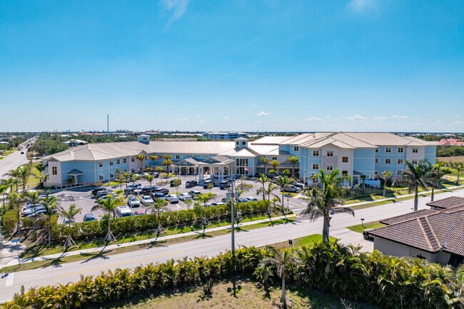
2001 Aqui Esta Dr
Punta Gorda, FL
Punta Gorda Isles
412214426002
PUNTA GORDA ISLES SEC 26 TRACT A 4.36 AC. M/L LESS A 15 FT X 20 FT IN NW COR 661/558 844/735-39 2049/1436 E2178/416 E2357/2099 CT3524/752 3674/663 4098/507 E4462/1498 4814/1951
Hospitalprivate
Charlotte
AE
Florida
12015C0237G
tra
2024
4.36 AC
2025
Punta Gorda
010405
Southwest Florida
119,034 SF
DEMOGRAPHICS near 2001 Aqui Esta Dr
1 Mile
3 Mile
5 Mile
2024 Total Population
6,831
21,728
42,948
2029 Population
8,225
26,195
51,704
Pop Growth 2024-2029
+ 20.41%
+ 20.56%
+ 20.39%
Average Age
66
62
57
2024 Total Households
3,612
11,210
20,981
HH Growth 2024-2029
+ 20.57%
+ 20.68%
+ 20.65%
Median Household Inc
$85,150
$69,910
$60,537
Avg Household Size
1.90
1.90
2.00
2024 Avg HH Vehicles
2.00
2.00
2.00
Median Home Value
$536,625
$456,559
$340,275
Median Year Built
1990
1992
1989
Nearby Places
Map Layers
Map Styles
 Street
 Aerial
- Restaurants
- Banks
- Shops
- Fitness
- Groceries
PUBLIC TRANSPORTATION
AIRPORT
Punta Gorda
DRIVE
WALK
Distance
Punta Gorda
12 min
5.5 mi
Freight Ports
Port Manatee
DRIVE
WALK
Distance
Port Manatee
93 min
75.5 mi
Nearby Properties
Address
Land Use
TOTAL SIZE
Lot Size
Zoning
Address
Land Use
TOTAL SIZE
Lot Size
Zoning
349,844 SF
78.47 AC
P
Address
Land Use
TOTAL SIZE
Lot Size
Zoning
77,154 SF
10.30 AC
CC
Address
Land Use
TOTAL SIZE
Lot Size
Zoning
47,443 SF
7.94 AC
CC
Address
Land Use
TOTAL SIZE
Lot Size
Zoning
15,253 SF
13.27 AC
P
Address
Land Use
TOTAL SIZE
Lot Size
Zoning
208,560 SF
36.69 AC
PD-GM
Address
Land Use
TOTAL SIZE
Lot Size
Zoning
142,812 SF
7.89 AC
HC
Address
Land Use
TOTAL SIZE
Lot Size
Zoning
6,313 SF
15.49 AC
P
Address
Land Use
TOTAL SIZE
Lot Size
Zoning
73,095 SF
5 AC
NC
Address
Land Use
TOTAL SIZE
Lot Size
Zoning
44,185 SF
1.22 AC
CC
Address
Land Use
TOTAL SIZE
Lot Size
Zoning
25,356 SF
1.40 AC
CC
Address
Land Use
TOTAL SIZE
Lot Size
Zoning
82,379 SF
0.88 AC
CC
Address
Land Use
TOTAL SIZE
Lot Size
Zoning
12,159 SF
0.56 AC
CC
Address
Land Use
TOTAL SIZE
Lot Size
Zoning
24,880 SF
84.50 AC
PKR
Address
Land Use
TOTAL SIZE
Lot Size
Zoning
43,755 SF
8.19 AC
CC
Address
Land Use
TOTAL SIZE
Lot Size
Zoning
30,472 SF
3.19 AC
NR-10
Address
Land Use
TOTAL SIZE
Lot Size
Zoning
30,940 SF
0.42 AC
NC
Address
Land Use
TOTAL SIZE
Lot Size
Zoning
68,492 SF
6.38 AC
HC
Address
Land Use
TOTAL SIZE
Lot Size
Zoning
43,914 SF
4.06 AC
HC
Address
Land Use
TOTAL SIZE
Lot Size
Zoning
63,902 SF
5.87 AC
HC
Address
Land Use
TOTAL SIZE
Lot Size
Zoning
181,137 SF
12.34 AC
NR-15
Address
Land Use
TOTAL SIZE
Lot Size
Zoning
19,271 SF
3.51 AC
SP
Address
Land Use
TOTAL SIZE
Lot Size
Zoning
49,958 SF
6.81 AC
CC
Address
Land Use
TOTAL SIZE
Lot Size
Zoning
720 SF
7.40 AC
P
Address
Land Use
TOTAL SIZE
Lot Size
Zoning
58,195 SF
7.94 AC
NC
Address
Land Use
TOTAL SIZE
Lot Size
Zoning
2,698 SF
5.81 AC
HC
Address
Land Use
TOTAL SIZE
Lot Size
Zoning
21,046 SF
4.09 AC
GM-15
Address
Land Use
TOTAL SIZE
Lot Size
Zoning
10,395 SF
0.66 AC
CC
Address
Land Use
TOTAL SIZE
Lot Size
Zoning
31,496 SF
4.33 AC
GM-15
Address
Land Use
TOTAL SIZE
Lot Size
Zoning
55,758 SF
12.96 AC
PD-NC
The World's #1 Commercial Real Estate Marketplace
Connect with us
© 2026 CoStar Group
The information above has been obtained from sources believed reliable. While we do not doubt its accuracy we have not verified it and make no guarantee, warranty or representation about it. It is your responsibility to independently confirm its accuracy and completeness. Any projections, opinions, assumptions, or estimates used are for example only and do not represent the current or future performance of the property. The value of this transaction to you depends on tax and other factors which should be evaluated by your tax, financial, and legal advisors. You and your advisors should conduct a careful, independent investigation of the property to determine to your satisfaction the suitability of the property for your needs.