Property Record
2001 Davis Park Rd, Gastonia, NC 28052


NEARBY LISTINGS FOR SALE OR LEASE
Property Detail
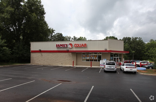
2001 Davis Park Rd
138699
Glenwood Acres Lots 1 6 Block F Plat Boo
Storebuilding
SEE 218343 FOR BUILDING 10 057A 046 00 000
X
Gaston
3710353400J
North Carolina
2025
4.26 AC
2025
Gaston County
033204
Charlotte
9,145 SF
Charlotte-Concord-Gastonia, NC-SC
DEMOGRAPHICS near 2001 Davis Park Rd
1 mile
3 mile
5 mile
2024 Total Population
4,733
39,117
79,867
2029 Population
5,050
41,913
85,394
Pop Growth 2024-2029
+ 6.70%
+ 7.15%
+ 6.92%
Average Age
37
39
40
2024 Total Households
1,750
15,463
31,866
HH Growth 2024-2029
+ 6.86%
+ 7.26%
+ 7.07%
Median Household Inc
$37,900
$39,807
$44,081
Avg Household Size
2.60
2.40
2.40
2024 Avg HH Vehicles
2.00
2.00
2.00
Median Home Value
$132,864
$142,644
$170,538
Median Year Built
1967
1969
1975
Nearby Places
Map Layers
Map Styles
 Street
 Aerial
Transit
 Traffic
 Biking
Places
Listings with unknown addresses are not visible on the map
- Restaurants
- Banks
- Shops
- Fitness
- Groceries
PUBLIC TRANSPORTATION
COMMUTER RAIL
Drive
Walk
Distance
11 min
5.4 mi
AIRPORT
Charlotte/Douglas International
Drive
Walk
Distance
Charlotte/Douglas International
37 min
21.0 mi
Concord-Padgett Regional
Drive
Walk
Distance
Concord-Padgett Regional
51 min
37.3 mi
Nearby Properties
Address
Land Use
TOTAL SIZE
Lot Size
Zoning
Address
Land Use
TOTAL SIZE
Lot Size
Zoning
4,519 SF
2.10 AC
Address
Land Use
TOTAL SIZE
Lot Size
Zoning
17.37 AC
Address
Land Use
TOTAL SIZE
Lot Size
Zoning
1,602 SF
14.02 AC
APT02
Address
Land Use
TOTAL SIZE
Lot Size
Zoning
9,792 SF
14.31 AC
APT01
Address
Land Use
TOTAL SIZE
Lot Size
Zoning
192,978 SF
22.67 AC
RET05
Address
Land Use
TOTAL SIZE
Lot Size
Zoning
0.79 AC
RET01
Address
Land Use
TOTAL SIZE
Lot Size
Zoning
112,513 SF
13.09 AC
PUB01
Address
Land Use
TOTAL SIZE
Lot Size
Zoning
8,412 SF
39.83 AC
PUB01
Address
Land Use
TOTAL SIZE
Lot Size
Zoning
14.51 AC
Address
Land Use
TOTAL SIZE
Lot Size
Zoning
1,760 SF
3.51 AC
Address
Land Use
TOTAL SIZE
Lot Size
Zoning
104,144 SF
13.69 AC
OFF04
Address
Land Use
TOTAL SIZE
Lot Size
Zoning
44,794 SF
46.96 AC
PUB01
Address
Land Use
TOTAL SIZE
Lot Size
Zoning
57,880 SF
5.99 AC
GOV05
Address
Land Use
TOTAL SIZE
Lot Size
Zoning
11,676 SF
7.31 AC
Address
Land Use
TOTAL SIZE
Lot Size
Zoning
1,200 SF
7.58 AC
APT02
Address
Land Use
TOTAL SIZE
Lot Size
Zoning
109,085 SF
1.69 AC
BANK1
Address
Land Use
TOTAL SIZE
Lot Size
Zoning
1,471 SF
8.96 AC
OFF01
Address
Land Use
TOTAL SIZE
Lot Size
Zoning
12.25 AC
Address
Land Use
TOTAL SIZE
Lot Size
Zoning
78,004 SF
5.72 AC
APT01
Address
Land Use
TOTAL SIZE
Lot Size
Zoning
514,404 SF
27.84 AC
INDS2
Address
Land Use
TOTAL SIZE
Lot Size
Zoning
1,746 SF
15.31 AC
Address
Land Use
TOTAL SIZE
Lot Size
Zoning
33,134 SF
6.80 AC
Address
Land Use
TOTAL SIZE
Lot Size
Zoning
1,800 SF
11.08 AC
APT01
Address
Land Use
TOTAL SIZE
Lot Size
Zoning
780 SF
7.07 AC
APT01
Address
Land Use
TOTAL SIZE
Lot Size
Zoning
26,924 SF
7.91 AC
APT01
Address
Land Use
TOTAL SIZE
Lot Size
Zoning
952 SF
22.68 AC
SHOP1
Address
Land Use
TOTAL SIZE
Lot Size
Zoning
79,635 SF
4.39 AC
Address
Land Use
TOTAL SIZE
Lot Size
Zoning
42,337 SF
1.61 AC
RET05
Address
Land Use
TOTAL SIZE
Lot Size
Zoning
52,676 SF
1.44 AC
GOV07
Address
Land Use
TOTAL SIZE
Lot Size
Zoning
60,685 SF
21.19 AC
PUB01
The World's #1 Commercial Real Estate Marketplace
Connect with us
© 2026 CoStar Group
The information above has been obtained from sources believed reliable. While we do not doubt its accuracy we have not verified it and make no guarantee, warranty or representation about it. It is your responsibility to independently confirm its accuracy and completeness. Any projections, opinions, assumptions, or estimates used are for example only and do not represent the current or future performance of the property. The value of this transaction to you depends on tax and other factors which should be evaluated by your tax, financial, and legal advisors. You and your advisors should conduct a careful, independent investigation of the property to determine to your satisfaction the suitability of the property for your needs.