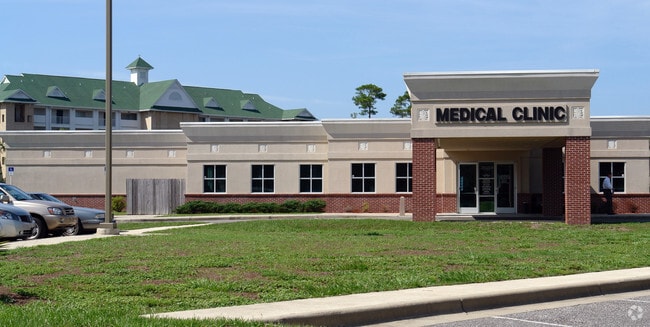
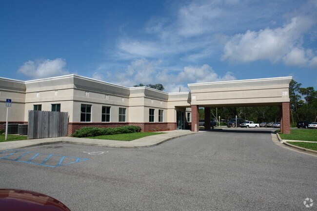
Property Record
2001 E Highway 20, Niceville, FL 32578


Property Detail
2001 E Highway 20
Crestview-Fort Walton Beach-Destin, FL
COM NW COR SE1/4 E40 FT S 138 FT TO POB N 70 DEG E 383.75 FT TO SW R/W SR #20 SE ALG CURVED R/W 148.67 FT S 41 DEG W 79.81 FT S 34 DEG W 293.79 FT S 77 DEG W 308.78 FT N 46.09 FT NE ALG CURVE 77.39 FT N 31 DEG E 138 FT N 30 DEG W 153.32 FT TO POB
15-1S-22-0000-0001-0050
Okaloosa
Commercialnec
Florida
B and X Area of moderate flood hazard, usually the area between the limits of the 100-year and 500-year floods.
50
2025
2.93 AC
2025
Fort Walton Beach
021002
Other Market Areas
12,934 SF
NEARBY LISTINGS FOR SALE OR LEASE
-
-
View all Niceville listings for sale on LoopNet.com
DEMOGRAPHICS near 2001 E Highway 20
1 mile
3 mile
5 mile
2025 Total Population
3,958
27,158
38,776
2030 Population
4,019
27,496
39,666
Pop Growth 2025-2030
+ 1.54%
+ 1.24%
+ 2.30%
Average Age
42
42
40
2025 Total Households
1,580
10,384
14,956
HH Growth 2025-2030
+ 1.33%
+ 1.03%
+ 2.15%
Median Household Inc
$126,792
$118,745
$105,903
Avg Household Size
2.50
2.60
2.50
2025 Avg HH Vehicles
2.00
2.00
2.00
Median Home Value
$445,652
$441,621
$423,131
Median Year Built
1990
1988
1988
Nearby Places
Map Layers
Map Styles
 Street
 Aerial
Layers
 Traffic
 Biking
Places
Listings with unknown addresses are not visible on the map
- Restaurants
- Banks
- Shops
- Fitness
- Groceries
PUBLIC TRANSPORTATION
AIRPORT
Eglin AFB/Destin-Ft Walton Beach
Drive
Walk
Distance
Eglin AFB/Destin-Ft Walton Beach
31 min
9.0 mi
Freight Ports
Port of Panama City
Drive
Walk
Distance
Port of Panama City
84 min
55.0 mi
Nearby Properties
Address
Land Use
TOTAL SIZE
Lot Size
Zoning
Address
Land Use
TOTAL SIZE
Lot Size
Zoning
279,145 SF
18.68 AC
Address
Land Use
TOTAL SIZE
Lot Size
Zoning
127,873 SF
2.79 AC
Address
Land Use
TOTAL SIZE
Lot Size
Zoning
263,492 SF
29.88 AC
Address
Land Use
TOTAL SIZE
Lot Size
Zoning
63,407 SF
3.25 AC
Address
Land Use
TOTAL SIZE
Lot Size
Zoning
75,002 SF
4.42 AC
Address
Land Use
TOTAL SIZE
Lot Size
Zoning
56,412 SF
2.09 AC
Address
Land Use
TOTAL SIZE
Lot Size
Zoning
165,059 SF
17.62 AC
Address
Land Use
TOTAL SIZE
Lot Size
Zoning
219.76 AC
Address
Land Use
TOTAL SIZE
Lot Size
Zoning
84,123 SF
10.17 AC
Address
Land Use
TOTAL SIZE
Lot Size
Zoning
126,169 SF
8.90 AC
Address
Land Use
TOTAL SIZE
Lot Size
Zoning
76,262 SF
10.67 AC
Address
Land Use
TOTAL SIZE
Lot Size
Zoning
95,868 SF
15.21 AC
Address
Land Use
TOTAL SIZE
Lot Size
Zoning
3.90 AC
Address
Land Use
TOTAL SIZE
Lot Size
Zoning
107,789 SF
10.47 AC
Address
Land Use
TOTAL SIZE
Lot Size
Zoning
21,687 SF
0.91 AC
Address
Land Use
TOTAL SIZE
Lot Size
Zoning
101,110 SF
20.64 AC
Address
Land Use
TOTAL SIZE
Lot Size
Zoning
40,261 SF
6.21 AC
Address
Land Use
TOTAL SIZE
Lot Size
Zoning
163.23 AC
Address
Land Use
TOTAL SIZE
Lot Size
Zoning
79,012 SF
0.47 AC
Address
Land Use
TOTAL SIZE
Lot Size
Zoning
82,203 SF
7.14 AC
Address
Land Use
TOTAL SIZE
Lot Size
Zoning
88,750 SF
9.95 AC
Address
Land Use
TOTAL SIZE
Lot Size
Zoning
43,920 SF
9.08 AC
Address
Land Use
TOTAL SIZE
Lot Size
Zoning
1,620 SF
128.18 AC
Address
Land Use
TOTAL SIZE
Lot Size
Zoning
53,693 SF
7.68 AC
Address
Land Use
TOTAL SIZE
Lot Size
Zoning
25.09 AC
Address
Land Use
TOTAL SIZE
Lot Size
Zoning
59,022 SF
4.96 AC
Address
Land Use
TOTAL SIZE
Lot Size
Zoning
19,408 SF
1.06 AC
Address
Land Use
TOTAL SIZE
Lot Size
Zoning
35,212 SF
3.53 AC
Address
Land Use
TOTAL SIZE
Lot Size
Zoning
49,647 SF
6.07 AC
Address
Land Use
TOTAL SIZE
Lot Size
Zoning
47,101 SF
2.98 AC
The World's #1 Commercial Real Estate Marketplace
Connect with us
© 2026 CoStar Group
The information above has been obtained from sources believed reliable. While we do not doubt its accuracy we have not verified it and make no guarantee, warranty or representation about it. It is your responsibility to independently confirm its accuracy and completeness. Any projections, opinions, assumptions, or estimates used are for example only and do not represent the current or future performance of the property. The value of this transaction to you depends on tax and other factors which should be evaluated by your tax, financial, and legal advisors. You and your advisors should conduct a careful, independent investigation of the property to determine to your satisfaction the suitability of the property for your needs.