Property Record
2001 E Madison St, Seattle, WA 98122


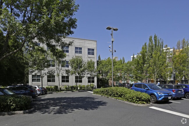

Property Detail
2001 E Madison St
332504-9042
POR OF NE QTR OF NW QTR STR 33-25-04 DAF: BEG ON SELY LN OF E MADISON ST AT PT WCH IS 685.74 FT W & 8.40 FT S OF NE COR SD SUBD TH S 58-11-29 W ALG SD SELY LN 184.30 FT TH S 0-05-03 W 92.04 FT (93 FT M/L-DEED) TO NLY LN OF E OLIVE ST TH S 89-54-57 E
Officebuilding
KING
NC3P-75 (M
Washington
B and X Area of moderate flood hazard, usually the area between the limits of the 100-year and 500-year floods.
332504
2021
1.01 AC
2024
Capitol Hill/Central Dist
007902
Seattle/Puget Sound
31,357 SF
Seattle-Tacoma-Bellevue, WA
NEARBY LISTINGS FOR SALE OR LEASE
DEMOGRAPHICS near 2001 E Madison St
1 mile
3 mile
5 mile
2025 Total Population
60,811
266,770
521,949
2030 Population
64,173
282,191
549,099
Pop Growth 2025-2030
+ 5.53%
+ 5.78%
+ 5.20%
Average Age
37
38
38
2025 Total Households
34,235
144,974
255,783
HH Growth 2025-2030
+ 5.69%
+ 6.09%
+ 5.52%
Median Household Inc
$114,523
$117,453
$125,332
Avg Household Size
1.70
1.70
1.90
2025 Avg HH Vehicles
1.00
1.00
1.00
Median Home Value
$1,000,991
$989,279
$1,027,225
Median Year Built
1982
1992
1984
Nearby Places
Map Layers
Map Styles
 Street
 Aerial
Layers
 Traffic
 Biking
Places
Listings with unknown addresses are not visible on the map
- Restaurants
- Banks
- Shops
- Fitness
- Groceries
PUBLIC TRANSPORTATION
TRANSIT/SUBWAY
Broadway & Pike-Pine (First Hill Streetcar - City of Seattle)
Drive
Walk
Distance
Broadway & Pike-Pine (First Hill Streetcar - City of Seattle)
2 min
15 min
0.8 mi
Broadway And Denny (First Hill Streetcar - City of Seattle)
Drive
Walk
Distance
Broadway And Denny (First Hill Streetcar - City of Seattle)
3 min
16 min
0.8 mi
Capitol Hill (Lynnwood - Angle Lake - Sound Transit)
Drive
Walk
Distance
Capitol Hill (Lynnwood - Angle Lake - Sound Transit)
3 min
17 min
0.9 mi
Broadway & Marion (First Hill Streetcar - City of Seattle)
Drive
Walk
Distance
Broadway & Marion (First Hill Streetcar - City of Seattle)
3 min
18 min
1.0 mi
COMMUTER RAIL
King Street (Seattle) Station (Sounder South Line - Central Puget Sound Regional Transit Authority Rail (Link Light Rail/Sounder))
Drive
Walk
Distance
King Street (Seattle) Station (Sounder South Line - Central Puget Sound Regional Transit Authority Rail (Link Light Rail/Sounder))
7 min
2.1 mi
AIRPORT
Seattle-Tacoma International
Drive
Walk
Distance
Seattle-Tacoma International
27 min
15.4 mi
Seattle Paine Field International
Drive
Walk
Distance
Seattle Paine Field International
36 min
24.0 mi
Freight Ports
Port of Seattle
Drive
Walk
Distance
Port of Seattle
14 min
5.9 mi
Nearby Properties
Address
Land Use
TOTAL SIZE
Lot Size
Zoning
Address
Land Use
TOTAL SIZE
Lot Size
Zoning
800,000 SF
8.57 AC
SM-UP 95 (
Address
Land Use
TOTAL SIZE
Lot Size
Zoning
471.20 AC
MIO-37-LR1
Address
Land Use
TOTAL SIZE
Lot Size
Zoning
2.84 AC
DMC 340/29
Address
Land Use
TOTAL SIZE
Lot Size
Zoning
793,990 SF
30.81 AC
UI U/85
Address
Land Use
TOTAL SIZE
Lot Size
Zoning
946,212 SF
1.58 AC
DMC 340/29
Address
Land Use
TOTAL SIZE
Lot Size
Zoning
686,722 SF
1.26 AC
SM-SLU 240
Address
Land Use
TOTAL SIZE
Lot Size
Zoning
36,864 SF
8.02 AC
SM-UP 95 (
Address
Land Use
TOTAL SIZE
Lot Size
Zoning
992,925 SF
4.28 AC
MIO-240-HR
Address
Land Use
TOTAL SIZE
Lot Size
Zoning
1,526,621 SF
1.36 AC
DOC1 U/450
Address
Land Use
TOTAL SIZE
Lot Size
Zoning
716,128 SF
1.41 AC
SM-SLU 175
Address
Land Use
TOTAL SIZE
Lot Size
Zoning
1,062,251 SF
1.47 AC
DOC2 500/3
Address
Land Use
TOTAL SIZE
Lot Size
Zoning
763,898 SF
2.03 AC
DOC2 500/3
Address
Land Use
TOTAL SIZE
Lot Size
Zoning
1,137,666 SF
2.07 AC
DOC1 U/450
Address
Land Use
TOTAL SIZE
Lot Size
Zoning
7,930 SF
4.14 AC
MIO-240-HR
Address
Land Use
TOTAL SIZE
Lot Size
Zoning
1,128,575 SF
1.30 AC
DOC1 U/450
Address
Land Use
TOTAL SIZE
Lot Size
Zoning
615,000 SF
0.88 AC
DOC2 500/3
Address
Land Use
TOTAL SIZE
Lot Size
Zoning
861,221 SF
1.30 AC
DMC 340/29
Address
Land Use
TOTAL SIZE
Lot Size
Zoning
377,813 SF
1.65 AC
DOC2 500/3
Address
Land Use
TOTAL SIZE
Lot Size
Zoning
1,011,547 SF
0.35 AC
DOC1 U/450
Address
Land Use
TOTAL SIZE
Lot Size
Zoning
67,235 SF
0.45 AC
DOC2 500/3
Address
Land Use
TOTAL SIZE
Lot Size
Zoning
922,344 SF
1.33 AC
DRC 85-170
Address
Land Use
TOTAL SIZE
Lot Size
Zoning
1,478,612 SF
0.80 AC
DOC2 500/3
Address
Land Use
TOTAL SIZE
Lot Size
Zoning
413,982 SF
0.58 AC
DMC 340/29
Address
Land Use
TOTAL SIZE
Lot Size
Zoning
412,000 SF
1.27 AC
DOC1 U/450
Address
Land Use
TOTAL SIZE
Lot Size
Zoning
943,610 SF
1.24 AC
DOC1 U/450
Address
Land Use
TOTAL SIZE
Lot Size
Zoning
155,795 SF
7.89 AC
SM-UP 95 (
Address
Land Use
TOTAL SIZE
Lot Size
Zoning
612,844 SF
0.09 AC
SM-U/R 75-
Address
Land Use
TOTAL SIZE
Lot Size
Zoning
411,654 SF
0.59 AC
DMC 240/29
The World's #1 Commercial Real Estate Marketplace
Connect with us
© 2026 CoStar Group
The information above has been obtained from sources believed reliable. While we do not doubt its accuracy we have not verified it and make no guarantee, warranty or representation about it. It is your responsibility to independently confirm its accuracy and completeness. Any projections, opinions, assumptions, or estimates used are for example only and do not represent the current or future performance of the property. The value of this transaction to you depends on tax and other factors which should be evaluated by your tax, financial, and legal advisors. You and your advisors should conduct a careful, independent investigation of the property to determine to your satisfaction the suitability of the property for your needs.