Property Record
2001 Grant Ave, El Paso, TX 79930
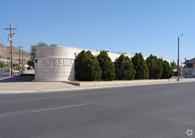
This Property Is For Sale
NEARBY LISTINGS FOR SALE OR LEASE
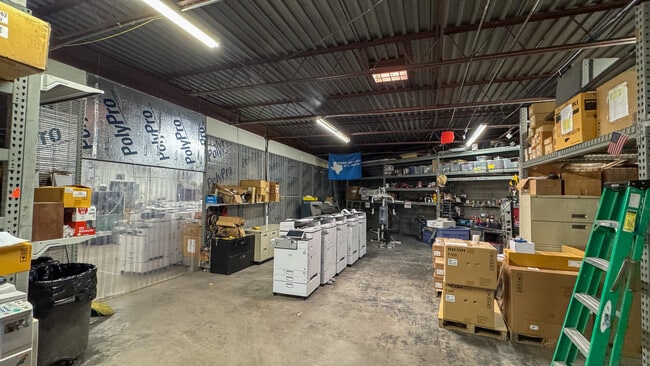
Property Detail
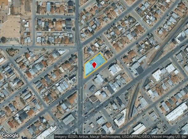
2001 Grant Ave
El Paso, TX
Cotton
C849-999-0320-0100
32 COTTON 1 TO 11 (30450 SQ FT)
Commercialnec
El Paso
2024
Texas
2025
0.70 AC
002300
Central
8,398 SF
El Paso
DEMOGRAPHICS near 2001 Grant Ave
1 mile
3 mile
5 mile
2024 Total Population
13,942
84,434
144,187
2029 Population
14,357
86,362
147,285
Pop Growth 2024-2029
+ 2.98%
+ 2.28%
+ 2.15%
Average Age
40
40
38
2024 Total Households
5,452
34,037
56,549
HH Growth 2024-2029
+ 2.88%
+ 2.40%
+ 2.14%
Median Household Inc
$24,336
$31,624
$34,325
Avg Household Size
2.40
2.30
2.40
2024 Avg HH Vehicles
1.00
1.00
2.00
Median Home Value
$130,582
$141,503
$140,159
Median Year Built
1951
1955
1964
Nearby Places
Map Layers
Map Styles
 Street
 Aerial
Transit
 Traffic
 Biking
Places
Listings with unknown addresses are not visible on the map
- Restaurants
- Banks
- Shops
- Fitness
- Groceries
PUBLIC TRANSPORTATION
AIRPORT
El Paso International
Drive
Walk
Distance
El Paso International
22 min
11.9 mi
Nearby Properties
Address
Land Use
TOTAL SIZE
Lot Size
Zoning
Address
Land Use
TOTAL SIZE
Lot Size
Zoning
1,387,028 SF
65.27 AC
R4
Address
Land Use
TOTAL SIZE
Lot Size
Zoning
558,800 SF
1.55 AC
C5
Address
Land Use
TOTAL SIZE
Lot Size
Zoning
318,665 SF
1.43 AC
C5
Address
Land Use
TOTAL SIZE
Lot Size
Zoning
237,300 SF
4.99 AC
M1
Address
Land Use
TOTAL SIZE
Lot Size
Zoning
315,094 SF
2.22 AC
M1S
Address
Land Use
TOTAL SIZE
Lot Size
Zoning
859,302 SF
21.17 AC
C2
Address
Land Use
TOTAL SIZE
Lot Size
Zoning
230,968 SF
10.69 AC
C4
Address
Land Use
TOTAL SIZE
Lot Size
Zoning
324,056 SF
1.49 AC
C4
Address
Land Use
TOTAL SIZE
Lot Size
Zoning
1 SF
5.75 AC
C5S
Address
Land Use
TOTAL SIZE
Lot Size
Zoning
347,241 SF
Address
Land Use
TOTAL SIZE
Lot Size
Zoning
89,935 SF
7.01 AC
PMD
Address
Land Use
TOTAL SIZE
Lot Size
Zoning
169,031 SF
1.22 AC
SP
Address
Land Use
TOTAL SIZE
Lot Size
Zoning
313,532 SF
5.73 AC
C1S
Address
Land Use
TOTAL SIZE
Lot Size
Zoning
289,146 SF
11.87 AC
C1S
Address
Land Use
TOTAL SIZE
Lot Size
Zoning
213,351 SF
12 AC
C3S
Address
Land Use
TOTAL SIZE
Lot Size
Zoning
1 SF
45.46 AC
M1
Address
Land Use
TOTAL SIZE
Lot Size
Zoning
629,002 SF
1.22 AC
C5
Address
Land Use
TOTAL SIZE
Lot Size
Zoning
128,916 SF
1.50 AC
C5
Address
Land Use
TOTAL SIZE
Lot Size
Zoning
86,391 SF
1.55 AC
C5
Address
Land Use
TOTAL SIZE
Lot Size
Zoning
142,858 SF
0.17 AC
R3H
Address
Land Use
TOTAL SIZE
Lot Size
Zoning
156,184 SF
8.39 AC
R5S
Address
Land Use
TOTAL SIZE
Lot Size
Zoning
97,809 SF
20.31 AC
C3S
Address
Land Use
TOTAL SIZE
Lot Size
Zoning
114,289 SF
3.03 AC
R5
Address
Land Use
TOTAL SIZE
Lot Size
Zoning
185,087 SF
10.27 AC
A3S
Address
Land Use
TOTAL SIZE
Lot Size
Zoning
420,509 SF
1.02 AC
C5
Address
Land Use
TOTAL SIZE
Lot Size
Zoning
229,821 SF
10.18 AC
A2
Address
Land Use
TOTAL SIZE
Lot Size
Zoning
128,560 SF
0.72 AC
M1
Address
Land Use
TOTAL SIZE
Lot Size
Zoning
73,574 SF
0.69 AC
C5
Address
Land Use
TOTAL SIZE
Lot Size
Zoning
155,308 SF
The World's #1 Commercial Real Estate Marketplace
Connect with us
© 2026 CoStar Group
The information above has been obtained from sources believed reliable. While we do not doubt its accuracy we have not verified it and make no guarantee, warranty or representation about it. It is your responsibility to independently confirm its accuracy and completeness. Any projections, opinions, assumptions, or estimates used are for example only and do not represent the current or future performance of the property. The value of this transaction to you depends on tax and other factors which should be evaluated by your tax, financial, and legal advisors. You and your advisors should conduct a careful, independent investigation of the property to determine to your satisfaction the suitability of the property for your needs.