Property Record
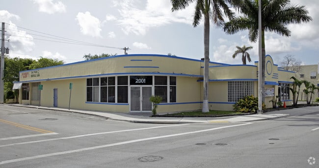
2001 Ludlam Rd, Miami, FL 33155


Property Detail
2001 Ludlam Rd
15-4012-046-0010
TAMIAMI ACRES PLAN 2 SEC SUB PB 6-180 LOTS 1 THRU 6 LESS N25FT & LESS W10FT FOR R/W & LOTS 21 THRU 26 LESS N25FT FOR R/W & RD LYG S & ADJ TO LOTS 6 LESS W10FT & LOT21 CLOSED PER ORD 2015-01 & ORD 2015-07 PER UNITY OF TITLE OR 30017-2751 LOT SIZE 9006
Multifamilydwelling
Miami-Dade
6200
Florida
C and X Area of minimal flood hazard, usually depicted on FIRMs as above the 500-year flood level.
1-6
2024
2.07 AC
2025
West Miami
005904
South Florida
369,180 SF
Miami-Miami Beach-Kendall, FL
NEARBY LISTINGS FOR SALE OR LEASE
DEMOGRAPHICS near 2001 Ludlam Rd
1 mile
3 mile
5 mile
2025 Total Population
24,992
188,090
497,777
2030 Population
26,506
200,063
531,592
Pop Growth 2025-2030
+ 6.06%
+ 6.37%
+ 6.79%
Average Age
44
44
43
2025 Total Households
8,596
69,748
186,215
HH Growth 2025-2030
+ 6.01%
+ 6.47%
+ 6.96%
Median Household Inc
$77,059
$78,165
$75,059
Avg Household Size
2.80
2.60
2.60
2025 Avg HH Vehicles
2.00
2.00
2.00
Median Home Value
$592,043
$601,137
$606,376
Median Year Built
1956
1969
1972
Nearby Places
Map Layers
Map Styles
 Street
 Aerial
Layers
 Traffic
 Biking
Places
Listings with unknown addresses are not visible on the map
- Restaurants
- Banks
- Shops
- Fitness
- Groceries
PUBLIC TRANSPORTATION
COMMUTER RAIL
South Miami (Metrorail Green Line - Miami-Dade Transit (Metrorail/Metromover))
Drive
Walk
Distance
South Miami (Metrorail Green Line - Miami-Dade Transit (Metrorail/Metromover))
9 min
4.4 mi
Douglas Road (Metrorail Green Line - Miami-Dade Transit (Metrorail/Metromover))
Drive
Walk
Distance
Douglas Road (Metrorail Green Line - Miami-Dade Transit (Metrorail/Metromover))
10 min
4.5 mi
AIRPORT
Miami International
Drive
Walk
Distance
Miami International
14 min
5.5 mi
Fort Lauderdale/Hollywood International
Drive
Walk
Distance
Fort Lauderdale/Hollywood International
45 min
30.3 mi
Freight Ports
Port of Miami
Drive
Walk
Distance
Port of Miami
21 min
11.4 mi
Nearby Properties
Address
Land Use
TOTAL SIZE
Lot Size
Zoning
Address
Land Use
TOTAL SIZE
Lot Size
Zoning
883,561 SF
5.63 AC
8200
Address
Land Use
TOTAL SIZE
Lot Size
Zoning
1,647,481 SF
23.04 AC
5000
Address
Land Use
TOTAL SIZE
Lot Size
Zoning
465,663 SF
11.29 AC
4100
Address
Land Use
TOTAL SIZE
Lot Size
Zoning
973,728 SF
76.18 AC
8200
Address
Land Use
TOTAL SIZE
Lot Size
Zoning
671,088 SF
19.84 AC
6400
Address
Land Use
TOTAL SIZE
Lot Size
Zoning
884,102 SF
28.46 AC
7300
Address
Land Use
TOTAL SIZE
Lot Size
Zoning
345,178 SF
6.73 AC
5005
Address
Land Use
TOTAL SIZE
Lot Size
Zoning
423,104 SF
2.58 AC
6200
Address
Land Use
TOTAL SIZE
Lot Size
Zoning
482,246 SF
0.83 AC
5005
Address
Land Use
TOTAL SIZE
Lot Size
Zoning
275,755 SF
6.73 AC
5005
Address
Land Use
TOTAL SIZE
Lot Size
Zoning
500,332 SF
3.46 AC
6000
Address
Land Use
TOTAL SIZE
Lot Size
Zoning
365,003 SF
15.05 AC
8200
Address
Land Use
TOTAL SIZE
Lot Size
Zoning
466,402 SF
2.22 AC
6106
Address
Land Use
TOTAL SIZE
Lot Size
Zoning
518,244 SF
1.06 AC
5005
Address
Land Use
TOTAL SIZE
Lot Size
Zoning
535,679 SF
2.73 AC
6000
Address
Land Use
TOTAL SIZE
Lot Size
Zoning
429,568 SF
7.44 AC
6400
Address
Land Use
TOTAL SIZE
Lot Size
Zoning
473,214 SF
2.51 AC
5005
Address
Land Use
TOTAL SIZE
Lot Size
Zoning
540,267 SF
1.74 AC
5005
Address
Land Use
TOTAL SIZE
Lot Size
Zoning
498,294 SF
1.19 AC
5005
Address
Land Use
TOTAL SIZE
Lot Size
Zoning
366,237 SF
9.24 AC
4100
Address
Land Use
TOTAL SIZE
Lot Size
Zoning
885,374 SF
20.59 AC
7300
Address
Land Use
TOTAL SIZE
Lot Size
Zoning
551,110 SF
1.33 AC
5005
Address
Land Use
TOTAL SIZE
Lot Size
Zoning
290,426 SF
1 AC
5004
Address
Land Use
TOTAL SIZE
Lot Size
Zoning
310,645 SF
0.91 AC
5005
Address
Land Use
TOTAL SIZE
Lot Size
Zoning
298,102 SF
0.99 AC
5005
Address
Land Use
TOTAL SIZE
Lot Size
Zoning
516,193 SF
571.83 AC
8900
Address
Land Use
TOTAL SIZE
Lot Size
Zoning
325,353 SF
6400
Address
Land Use
TOTAL SIZE
Lot Size
Zoning
353,267 SF
30.40 AC
6400
Address
Land Use
TOTAL SIZE
Lot Size
Zoning
667,273 SF
38.34 AC
6400
The World's #1 Commercial Real Estate Marketplace
Connect with us
© 2026 CoStar Group
The information above has been obtained from sources believed reliable. While we do not doubt its accuracy we have not verified it and make no guarantee, warranty or representation about it. It is your responsibility to independently confirm its accuracy and completeness. Any projections, opinions, assumptions, or estimates used are for example only and do not represent the current or future performance of the property. The value of this transaction to you depends on tax and other factors which should be evaluated by your tax, financial, and legal advisors. You and your advisors should conduct a careful, independent investigation of the property to determine to your satisfaction the suitability of the property for your needs.