Property Record
2001 N Cassia St, Nampa, ID 83651
NEARBY LISTINGS FOR SALE OR LEASE
Property Detail
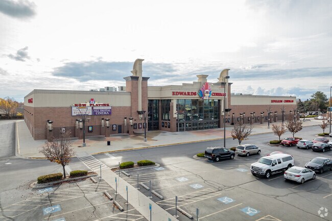
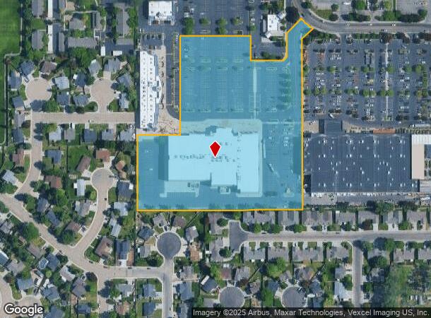
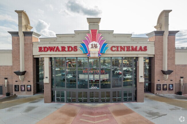
2001 N Cassia St
Boise City, ID
Midtowne Spectrum
3142230600
17-3N-2W NW MIDTOWNE SPECTRUM LT 7 BLK 1
Commercialnec
Canyon
X
Idaho
16027C0376F
7
2024
8.82 AC
2025
Nampa
021006
Boise City/Nampa
DEMOGRAPHICS near 2001 N Cassia St
1 Mile
3 Mile
5 Mile
2024 Total Population
9,695
66,405
162,133
2029 Population
11,858
80,998
197,973
Pop Growth 2024-2029
+ 22.31%
+ 21.98%
+ 22.11%
Average Age
40
37
36
2024 Total Households
3,843
22,838
54,949
HH Growth 2024-2029
+ 22.61%
+ 22.29%
+ 22.41%
Median Household Inc
$55,880
$65,295
$64,988
Avg Household Size
2.40
2.80
2.90
2024 Avg HH Vehicles
2.00
2.00
2.00
Median Home Value
$287,930
$327,148
$332,433
Median Year Built
1999
2000
2000
Nearby Places
Map Layers
Map Styles
 Street
 Aerial
- Restaurants
- Banks
- Shops
- Fitness
- Groceries
PUBLIC TRANSPORTATION
AIRPORT
Boise Air Trml/Gowen Field
DRIVE
WALK
Distance
Boise Air Trml/Gowen Field
32 min
21.9 mi
Nearby Properties
Address
Land Use
TOTAL SIZE
Lot Size
Zoning
Address
Land Use
TOTAL SIZE
Lot Size
Zoning
13.53 AC
Address
Land Use
TOTAL SIZE
Lot Size
Zoning
345,974 SF
40.28 AC
Address
Land Use
TOTAL SIZE
Lot Size
Zoning
13.10 AC
Address
Land Use
TOTAL SIZE
Lot Size
Zoning
11.26 AC
Address
Land Use
TOTAL SIZE
Lot Size
Zoning
28.08 AC
Address
Land Use
TOTAL SIZE
Lot Size
Zoning
37.83 AC
Address
Land Use
TOTAL SIZE
Lot Size
Zoning
18.74 AC
Address
Land Use
TOTAL SIZE
Lot Size
Zoning
158.05 AC
M1
Address
Land Use
TOTAL SIZE
Lot Size
Zoning
11.15 AC
Address
Land Use
TOTAL SIZE
Lot Size
Zoning
1,048 SF
13.09 AC
Address
Land Use
TOTAL SIZE
Lot Size
Zoning
243,353 SF
20.57 AC
Address
Land Use
TOTAL SIZE
Lot Size
Zoning
219,520 SF
26.72 AC
Address
Land Use
TOTAL SIZE
Lot Size
Zoning
119.97 AC
Address
Land Use
TOTAL SIZE
Lot Size
Zoning
1.03 AC
Address
Land Use
TOTAL SIZE
Lot Size
Zoning
244,100 SF
13.64 AC
Address
Land Use
TOTAL SIZE
Lot Size
Zoning
8.34 AC
R1
Address
Land Use
TOTAL SIZE
Lot Size
Zoning
11.48 AC
Address
Land Use
TOTAL SIZE
Lot Size
Zoning
1,212 SF
14.91 AC
Address
Land Use
TOTAL SIZE
Lot Size
Zoning
11.75 AC
Address
Land Use
TOTAL SIZE
Lot Size
Zoning
1,696 SF
5.28 AC
R1
Address
Land Use
TOTAL SIZE
Lot Size
Zoning
Address
Land Use
TOTAL SIZE
Lot Size
Zoning
189,415 SF
10 AC
Address
Land Use
TOTAL SIZE
Lot Size
Zoning
42.30 AC
M2
Address
Land Use
TOTAL SIZE
Lot Size
Zoning
7.48 AC
Address
Land Use
TOTAL SIZE
Lot Size
Zoning
7.06 AC
Address
Land Use
TOTAL SIZE
Lot Size
Zoning
25.32 AC
Address
Land Use
TOTAL SIZE
Lot Size
Zoning
9.81 AC
R1
Address
Land Use
TOTAL SIZE
Lot Size
Zoning
52,336 SF
11.13 AC
Address
Land Use
TOTAL SIZE
Lot Size
Zoning
7.22 AC
Address
Land Use
TOTAL SIZE
Lot Size
Zoning
6.29 AC
The World's #1 Commercial Real Estate Marketplace
Connect with us
© 2025 CoStar Group
The information above has been obtained from sources believed reliable. While we do not doubt its accuracy we have not verified it and make no guarantee, warranty or representation about it. It is your responsibility to independently confirm its accuracy and completeness. Any projections, opinions, assumptions, or estimates used are for example only and do not represent the current or future performance of the property. The value of this transaction to you depends on tax and other factors which should be evaluated by your tax, financial, and legal advisors. You and your advisors should conduct a careful, independent investigation of the property to determine to your satisfaction the suitability of the property for your needs.