Property Record
2001 S Tibbs Ave, Indianapolis, IN 46241

NEARBY LISTINGS FOR SALE OR LEASE
Property Detail
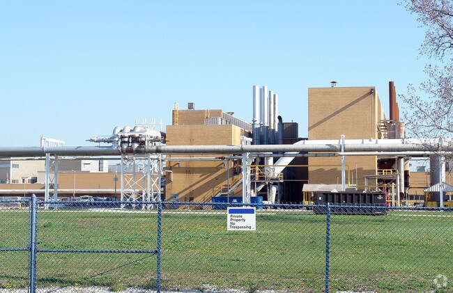
2001 S Tibbs Ave
49-11-16-114-001.000-970
PT NW1/4 OF SW1/4 & SW1/4 OF NW1/4 S21 T15 R3 BEG305.08FT N & 50.01FT W OF SW COR NW1/4 TO BEG PNT E351.99FT S 325FT W 6FT S 165FT W 350.96FT N IRR490.55FT TO BEG 4.086 AC
Heavyindustrial
Marion
X
Indiana
18097C0227G
111.99 AC
2023
Stout Field
2024
Indianapolis
342400
Indianapolis-Carmel-Greenwood, IN
537,085 SF
DEMOGRAPHICS near 2001 S Tibbs Ave
1 Mile
3 Mile
5 Mile
2024 Total Population
2,147
57,162
202,224
2029 Population
2,177
57,342
202,691
Pop Growth 2024-2029
+ 1.40%
+ 0.31%
+ 0.23%
Average Age
37
35
35
2024 Total Households
761
20,989
83,981
HH Growth 2024-2029
+ 1.31%
+ 0.51%
+ 0.34%
Median Household Inc
$54,810
$46,038
$53,938
Avg Household Size
2.70
2.60
2.30
2024 Avg HH Vehicles
2.00
2.00
2.00
Median Home Value
$68,947
$82,981
$146,133
Median Year Built
1953
1955
1961
Nearby Places
Map Layers
Map Styles
 Street
 Aerial
- Restaurants
- Banks
- Shops
- Fitness
- Groceries
PUBLIC TRANSPORTATION
COMMUTER RAIL
Indianapolis (Cardinal - Amtrak)
DRIVE
WALK
Distance
Indianapolis (Cardinal - Amtrak)
8 min
4.1 mi
AIRPORT
Indianapolis International
DRIVE
WALK
Distance
Indianapolis International
20 min
9.6 mi
Freight Ports
Port of Toledo
DRIVE
WALK
Distance
Port of Toledo
278 min
230.6 mi
Nearby Properties
Address
Land Use
TOTAL SIZE
Lot Size
Zoning
Address
Land Use
TOTAL SIZE
Lot Size
Zoning
33.61 AC
ZO01
Address
Land Use
TOTAL SIZE
Lot Size
Zoning
546,391 SF
4.38 AC
ZO01
Address
Land Use
TOTAL SIZE
Lot Size
Zoning
44,485 SF
0.76 AC
ZO01
Address
Land Use
TOTAL SIZE
Lot Size
Zoning
111,238 SF
0.06 AC
ZO01
Address
Land Use
TOTAL SIZE
Lot Size
Zoning
67,783 SF
44.97 AC
ZO01
Address
Land Use
TOTAL SIZE
Lot Size
Zoning
19.74 AC
ZO01
Address
Land Use
TOTAL SIZE
Lot Size
Zoning
405,888 SF
19.56 AC
ZO01
Address
Land Use
TOTAL SIZE
Lot Size
Zoning
51,801 SF
0.06 AC
ZO01
Address
Land Use
TOTAL SIZE
Lot Size
Zoning
366,600 SF
29.05 AC
ZO01
Address
Land Use
TOTAL SIZE
Lot Size
Zoning
132 SF
3.26 AC
ZO01
Address
Land Use
TOTAL SIZE
Lot Size
Zoning
38,094 SF
0.83 AC
ZO01
Address
Land Use
TOTAL SIZE
Lot Size
Zoning
49,008 SF
4.80 AC
ZO01
Address
Land Use
TOTAL SIZE
Lot Size
Zoning
4,663 SF
7.98 AC
ZO01
Address
Land Use
TOTAL SIZE
Lot Size
Zoning
600,000 SF
41.64 AC
ZO01
Address
Land Use
TOTAL SIZE
Lot Size
Zoning
61,832 SF
0.06 AC
ZO01
Address
Land Use
TOTAL SIZE
Lot Size
Zoning
24,798 SF
1.40 AC
ZO01
Address
Land Use
TOTAL SIZE
Lot Size
Zoning
19,930 SF
3.92 AC
ZO01
Address
Land Use
TOTAL SIZE
Lot Size
Zoning
1.88 AC
ZO01
Address
Land Use
TOTAL SIZE
Lot Size
Zoning
101,718 SF
49.77 AC
ZO01
Address
Land Use
TOTAL SIZE
Lot Size
Zoning
595,354 SF
193.41 AC
ZO01
Address
Land Use
TOTAL SIZE
Lot Size
Zoning
378,039 SF
0.06 AC
ZO01
Address
Land Use
TOTAL SIZE
Lot Size
Zoning
20,143 SF
17.10 AC
ZO01
Address
Land Use
TOTAL SIZE
Lot Size
Zoning
438,419 SF
17.26 AC
ZO01
Address
Land Use
TOTAL SIZE
Lot Size
Zoning
150,376 SF
7.30 AC
ZO01
Address
Land Use
TOTAL SIZE
Lot Size
Zoning
113,213 SF
0.06 AC
ZO01
Address
Land Use
TOTAL SIZE
Lot Size
Zoning
75,012 SF
0.06 AC
ZO01
Address
Land Use
TOTAL SIZE
Lot Size
Zoning
290,347 SF
30.40 AC
ZO01
Address
Land Use
TOTAL SIZE
Lot Size
Zoning
18,209 SF
38.23 AC
ZO01
Address
Land Use
TOTAL SIZE
Lot Size
Zoning
43,122 SF
1.01 AC
ZO01
The World's #1 Commercial Real Estate Marketplace
Connect with us
© 2026 CoStar Group
The information above has been obtained from sources believed reliable. While we do not doubt its accuracy we have not verified it and make no guarantee, warranty or representation about it. It is your responsibility to independently confirm its accuracy and completeness. Any projections, opinions, assumptions, or estimates used are for example only and do not represent the current or future performance of the property. The value of this transaction to you depends on tax and other factors which should be evaluated by your tax, financial, and legal advisors. You and your advisors should conduct a careful, independent investigation of the property to determine to your satisfaction the suitability of the property for your needs.