Property Record
2001 Shady Oaks Dr, Southlake, TX 76092
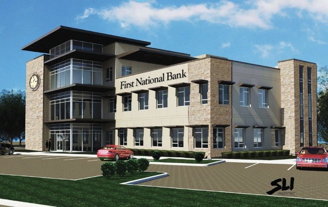
Property Detail
2001 Shady Oaks Dr
Dallas-Fort Worth-Arlington, TX
WEST, JAMES J SURVEY ABSTRACT 1620 TRACT 1B
05979749
TARRANT
Residentialacreage
Texas
AE The base floodplain where base flood elevations are provided. AE Zones are now used on new format FIRMs instead of A1-A30 Zones.
3.90 AC
2025
Southlake
2025
Dallas/Ft Worth
113956
NEARBY LISTINGS FOR SALE OR LEASE
DEMOGRAPHICS near 2001 Shady Oaks Dr
1 mile
3 mile
5 mile
2025 Total Population
4,635
42,022
124,900
2030 Population
4,911
44,646
132,986
Pop Growth 2025-2030
+ 5.95%
+ 6.24%
+ 6.47%
Average Age
39
41
41
2025 Total Households
1,389
13,379
42,872
HH Growth 2025-2030
+ 6.12%
+ 6.53%
+ 6.63%
Median Household Inc
$249,512
$233,760
$178,796
Avg Household Size
3.30
3.10
2.90
2025 Avg HH Vehicles
3.00
3.00
2.00
Median Home Value
$1,032,891
$887,881
$761,008
Median Year Built
1999
1995
1996
Nearby Places
Map Layers
Map Styles
 Street
 Aerial
Layers
 Traffic
 Biking
Places
Listings with unknown addresses are not visible on the map
- Restaurants
- Banks
- Shops
- Fitness
- Groceries
PUBLIC TRANSPORTATION
AIRPORT
Dallas-Fort Worth International
Drive
Walk
Distance
Dallas-Fort Worth International
14 min
10.9 mi
Dallas Love Field
Drive
Walk
Distance
Dallas Love Field
32 min
24.6 mi
Freight Ports
Port of Shreveport
Drive
Walk
Distance
Port of Shreveport
242 min
224.4 mi
Nearby Properties
Address
Land Use
TOTAL SIZE
Lot Size
Zoning
Address
Land Use
TOTAL SIZE
Lot Size
Zoning
1,315,600 SF
106.95 AC
Address
Land Use
TOTAL SIZE
Lot Size
Zoning
255,937 SF
55.03 AC
Address
Land Use
TOTAL SIZE
Lot Size
Zoning
254,250 SF
6.21 AC
Address
Land Use
TOTAL SIZE
Lot Size
Zoning
1,603,686 SF
81.43 AC
Address
Land Use
TOTAL SIZE
Lot Size
Zoning
203,458 SF
16.58 AC
Address
Land Use
TOTAL SIZE
Lot Size
Zoning
1,872,003 SF
52.16 AC
Address
Land Use
TOTAL SIZE
Lot Size
Zoning
1,420,661 SF
40.78 AC
Address
Land Use
TOTAL SIZE
Lot Size
Zoning
314,692 SF
78.63 AC
Address
Land Use
TOTAL SIZE
Lot Size
Zoning
645,587 SF
12.57 AC
Address
Land Use
TOTAL SIZE
Lot Size
Zoning
242,000 SF
3.72 AC
Address
Land Use
TOTAL SIZE
Lot Size
Zoning
261,466 SF
6.83 AC
Address
Land Use
TOTAL SIZE
Lot Size
Zoning
306,052 SF
1.92 AC
Address
Land Use
TOTAL SIZE
Lot Size
Zoning
191,001 SF
17.58 AC
Address
Land Use
TOTAL SIZE
Lot Size
Zoning
89,500 SF
8.47 AC
Address
Land Use
TOTAL SIZE
Lot Size
Zoning
597,855 SF
Address
Land Use
TOTAL SIZE
Lot Size
Zoning
1,188,418 SF
20.15 AC
Address
Land Use
TOTAL SIZE
Lot Size
Zoning
219,109 SF
24.78 AC
Address
Land Use
TOTAL SIZE
Lot Size
Zoning
122,466 SF
43.83 AC
Address
Land Use
TOTAL SIZE
Lot Size
Zoning
262,306 SF
8.02 AC
Address
Land Use
TOTAL SIZE
Lot Size
Zoning
143,500 SF
1.79 AC
Address
Land Use
TOTAL SIZE
Lot Size
Zoning
121,348 SF
13.78 AC
Address
Land Use
TOTAL SIZE
Lot Size
Zoning
188,500 SF
6.28 AC
Address
Land Use
TOTAL SIZE
Lot Size
Zoning
155,000 SF
24.66 AC
Address
Land Use
TOTAL SIZE
Lot Size
Zoning
133,430 SF
19.75 AC
Address
Land Use
TOTAL SIZE
Lot Size
Zoning
317,920 SF
3.42 AC
Address
Land Use
TOTAL SIZE
Lot Size
Zoning
346,672 SF
2.41 AC
Address
Land Use
TOTAL SIZE
Lot Size
Zoning
463,990 SF
Address
Land Use
TOTAL SIZE
Lot Size
Zoning
63,146 SF
8.72 AC
Address
Land Use
TOTAL SIZE
Lot Size
Zoning
25,965 SF
79.42 AC
Address
Land Use
TOTAL SIZE
Lot Size
Zoning
181,230 SF
3.30 AC
The World's #1 Commercial Real Estate Marketplace
Connect with us
© 2026 CoStar Group
The information above has been obtained from sources believed reliable. While we do not doubt its accuracy we have not verified it and make no guarantee, warranty or representation about it. It is your responsibility to independently confirm its accuracy and completeness. Any projections, opinions, assumptions, or estimates used are for example only and do not represent the current or future performance of the property. The value of this transaction to you depends on tax and other factors which should be evaluated by your tax, financial, and legal advisors. You and your advisors should conduct a careful, independent investigation of the property to determine to your satisfaction the suitability of the property for your needs.