Property Record
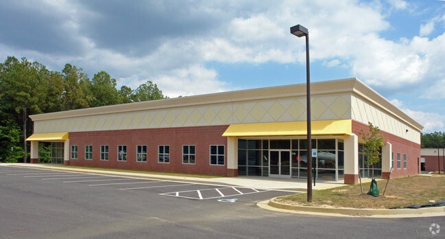
2001 Techpark Pl, Sandston, VA 23150


Current Lease Availabilities
Property Detail
2001 Techpark Pl
845-705-3726
TECHPARK SC B AC 1.570 PAR B
Multipleuses
HENRICO
M-2C
Virginia
B and X Area of moderate flood hazard, usually the area between the limits of the 100-year and 500-year floods.
1.57 AC
2026
Airport
2026
Richmond VA
201404
Richmond, VA
11,930 SF
NEARBY LISTINGS FOR SALE OR LEASE
-
-
View all Sandston listings for lease on LoopNet.com
DEMOGRAPHICS near 2001 Techpark Pl
1 mile
3 mile
5 mile
2025 Total Population
317
5,848
25,500
2030 Population
322
5,955
26,546
Pop Growth 2025-2030
+ 1.58%
+ 1.83%
+ 4.10%
Average Age
48
46
43
2025 Total Households
133
2,444
10,070
HH Growth 2025-2030
+ 2.26%
+ 1.92%
+ 4.08%
Median Household Inc
$89,244
$89,703
$87,312
Avg Household Size
2.30
2.40
2.50
2025 Avg HH Vehicles
2.00
2.00
2.00
Median Home Value
$303,659
$336,524
$323,883
Median Year Built
1980
1982
1986
Nearby Places
Map Layers
Map Styles
 Street
 Aerial
Layers
 Traffic
 Biking
Places
Listings with unknown addresses are not visible on the map
- Restaurants
- Banks
- Shops
- Fitness
- Groceries
PUBLIC TRANSPORTATION
AIRPORT
Richmond International
Drive
Walk
Distance
Richmond International
11 min
5.4 mi
Freight Ports
Virginia Port Authority - Richmond
Drive
Walk
Distance
Virginia Port Authority - Richmond
25 min
16.1 mi
Nearby Properties
Address
Land Use
TOTAL SIZE
Lot Size
Zoning
Address
Land Use
TOTAL SIZE
Lot Size
Zoning
320,459 SF
172.05 AC
M-2
Address
Land Use
TOTAL SIZE
Lot Size
Zoning
976,550 SF
129.27 AC
M-2
Address
Land Use
TOTAL SIZE
Lot Size
Zoning
382,408 SF
65 AC
M-2
Address
Land Use
TOTAL SIZE
Lot Size
Zoning
357,728 SF
M-2
Address
Land Use
TOTAL SIZE
Lot Size
Zoning
338,936 SF
15.78 AC
M-2
Address
Land Use
TOTAL SIZE
Lot Size
Zoning
337,669 SF
15.97 AC
M-2
Address
Land Use
TOTAL SIZE
Lot Size
Zoning
337,669 SF
15.85 AC
M-2
Address
Land Use
TOTAL SIZE
Lot Size
Zoning
338,936 SF
12.18 AC
M-2
Address
Land Use
TOTAL SIZE
Lot Size
Zoning
338,936 SF
15.89 AC
M-2
Address
Land Use
TOTAL SIZE
Lot Size
Zoning
341,614 SF
16.10 AC
M-2
Address
Land Use
TOTAL SIZE
Lot Size
Zoning
339,884 SF
22.48 AC
M-2
Address
Land Use
TOTAL SIZE
Lot Size
Zoning
270,416 SF
M-2
Address
Land Use
TOTAL SIZE
Lot Size
Zoning
320,152 SF
M-2
Address
Land Use
TOTAL SIZE
Lot Size
Zoning
385,896 SF
128.24 AC
M-2
Address
Land Use
TOTAL SIZE
Lot Size
Zoning
995,854 SF
97.55 AC
M-2
Address
Land Use
TOTAL SIZE
Lot Size
Zoning
308,840 SF
93.42 AC
M-2
Address
Land Use
TOTAL SIZE
Lot Size
Zoning
716,824 SF
60.89 AC
M-2C
Address
Land Use
TOTAL SIZE
Lot Size
Zoning
345,600 SF
64.05 AC
M-2
Address
Land Use
TOTAL SIZE
Lot Size
Zoning
Address
Land Use
TOTAL SIZE
Lot Size
Zoning
117,522 SF
67.74 AC
A-1
Address
Land Use
TOTAL SIZE
Lot Size
Zoning
313.98 AC
M-2
Address
Land Use
TOTAL SIZE
Lot Size
Zoning
181,200 SF
14.74 AC
R-5
Address
Land Use
TOTAL SIZE
Lot Size
Zoning
420.71 AC
M-2
Address
Land Use
TOTAL SIZE
Lot Size
Zoning
212,576 SF
94.90 AC
MIXED
Address
Land Use
TOTAL SIZE
Lot Size
Zoning
54,328 SF
22.75 AC
M-2
Address
Land Use
TOTAL SIZE
Lot Size
Zoning
Address
Land Use
TOTAL SIZE
Lot Size
Zoning
171.80 AC
A-1
Address
Land Use
TOTAL SIZE
Lot Size
Zoning
Address
Land Use
TOTAL SIZE
Lot Size
Zoning
46,937 SF
41.66 AC
M-2
Address
Land Use
TOTAL SIZE
Lot Size
Zoning
42,755 SF
103.73 AC
M-1
The World's #1 Commercial Real Estate Marketplace
Connect with us
© 2026 CoStar Group
The information above has been obtained from sources believed reliable. While we do not doubt its accuracy we have not verified it and make no guarantee, warranty or representation about it. It is your responsibility to independently confirm its accuracy and completeness. Any projections, opinions, assumptions, or estimates used are for example only and do not represent the current or future performance of the property. The value of this transaction to you depends on tax and other factors which should be evaluated by your tax, financial, and legal advisors. You and your advisors should conduct a careful, independent investigation of the property to determine to your satisfaction the suitability of the property for your needs.