Property Record
2002 20Th St, Kenner, LA 70062


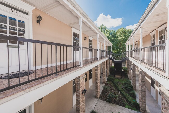
Property Detail
2002 20Th St
New Orleans/Metairie/Kenner
IN THE COMMON ELEMENTS 1162/190 HIGHWAY PARK
New Orleans-Metairie, LA
Jefferson
0920027257
Louisiana
Miscpropertynotclassed
40a
2025
0.03 AC
2025
Kenner
021100
NEARBY LISTINGS FOR SALE OR LEASE
DEMOGRAPHICS near 2002 20Th St
1 mile
3 mile
5 mile
2025 Total Population
10,591
105,653
204,212
2030 Population
10,357
103,929
200,864
Pop Growth 2025-2030
(2.21%)
(1.63%)
(1.64%)
Average Age
43
42
42
2025 Total Households
4,271
41,897
84,219
HH Growth 2025-2030
(2.27%)
(1.68%)
(1.74%)
Median Household Inc
$64,154
$64,907
$66,751
Avg Household Size
2.40
2.40
2.40
2025 Avg HH Vehicles
2.00
2.00
2.00
Median Home Value
$235,687
$259,119
$283,904
Median Year Built
1967
1971
1973
Nearby Places
Map Layers
Map Styles
 Street
 Aerial
Layers
 Traffic
 Biking
Places
Listings with unknown addresses are not visible on the map
- Restaurants
- Banks
- Shops
- Fitness
- Groceries
PUBLIC TRANSPORTATION
AIRPORT
Louis Armstrong New Orleans International
Drive
Walk
Distance
Louis Armstrong New Orleans International
8 min
3.7 mi
Freight Ports
Port of New Orleans
Drive
Walk
Distance
Port of New Orleans
26 min
15.4 mi
SALE & LEASE HISTORY
LISTING DATE
SALE/LEASE

Sep 09, 2025
For Sale
Oct 16, 2019
For Sale
Oct 15, 2024
For Sale
Jul 17, 2020
For Sale
Jan 23, 2019
For Lease
Aug 05, 2020
For Lease
Nearby Properties
Address
Land Use
TOTAL SIZE
Lot Size
Zoning
Address
Land Use
TOTAL SIZE
Lot Size
Zoning
728 AC
R1A
Address
Land Use
TOTAL SIZE
Lot Size
Zoning
Address
Land Use
TOTAL SIZE
Lot Size
Zoning
0.09 AC
Address
Land Use
TOTAL SIZE
Lot Size
Zoning
42.34 AC
Address
Land Use
TOTAL SIZE
Lot Size
Zoning
0.12 AC
Address
Land Use
TOTAL SIZE
Lot Size
Zoning
9.74 AC
Address
Land Use
TOTAL SIZE
Lot Size
Zoning
31.55 AC
R1A
Address
Land Use
TOTAL SIZE
Lot Size
Zoning
15.97 AC
Address
Land Use
TOTAL SIZE
Lot Size
Zoning
19.35 AC
R1A
Address
Land Use
TOTAL SIZE
Lot Size
Zoning
18.01 AC
Address
Land Use
TOTAL SIZE
Lot Size
Zoning
10.16 AC
Address
Land Use
TOTAL SIZE
Lot Size
Zoning
0.15 AC
Address
Land Use
TOTAL SIZE
Lot Size
Zoning
0.13 AC
Address
Land Use
TOTAL SIZE
Lot Size
Zoning
12.69 AC
Address
Land Use
TOTAL SIZE
Lot Size
Zoning
0.14 AC
GO1
Address
Land Use
TOTAL SIZE
Lot Size
Zoning
2.03 AC
Address
Land Use
TOTAL SIZE
Lot Size
Zoning
Address
Land Use
TOTAL SIZE
Lot Size
Zoning
14.95 AC
Address
Land Use
TOTAL SIZE
Lot Size
Zoning
Address
Land Use
TOTAL SIZE
Lot Size
Zoning
Address
Land Use
TOTAL SIZE
Lot Size
Zoning
0.14 AC
Address
Land Use
TOTAL SIZE
Lot Size
Zoning
0.18 AC
Address
Land Use
TOTAL SIZE
Lot Size
Zoning
Address
Land Use
TOTAL SIZE
Lot Size
Zoning
25.77 AC
Address
Land Use
TOTAL SIZE
Lot Size
Zoning
22.92 AC
Address
Land Use
TOTAL SIZE
Lot Size
Zoning
Address
Land Use
TOTAL SIZE
Lot Size
Zoning
0.13 AC
Address
Land Use
TOTAL SIZE
Lot Size
Zoning
4.23 AC
Address
Land Use
TOTAL SIZE
Lot Size
Zoning
85,000 SF
3.60 AC
Address
Land Use
TOTAL SIZE
Lot Size
Zoning
253,722 SF
19.66 AC
The World's #1 Commercial Real Estate Marketplace
Connect with us
© 2026 CoStar Group
The information above has been obtained from sources believed reliable. While we do not doubt its accuracy we have not verified it and make no guarantee, warranty or representation about it. It is your responsibility to independently confirm its accuracy and completeness. Any projections, opinions, assumptions, or estimates used are for example only and do not represent the current or future performance of the property. The value of this transaction to you depends on tax and other factors which should be evaluated by your tax, financial, and legal advisors. You and your advisors should conduct a careful, independent investigation of the property to determine to your satisfaction the suitability of the property for your needs.