Property Record
2002 E 53Rd St, Anderson, IN 46013
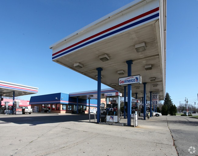


Property Detail
2002 E 53Rd St
48-12-29-300-032.000-003
PINNELL ADDN 1.0930ACRES STR: SECTION: PLAT: IN: OUT:
Storebuilding
Madison
B and X Area of moderate flood hazard, usually the area between the limits of the 100-year and 500-year floods.
Indiana
2024
1.09 AC
2025
Anderson/Madison Cnty
002000
Indianapolis
5,854 SF
Indianapolis-Carmel-Greenwood, IN
NEARBY LISTINGS FOR SALE OR LEASE
DEMOGRAPHICS near 2002 E 53Rd St
1 mile
3 mile
5 mile
2025 Total Population
3,237
30,532
67,597
2030 Population
3,276
31,682
70,210
Pop Growth 2025-2030
+ 1.20%
+ 3.77%
+ 3.87%
Average Age
43
41
41
2025 Total Households
1,555
13,551
28,719
HH Growth 2025-2030
+ 1.29%
+ 3.78%
+ 3.95%
Median Household Inc
$48,866
$46,956
$53,493
Avg Household Size
2.10
2.20
2.20
2025 Avg HH Vehicles
2.00
2.00
2.00
Median Home Value
$159,645
$115,983
$132,294
Median Year Built
1980
1963
1962
Nearby Places
Map Layers
Map Styles
 Street
 Aerial
Transit
 Traffic
 Biking
Places
Listings with unknown addresses are not visible on the map
- Restaurants
- Banks
- Shops
- Fitness
- Groceries
Nearby Properties
Address
Land Use
TOTAL SIZE
Lot Size
Zoning
Address
Land Use
TOTAL SIZE
Lot Size
Zoning
19,855 SF
10.64 AC
Address
Land Use
TOTAL SIZE
Lot Size
Zoning
214,395 SF
22.85 AC
Address
Land Use
TOTAL SIZE
Lot Size
Zoning
212,232 SF
28.92 AC
Address
Land Use
TOTAL SIZE
Lot Size
Zoning
1,431 SF
17.23 AC
Address
Land Use
TOTAL SIZE
Lot Size
Zoning
86,770 SF
11.11 AC
Address
Land Use
TOTAL SIZE
Lot Size
Zoning
71,379 SF
9.21 AC
Address
Land Use
TOTAL SIZE
Lot Size
Zoning
173,030 SF
22.39 AC
Address
Land Use
TOTAL SIZE
Lot Size
Zoning
36,120 SF
22.78 AC
Address
Land Use
TOTAL SIZE
Lot Size
Zoning
43,132 SF
47.35 AC
Address
Land Use
TOTAL SIZE
Lot Size
Zoning
176 SF
20.09 AC
Address
Land Use
TOTAL SIZE
Lot Size
Zoning
140,429 SF
18.58 AC
Address
Land Use
TOTAL SIZE
Lot Size
Zoning
70,286 SF
3.89 AC
Address
Land Use
TOTAL SIZE
Lot Size
Zoning
13,032 SF
12.58 AC
Address
Land Use
TOTAL SIZE
Lot Size
Zoning
19,822 SF
18.49 AC
Address
Land Use
TOTAL SIZE
Lot Size
Zoning
44,160 SF
4.96 AC
Address
Land Use
TOTAL SIZE
Lot Size
Zoning
3,704 SF
10 AC
Address
Land Use
TOTAL SIZE
Lot Size
Zoning
79,422 SF
5.37 AC
Address
Land Use
TOTAL SIZE
Lot Size
Zoning
87,171 SF
7.89 AC
Address
Land Use
TOTAL SIZE
Lot Size
Zoning
74,538 SF
6.78 AC
Address
Land Use
TOTAL SIZE
Lot Size
Zoning
16,136 SF
9.39 AC
Address
Land Use
TOTAL SIZE
Lot Size
Zoning
44,107 SF
5 AC
Address
Land Use
TOTAL SIZE
Lot Size
Zoning
106,416 SF
6.45 AC
Address
Land Use
TOTAL SIZE
Lot Size
Zoning
51,036 SF
3.06 AC
Address
Land Use
TOTAL SIZE
Lot Size
Zoning
91,254 SF
8.67 AC
Address
Land Use
TOTAL SIZE
Lot Size
Zoning
29,520 SF
12.15 AC
Address
Land Use
TOTAL SIZE
Lot Size
Zoning
57,535 SF
4.18 AC
Address
Land Use
TOTAL SIZE
Lot Size
Zoning
117,934 SF
2.91 AC
Address
Land Use
TOTAL SIZE
Lot Size
Zoning
25,575 SF
5.10 AC
Address
Land Use
TOTAL SIZE
Lot Size
Zoning
180,993 SF
36.58 AC
Address
Land Use
TOTAL SIZE
Lot Size
Zoning
38,274 SF
2.21 AC
The World's #1 Commercial Real Estate Marketplace
Connect with us
© 2026 CoStar Group
The information above has been obtained from sources believed reliable. While we do not doubt its accuracy we have not verified it and make no guarantee, warranty or representation about it. It is your responsibility to independently confirm its accuracy and completeness. Any projections, opinions, assumptions, or estimates used are for example only and do not represent the current or future performance of the property. The value of this transaction to you depends on tax and other factors which should be evaluated by your tax, financial, and legal advisors. You and your advisors should conduct a careful, independent investigation of the property to determine to your satisfaction the suitability of the property for your needs.