Property Record
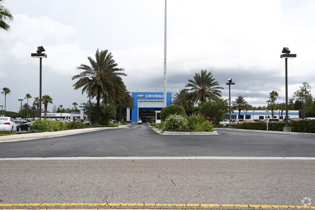
2002 N Frontage Rd, Plant City, FL 33563


NEARBY LISTINGS FOR SALE OR LEASE
Property Detail
2002 N Frontage Rd
Tampa-St. Petersburg-Clearwater, FL
Unplatted
P-22-28-22-ZZZ-000006-03340.0
E 1/2 OF NW 1/4 OF NW 1/4 LESS HWY AND W 1/2 OF NW 1/4 OF NW 1/4 LESS N 367 FT MOL OF W 210 FT LESS HWY AND S1/4 OF SW 1/4 OF SW 1/4 LYING E OF PARK RD R/W TOGETHER WITH THE FOLLOWING DESC PARCEL THAT PART OF THE N 1/2 OF S 1/2 OF SW 1/4 OF SW 1/4 LY
Vehiclerentalsvehiclesales
Hillsborough
AE
Florida
12057C0286H
3340
2024
43.50 AC
2024
Eastern Outlying
010107
Tampa/St Petersburg
188,212 SF
DEMOGRAPHICS near 2002 N Frontage Rd
1 Mile
3 Mile
5 Mile
2024 Total Population
2,695
26,844
58,584
2029 Population
2,956
29,520
64,554
Pop Growth 2024-2029
+ 9.68%
+ 9.97%
+ 10.19%
Average Age
40
40
39
2024 Total Households
945
9,874
20,961
HH Growth 2024-2029
+ 9.95%
+ 10.26%
+ 10.50%
Median Household Inc
$66,369
$50,649
$55,150
Avg Household Size
2.80
2.60
2.70
2024 Avg HH Vehicles
2.00
2.00
2.00
Median Home Value
$253,571
$174,735
$223,716
Median Year Built
1986
1984
1986
Nearby Places
Map Layers
Map Styles
 Street
 Aerial
- Restaurants
- Banks
- Shops
- Fitness
- Groceries
PUBLIC TRANSPORTATION
AIRPORT
Tampa International
DRIVE
WALK
Distance
Tampa International
41 min
31.4 mi
Freight Ports
Port of Tampa Bay
DRIVE
WALK
Distance
Port of Tampa Bay
33 min
24.8 mi
Nearby Properties
Address
Land Use
TOTAL SIZE
Lot Size
Zoning
Address
Land Use
TOTAL SIZE
Lot Size
Zoning
1,055,503 SF
112.72 AC
R-4
Address
Land Use
TOTAL SIZE
Lot Size
Zoning
519,942 SF
130.03 AC
I
Address
Land Use
TOTAL SIZE
Lot Size
Zoning
723,962 SF
47.49 AC
I
Address
Land Use
TOTAL SIZE
Lot Size
Zoning
505,506 SF
50.60 AC
MU-R/C/I
Address
Land Use
TOTAL SIZE
Lot Size
Zoning
235,102 SF
7.73 AC
P
Address
Land Use
TOTAL SIZE
Lot Size
Zoning
415,389 SF
62.31 AC
MU-R/C/I
Address
Land Use
TOTAL SIZE
Lot Size
Zoning
220,510 SF
37.56 AC
I
Address
Land Use
TOTAL SIZE
Lot Size
Zoning
243,294 SF
19.80 AC
CC
Address
Land Use
TOTAL SIZE
Lot Size
Zoning
333,718 SF
28.99 AC
I
Address
Land Use
TOTAL SIZE
Lot Size
Zoning
492,180 SF
32.61 AC
PD
Address
Land Use
TOTAL SIZE
Lot Size
Zoning
93,924 SF
3.96 AC
DC
Address
Land Use
TOTAL SIZE
Lot Size
Zoning
213,188 SF
16.10 AC
PD
Address
Land Use
TOTAL SIZE
Lot Size
Zoning
35,426 SF
39.92 AC
P
Address
Land Use
TOTAL SIZE
Lot Size
Zoning
145,222 SF
36.47 AC
PD
Address
Land Use
TOTAL SIZE
Lot Size
Zoning
192,911 SF
16.36 AC
PD
Address
Land Use
TOTAL SIZE
Lot Size
Zoning
247,608 SF
25.84 AC
PD
Address
Land Use
TOTAL SIZE
Lot Size
Zoning
122,814 SF
17.18 AC
I
Address
Land Use
TOTAL SIZE
Lot Size
Zoning
132,285 SF
30.77 AC
PD
Address
Land Use
TOTAL SIZE
Lot Size
Zoning
252,166 SF
22.88 AC
I
Address
Land Use
TOTAL SIZE
Lot Size
Zoning
139,392 SF
73.31 AC
RO
Address
Land Use
TOTAL SIZE
Lot Size
Zoning
197,540 SF
9.18 AC
I
Address
Land Use
TOTAL SIZE
Lot Size
Zoning
40,530 SF
2.36 AC
DC
Address
Land Use
TOTAL SIZE
Lot Size
Zoning
33,282 SF
16.94 AC
RO
Address
Land Use
TOTAL SIZE
Lot Size
Zoning
90,504 SF
5.33 AC
I
Address
Land Use
TOTAL SIZE
Lot Size
Zoning
149,952 SF
19.41 AC
I
Address
Land Use
TOTAL SIZE
Lot Size
Zoning
99,654 SF
24.64 AC
I
Address
Land Use
TOTAL SIZE
Lot Size
Zoning
100,852 SF
5.46 AC
PD
Address
Land Use
TOTAL SIZE
Lot Size
Zoning
76,068 SF
9.95 AC
Address
Land Use
TOTAL SIZE
Lot Size
Zoning
98,732 SF
6.12 AC
MU-R/C/I
The World's #1 Commercial Real Estate Marketplace
Connect with us
© 2025 CoStar Group
The information above has been obtained from sources believed reliable. While we do not doubt its accuracy we have not verified it and make no guarantee, warranty or representation about it. It is your responsibility to independently confirm its accuracy and completeness. Any projections, opinions, assumptions, or estimates used are for example only and do not represent the current or future performance of the property. The value of this transaction to you depends on tax and other factors which should be evaluated by your tax, financial, and legal advisors. You and your advisors should conduct a careful, independent investigation of the property to determine to your satisfaction the suitability of the property for your needs.