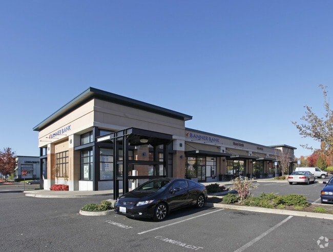
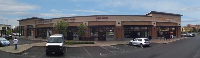
Property Record
2002 Ne Stucki Ave, Hillsboro, OR 97124


Property Detail
2002 Ne Stucki Ave
Portland-Vancouver-Hillsboro, OR-WA
TANASBOURNE COMMUNITY, LOT 11, ACRES 2.41
R1390676
Washington
Commercialbuilding
Oregon
C-G
11
B and X Area of moderate flood hazard, usually the area between the limits of the 100-year and 500-year floods.
2.41 AC
2024
Sunset Corridor/Hillsboro
2026
Portland
031616
NEARBY LISTINGS FOR SALE OR LEASE
DEMOGRAPHICS near 2002 Ne Stucki Ave
1 mile
3 mile
5 mile
2024 Total Population
21,554
140,610
295,644
2029 Population
21,757
142,011
299,154
Pop Growth 2024-2029
+ 0.94%
+ 1.00%
+ 1.19%
Average Age
36
38
39
2024 Total Households
9,972
55,079
111,184
HH Growth 2024-2029
+ 1.17%
+ 1.12%
+ 1.31%
Median Household Inc
$92,195
$108,684
$108,124
Avg Household Size
2.10
2.50
2.60
2024 Avg HH Vehicles
2.00
2.00
2.00
Median Home Value
$490,595
$619,413
$621,415
Median Year Built
1997
1996
1993
Nearby Places
Map Layers
Map Styles
 Street
 Aerial
Transit
 Traffic
 Biking
Places
Listings with unknown addresses are not visible on the map
- Restaurants
- Banks
- Shops
- Fitness
- Groceries
PUBLIC TRANSPORTATION
COMMUTER RAIL
Beaverton Transit Center (West Side Express) (Westside Express Service - Tri-County Metropolitan Transportation District of Oregon Rail (TriMet Rail))
Drive
Walk
Distance
Beaverton Transit Center (West Side Express) (Westside Express Service - Tri-County Metropolitan Transportation District of Oregon Rail (TriMet Rail))
12 min
5.7 mi
Hall/Nimbus (Westside Express Service - Tri-County Metropolitan Transportation District of Oregon Rail (TriMet Rail))
Drive
Walk
Distance
Hall/Nimbus (Westside Express Service - Tri-County Metropolitan Transportation District of Oregon Rail (TriMet Rail))
14 min
8.1 mi
AIRPORT
Portland International
Drive
Walk
Distance
Portland International
37 min
23.9 mi
Freight Ports
Port of Portland
Drive
Walk
Distance
Port of Portland
20 min
13.0 mi
Nearby Properties
Address
Land Use
TOTAL SIZE
Lot Size
Zoning
Address
Land Use
TOTAL SIZE
Lot Size
Zoning
21.21 AC
I-P
Address
Land Use
TOTAL SIZE
Lot Size
Zoning
0.13 AC
I-P
Address
Land Use
TOTAL SIZE
Lot Size
Zoning
2,936,291 SF
72.49 AC
TO:EMP
Address
Land Use
TOTAL SIZE
Lot Size
Zoning
337.91 AC
I-P
Address
Land Use
TOTAL SIZE
Lot Size
Zoning
562,350 SF
203.06 AC
INST
Address
Land Use
TOTAL SIZE
Lot Size
Zoning
35.87 AC
SSID
Address
Land Use
TOTAL SIZE
Lot Size
Zoning
373,884 SF
153.56 AC
UC-RP
Address
Land Use
TOTAL SIZE
Lot Size
Zoning
1,004,655 SF
24.55 AC
SCR-V
Address
Land Use
TOTAL SIZE
Lot Size
Zoning
716,311 SF
75.07 AC
TO:EMP
Address
Land Use
TOTAL SIZE
Lot Size
Zoning
Address
Land Use
TOTAL SIZE
Lot Size
Zoning
Address
Land Use
TOTAL SIZE
Lot Size
Zoning
194.52 AC
R1
Address
Land Use
TOTAL SIZE
Lot Size
Zoning
292,000 SF
53.23 AC
I-G
Address
Land Use
TOTAL SIZE
Lot Size
Zoning
0.03 AC
I-P
Address
Land Use
TOTAL SIZE
Lot Size
Zoning
316,321 SF
0.11 AC
I-P
Address
Land Use
TOTAL SIZE
Lot Size
Zoning
37.66 AC
IND
Address
Land Use
TOTAL SIZE
Lot Size
Zoning
704,877 SF
18.72 AC
OI-NC
Address
Land Use
TOTAL SIZE
Lot Size
Zoning
174,233 SF
14.74 AC
I-P
Address
Land Use
TOTAL SIZE
Lot Size
Zoning
791,581 SF
22.58 AC
MFR-3
Address
Land Use
TOTAL SIZE
Lot Size
Zoning
53.13 AC
SC-BP
Address
Land Use
TOTAL SIZE
Lot Size
Zoning
281,695 SF
7.41 AC
SC-HDR
Address
Land Use
TOTAL SIZE
Lot Size
Zoning
482,173 SF
14.99 AC
C-G
Address
Land Use
TOTAL SIZE
Lot Size
Zoning
281,183 SF
44.96 AC
R-5
Address
Land Use
TOTAL SIZE
Lot Size
Zoning
38.36 AC
I-P
Address
Land Use
TOTAL SIZE
Lot Size
Zoning
270,000 SF
37.85 AC
SFR-6
Address
Land Use
TOTAL SIZE
Lot Size
Zoning
Address
Land Use
TOTAL SIZE
Lot Size
Zoning
0.68 AC
SCR-V
Address
Land Use
TOTAL SIZE
Lot Size
Zoning
253,727 SF
38.06 AC
OI
Address
Land Use
TOTAL SIZE
Lot Size
Zoning
29.94 AC
SID I-P
The World's #1 Commercial Real Estate Marketplace
Connect with us
© 2026 CoStar Group
The information above has been obtained from sources believed reliable. While we do not doubt its accuracy we have not verified it and make no guarantee, warranty or representation about it. It is your responsibility to independently confirm its accuracy and completeness. Any projections, opinions, assumptions, or estimates used are for example only and do not represent the current or future performance of the property. The value of this transaction to you depends on tax and other factors which should be evaluated by your tax, financial, and legal advisors. You and your advisors should conduct a careful, independent investigation of the property to determine to your satisfaction the suitability of the property for your needs.