Property Record
2002 Phillips Field Rd, Fairbanks, AK 99701
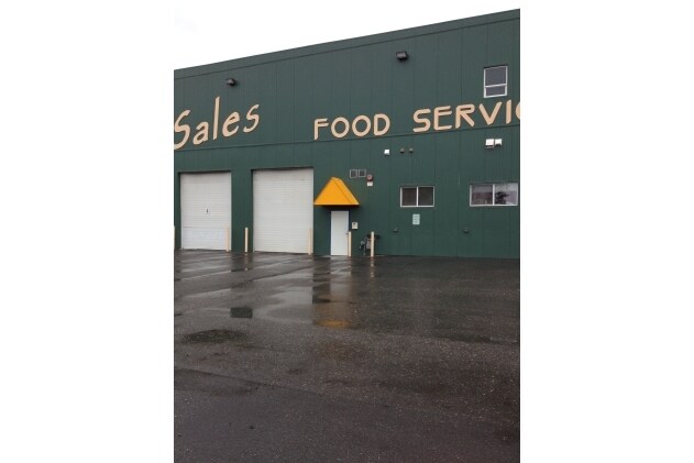


Property Detail
2002 Phillips Field Rd
Fairbanks-College, AK
UMB01 BLOCK A RAILROAD CHENA ARR 20902 TERM EXPIRES 6/30/2043 PREVIOUS ARR 8582 2004 T/R ASSEMBLED LOTS 10A, 11A & 12A BLOCK A RAILROAD CHENA SUPPLEMENTAL 2003-020509-0 - 8/18/2003 PREVIOUSLY ASSESSED AS RAILROAD CHENA A 11A&
540005
FAIRBANKS NORTH STAR
Industrialgeneral
Alaska
2025
10a
2025
2.63 AC
000300
Alaska Regional
22,409 SF
Other Market Areas
NEARBY LISTINGS FOR SALE OR LEASE
DEMOGRAPHICS near 2002 Phillips Field Rd
1 mile
3 mile
5 mile
2025 Total Population
6,453
36,477
51,216
2030 Population
6,429
36,480
51,010
Pop Growth 2025-2030
(0.37%)
+ 0.01%
(0.40%)
Average Age
40
36
36
2025 Total Households
2,532
14,178
19,353
HH Growth 2025-2030
(0.16%)
+ 0.03%
(0.48%)
Median Household Inc
$92,942
$72,712
$79,262
Avg Household Size
2.30
2.30
2.40
2025 Avg HH Vehicles
2.00
2.00
2.00
Median Home Value
$287,768
$259,521
$278,841
Median Year Built
1973
1980
1982
Nearby Places
Map Layers
Map Styles
 Street
 Aerial
Transit
 Traffic
 Biking
Places
Listings with unknown addresses are not visible on the map
- Restaurants
- Banks
- Shops
- Fitness
- Groceries
PUBLIC TRANSPORTATION
AIRPORT
Fairbanks International
Drive
Walk
Distance
Fairbanks International
23 min
7.7 mi
Nearby Properties
Address
Land Use
TOTAL SIZE
Lot Size
Zoning
Address
Land Use
TOTAL SIZE
Lot Size
Zoning
Address
Land Use
TOTAL SIZE
Lot Size
Zoning
Address
Land Use
TOTAL SIZE
Lot Size
Zoning
12,838 SF
Address
Land Use
TOTAL SIZE
Lot Size
Zoning
87.12 AC
Address
Land Use
TOTAL SIZE
Lot Size
Zoning
Address
Land Use
TOTAL SIZE
Lot Size
Zoning
Address
Land Use
TOTAL SIZE
Lot Size
Zoning
65,775.60 AC
Address
Land Use
TOTAL SIZE
Lot Size
Zoning
Address
Land Use
TOTAL SIZE
Lot Size
Zoning
178,992 SF
5.03 AC
Address
Land Use
TOTAL SIZE
Lot Size
Zoning
1,072,047 SF
26.44 AC
Address
Land Use
TOTAL SIZE
Lot Size
Zoning
28,000 SF
5.22 AC
Address
Land Use
TOTAL SIZE
Lot Size
Zoning
750,460 SF
17.60 AC
Address
Land Use
TOTAL SIZE
Lot Size
Zoning
190,284 SF
12.51 AC
Address
Land Use
TOTAL SIZE
Lot Size
Zoning
479,156 SF
18.38 AC
Address
Land Use
TOTAL SIZE
Lot Size
Zoning
191,644 SF
38.20 AC
Address
Land Use
TOTAL SIZE
Lot Size
Zoning
320,451 SF
27.84 AC
Address
Land Use
TOTAL SIZE
Lot Size
Zoning
620.32 AC
Address
Land Use
TOTAL SIZE
Lot Size
Zoning
254,075 SF
12.42 AC
Address
Land Use
TOTAL SIZE
Lot Size
Zoning
196,552 SF
56.08 AC
Address
Land Use
TOTAL SIZE
Lot Size
Zoning
85,213 SF
13.15 AC
Address
Land Use
TOTAL SIZE
Lot Size
Zoning
40,940 SF
41.82 AC
Address
Land Use
TOTAL SIZE
Lot Size
Zoning
55,734 SF
6 AC
Address
Land Use
TOTAL SIZE
Lot Size
Zoning
64,725 SF
1.72 AC
Address
Land Use
TOTAL SIZE
Lot Size
Zoning
27,007.20 AC
Address
Land Use
TOTAL SIZE
Lot Size
Zoning
130,750 SF
20.20 AC
Address
Land Use
TOTAL SIZE
Lot Size
Zoning
49,814 SF
7 AC
Address
Land Use
TOTAL SIZE
Lot Size
Zoning
43,463 SF
76.02 AC
Address
Land Use
TOTAL SIZE
Lot Size
Zoning
43,632 SF
1.27 AC
Address
Land Use
TOTAL SIZE
Lot Size
Zoning
79,445 SF
8.60 AC
Address
Land Use
TOTAL SIZE
Lot Size
Zoning
The World's #1 Commercial Real Estate Marketplace
Connect with us
© 2026 CoStar Group
The information above has been obtained from sources believed reliable. While we do not doubt its accuracy we have not verified it and make no guarantee, warranty or representation about it. It is your responsibility to independently confirm its accuracy and completeness. Any projections, opinions, assumptions, or estimates used are for example only and do not represent the current or future performance of the property. The value of this transaction to you depends on tax and other factors which should be evaluated by your tax, financial, and legal advisors. You and your advisors should conduct a careful, independent investigation of the property to determine to your satisfaction the suitability of the property for your needs.