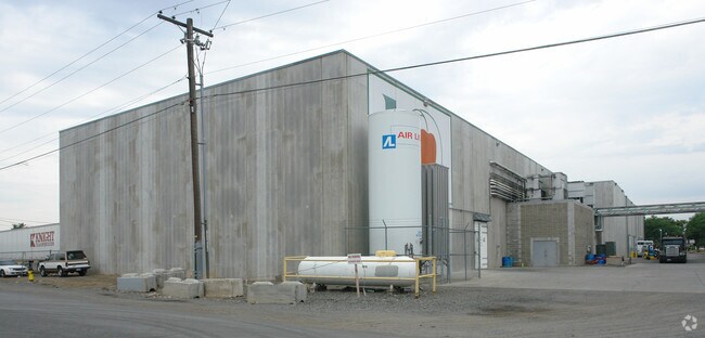
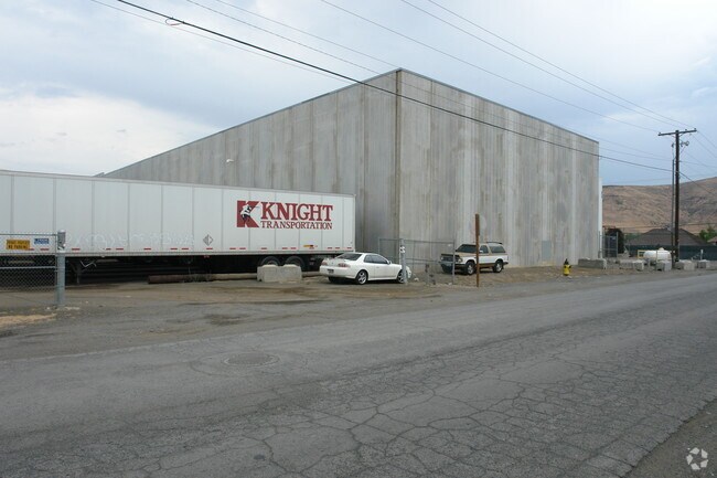
Property Record
2002 River Rd, Yakima, WA 98902

Property Detail
2002 River Rd
181314-13052
SECTION 14 TOWNSHIP 13 RANGE 18 QUARTER NE: E1/2 NE1/4 SW1/4 NE1/4 EX S 360 FT AND EX E 25 FT & N 30 FT STR. R/W ALSO E 353.1 FT OF W 994.1 FT OF N 665.4 FT OF SW1/4 NE1/4 EX N 30 FT STR.R/W (AKA LOTS 1 THRU 5A AND LOTS 16 THRU 21 BLK 1 RICHARDSON SU
Foodprocessing
YAKIMA
M1
Washington
B and X Area of moderate flood hazard, usually the area between the limits of the 100-year and 500-year floods.
1
2025
7.27 AC
2025
Greater Yakima
000800
Yakima
173,916 SF
Yakima, WA
NEARBY LISTINGS FOR SALE OR LEASE
DEMOGRAPHICS near 2002 River Rd
1 mile
3 mile
5 mile
2025 Total Population
9,689
81,812
129,560
2030 Population
9,737
82,443
130,997
Pop Growth 2025-2030
+ 0.50%
+ 0.77%
+ 1.11%
Average Age
36
37
38
2025 Total Households
3,500
29,912
47,332
HH Growth 2025-2030
+ 0.60%
+ 0.81%
+ 1.13%
Median Household Inc
$39,853
$59,564
$65,752
Avg Household Size
2.60
2.60
2.60
2025 Avg HH Vehicles
2.00
2.00
2.00
Median Home Value
$218,596
$303,574
$323,320
Median Year Built
1972
1967
1974
Nearby Places
Map Layers
Map Styles
 Street
 Aerial
Layers
 Traffic
 Biking
Places
Listings with unknown addresses are not visible on the map
- Restaurants
- Banks
- Shops
- Fitness
- Groceries
PUBLIC TRANSPORTATION
AIRPORT
Yakima Air Trml/McAllister Field
Drive
Walk
Distance
Yakima Air Trml/McAllister Field
10 min
3.9 mi
Freight Ports
Port of Tacoma
Drive
Walk
Distance
Port of Tacoma
182 min
154.9 mi
Nearby Properties
Address
Land Use
TOTAL SIZE
Lot Size
Zoning
Address
Land Use
TOTAL SIZE
Lot Size
Zoning
331,736 SF
34.95 AC
R1
Address
Land Use
TOTAL SIZE
Lot Size
Zoning
390,527 SF
11.86 AC
R3
Address
Land Use
TOTAL SIZE
Lot Size
Zoning
409,453 SF
8.25 AC
R3
Address
Land Use
TOTAL SIZE
Lot Size
Zoning
326,323 SF
30.05 AC
R2
Address
Land Use
TOTAL SIZE
Lot Size
Zoning
499,230 SF
22.57 AC
M1
Address
Land Use
TOTAL SIZE
Lot Size
Zoning
193,955 SF
9.94 AC
C1
Address
Land Use
TOTAL SIZE
Lot Size
Zoning
474,587 SF
18.06 AC
M1
Address
Land Use
TOTAL SIZE
Lot Size
Zoning
132,582 SF
32.50 AC
R1
Address
Land Use
TOTAL SIZE
Lot Size
Zoning
87,068 SF
2.89 AC
CBD
Address
Land Use
TOTAL SIZE
Lot Size
Zoning
176,098 SF
1.67 AC
CBD
Address
Land Use
TOTAL SIZE
Lot Size
Zoning
235,222 SF
14.23 AC
M1
Address
Land Use
TOTAL SIZE
Lot Size
Zoning
298,360 SF
15.21 AC
M1
Address
Land Use
TOTAL SIZE
Lot Size
Zoning
329,388 SF
16.13 AC
M1
Address
Land Use
TOTAL SIZE
Lot Size
Zoning
501,270 SF
21.09 AC
M1
Address
Land Use
TOTAL SIZE
Lot Size
Zoning
126,988 SF
9.65 AC
R2
Address
Land Use
TOTAL SIZE
Lot Size
Zoning
65,606 SF
3.39 AC
R2
Address
Land Use
TOTAL SIZE
Lot Size
Zoning
79,293 SF
14.01 AC
R1
Address
Land Use
TOTAL SIZE
Lot Size
Zoning
69,675 SF
10.48 AC
R1
Address
Land Use
TOTAL SIZE
Lot Size
Zoning
124,505 SF
13.59 AC
R1
Address
Land Use
TOTAL SIZE
Lot Size
Zoning
56,505 SF
2.75 AC
C1
Address
Land Use
TOTAL SIZE
Lot Size
Zoning
98,397 SF
17.48 AC
R1
Address
Land Use
TOTAL SIZE
Lot Size
Zoning
327,890 SF
18.44 AC
M1
Address
Land Use
TOTAL SIZE
Lot Size
Zoning
197,263 SF
18.08 AC
C1
Address
Land Use
TOTAL SIZE
Lot Size
Zoning
128,789 SF
6.65 AC
R3
Address
Land Use
TOTAL SIZE
Lot Size
Zoning
93,286 SF
8.87 AC
R3
Address
Land Use
TOTAL SIZE
Lot Size
Zoning
162,933 SF
14.96 AC
SCC
Address
Land Use
TOTAL SIZE
Lot Size
Zoning
99,000 SF
5.44 AC
C1
Address
Land Use
TOTAL SIZE
Lot Size
Zoning
97,976 SF
3.98 AC
SCC
Address
Land Use
TOTAL SIZE
Lot Size
Zoning
196,486 SF
10.61 AC
M1
Address
Land Use
TOTAL SIZE
Lot Size
Zoning
118,830 SF
5.34 AC
LCC
The World's #1 Commercial Real Estate Marketplace
Connect with us
© 2026 CoStar Group
The information above has been obtained from sources believed reliable. While we do not doubt its accuracy we have not verified it and make no guarantee, warranty or representation about it. It is your responsibility to independently confirm its accuracy and completeness. Any projections, opinions, assumptions, or estimates used are for example only and do not represent the current or future performance of the property. The value of this transaction to you depends on tax and other factors which should be evaluated by your tax, financial, and legal advisors. You and your advisors should conduct a careful, independent investigation of the property to determine to your satisfaction the suitability of the property for your needs.