Property Record
20021 Sherwood St, Detroit, MI 48234
NEARBY LISTINGS FOR SALE OR LEASE
Property Detail
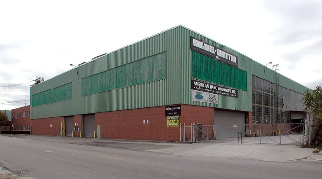
20021 Sherwood St
Detroit-Warren-Dearborn, MI
Cummiskey Outer B L V
15-012144
E SHERWOOD N 30 FT 61 60 THRU 58 CUMMISKEYS OUTER BLVD SUB L46 P44 PLATS, W C R 15/255 135 X 119
Industrialacreage
Wayne
X
Michigan
26163C0125E
8.83 AC
2024
Detroit East
2025
Detroit
506100
DEMOGRAPHICS near 20021 Sherwood St
1 Mile
3 Mile
5 Mile
2024 Total Population
14,484
136,211
370,549
2029 Population
14,465
136,097
370,616
Pop Growth 2024-2029
(0.13%)
(0.08%)
+ 0.02%
Average Age
37
37
38
2024 Total Households
5,387
49,943
141,885
HH Growth 2024-2029
(0.15%)
(0.07%)
+ 0.09%
Median Household Inc
$38,542
$39,481
$42,453
Avg Household Size
2.60
2.60
2.50
2024 Avg HH Vehicles
1.00
1.00
1.00
Median Home Value
$58,196
$72,135
$95,743
Median Year Built
1952
1953
1954
Nearby Places
Map Layers
Map Styles
 Street
 Aerial
- Restaurants
- Banks
- Shops
- Fitness
- Groceries
PUBLIC TRANSPORTATION
COMMUTER RAIL
DRIVE
WALK
Distance
17 min
7.8 mi
DRIVE
WALK
Distance
17 min
8.6 mi
AIRPORT
Windsor International
DRIVE
WALK
Distance
Windsor International
42 min
19.5 mi
Detroit Metro Wayne County
DRIVE
WALK
Distance
Detroit Metro Wayne County
45 min
28.8 mi
Nearby Properties
Address
Land Use
TOTAL SIZE
Lot Size
Zoning
Address
Land Use
TOTAL SIZE
Lot Size
Zoning
419,600 SF
Address
Land Use
TOTAL SIZE
Lot Size
Zoning
3,327,621 SF
130.89 AC
M-4
Address
Land Use
TOTAL SIZE
Lot Size
Zoning
450,958 SF
Address
Land Use
TOTAL SIZE
Lot Size
Zoning
1,784,888 SF
58.32 AC
M-4
Address
Land Use
TOTAL SIZE
Lot Size
Zoning
455,425 SF
Address
Land Use
TOTAL SIZE
Lot Size
Zoning
401,671 SF
19.40 AC
MZ
Address
Land Use
TOTAL SIZE
Lot Size
Zoning
198,064 SF
11.11 AC
MZ
Address
Land Use
TOTAL SIZE
Lot Size
Zoning
1,261,658 SF
71.94 AC
M-2
Address
Land Use
TOTAL SIZE
Lot Size
Zoning
Address
Land Use
TOTAL SIZE
Lot Size
Zoning
362,895 SF
14.85 AC
M-2
Address
Land Use
TOTAL SIZE
Lot Size
Zoning
259,959 SF
27.39 AC
MZ
Address
Land Use
TOTAL SIZE
Lot Size
Zoning
1,094,075 SF
58.76 AC
M-4
Address
Land Use
TOTAL SIZE
Lot Size
Zoning
303,615 SF
22.07 AC
MZ
Address
Land Use
TOTAL SIZE
Lot Size
Zoning
426,764 SF
38.46 AC
R-M
Address
Land Use
TOTAL SIZE
Lot Size
Zoning
197,670 SF
42.84 AC
M4
Address
Land Use
TOTAL SIZE
Lot Size
Zoning
166,064 SF
6.33 AC
M-3
Address
Land Use
TOTAL SIZE
Lot Size
Zoning
123,844 SF
1.81 AC
R2
Address
Land Use
TOTAL SIZE
Lot Size
Zoning
156,250 SF
8.79 AC
B4
Address
Land Use
TOTAL SIZE
Lot Size
Zoning
116,060 SF
6.95 AC
R2
Address
Land Use
TOTAL SIZE
Lot Size
Zoning
410,359 SF
27.52 AC
M4
Address
Land Use
TOTAL SIZE
Lot Size
Zoning
125,055 SF
7.74 AC
MZ
Address
Land Use
TOTAL SIZE
Lot Size
Zoning
81,072 SF
5.67 AC
M-4
Address
Land Use
TOTAL SIZE
Lot Size
Zoning
180,834 SF
17.97 AC
M-3
Address
Land Use
TOTAL SIZE
Lot Size
Zoning
251,056 SF
17.80 AC
MZ
Address
Land Use
TOTAL SIZE
Lot Size
Zoning
87,890 SF
Address
Land Use
TOTAL SIZE
Lot Size
Zoning
641,836 SF
20.69 AC
M4
Address
Land Use
TOTAL SIZE
Lot Size
Zoning
182,800 SF
7.86 AC
M-3
Address
Land Use
TOTAL SIZE
Lot Size
Zoning
74,112 SF
4.51 AC
R-M
Address
Land Use
TOTAL SIZE
Lot Size
Zoning
194,476 SF
15.09 AC
MZ
Address
Land Use
TOTAL SIZE
Lot Size
Zoning
165,232 SF
6.56 AC
M-2
The World's #1 Commercial Real Estate Marketplace
Connect with us
© 2025 CoStar Group
The information above has been obtained from sources believed reliable. While we do not doubt its accuracy we have not verified it and make no guarantee, warranty or representation about it. It is your responsibility to independently confirm its accuracy and completeness. Any projections, opinions, assumptions, or estimates used are for example only and do not represent the current or future performance of the property. The value of this transaction to you depends on tax and other factors which should be evaluated by your tax, financial, and legal advisors. You and your advisors should conduct a careful, independent investigation of the property to determine to your satisfaction the suitability of the property for your needs.