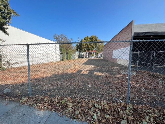
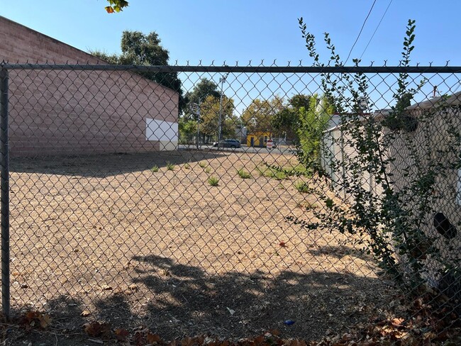
Property Record
2003 Broadway, Sacramento, CA 95818

Property Detail
2003 Broadway
Sacramento-Roseville-Folsom, CA
W 1/2 OF S 3/4 LOT 7 BLK X & Y 20 & 21
010-0217-002
SACRAMENTO
Commercialacreage
California
C-2-SPD
7
2025
0.11 AC
2025
Midtown
002000
Sacramento
NEARBY LISTINGS FOR SALE OR LEASE
-
-
-
-
-
-
-
-
-
-
-
-
No Photo
-
View all Sacramento listings for sale on LoopNet.com
DEMOGRAPHICS near 2003 Broadway
1 mile
3 mile
5 mile
2025 Total Population
28,836
163,167
413,340
2030 Population
29,598
167,069
421,293
Pop Growth 2025-2030
+ 2.64%
+ 2.39%
+ 1.92%
Average Age
40
40
39
2025 Total Households
15,029
71,401
162,007
HH Growth 2025-2030
+ 2.91%
+ 2.68%
+ 2.11%
Median Household Inc
$87,937
$89,025
$79,865
Avg Household Size
1.80
2.10
2.40
2025 Avg HH Vehicles
1.00
2.00
2.00
Median Home Value
$776,797
$679,999
$522,657
Median Year Built
1953
1956
1969
Nearby Places
Map Layers
Map Styles
 Street
 Aerial
Layers
 Traffic
 Biking
Places
Listings with unknown addresses are not visible on the map
- Restaurants
- Banks
- Shops
- Fitness
- Groceries
PUBLIC TRANSPORTATION
TRANSIT/SUBWAY
Broadway (Blue Line - Sacramento Regional Transit District Light Rail (The RT))
Drive
Walk
Distance
Broadway (Blue Line - Sacramento Regional Transit District Light Rail (The RT))
1 min
3 min
0.1 mi
4th Ave./Wayne Hultgren (Blue Line - Sacramento Regional Transit District Light Rail (The RT))
Drive
Walk
Distance
4th Ave./Wayne Hultgren (Blue Line - Sacramento Regional Transit District Light Rail (The RT))
1 min
13 min
0.7 mi
23rd Street (Gold Line - Sacramento Regional Transit District Light Rail (The RT))
Drive
Walk
Distance
23rd Street (Gold Line - Sacramento Regional Transit District Light Rail (The RT))
2 min
15 min
0.8 mi
16th Street (Blue Line - Sacramento Regional Transit District Light Rail (The RT), Gold Line - Sacramento Regional Transit District Light Rail (The RT))
Drive
Walk
Distance
16th Street (Blue Line - Sacramento Regional Transit District Light Rail (The RT), Gold Line - Sacramento Regional Transit District Light Rail (The RT))
2 min
18 min
0.9 mi
COMMUTER RAIL
Drive
Walk
Distance
6 min
2.5 mi
AIRPORT
Sacramento International
Drive
Walk
Distance
Sacramento International
20 min
13.2 mi
Freight Ports
Port of Stockton
Drive
Walk
Distance
Port of Stockton
55 min
46.0 mi
SALE & LEASE HISTORY
LISTING DATE
SALE/LEASE

Oct 04, 2022
For Sale
Nov 01, 2024
For Sale
Nearby Properties
Address
Land Use
TOTAL SIZE
Lot Size
Zoning
Address
Land Use
TOTAL SIZE
Lot Size
Zoning
1,095,507 SF
1.39 AC
H-SPD C-2-
Address
Land Use
TOTAL SIZE
Lot Size
Zoning
5.64 AC
C-3-SPD
Address
Land Use
TOTAL SIZE
Lot Size
Zoning
10.28 AC
H
Address
Land Use
TOTAL SIZE
Lot Size
Zoning
299,943 SF
4.95 AC
H
Address
Land Use
TOTAL SIZE
Lot Size
Zoning
487,483 SF
1.12 AC
C-3-SPD
Address
Land Use
TOTAL SIZE
Lot Size
Zoning
1.33 AC
R-1
Address
Land Use
TOTAL SIZE
Lot Size
Zoning
756,831 SF
1.39 AC
C-2-SPD
Address
Land Use
TOTAL SIZE
Lot Size
Zoning
399,626 SF
2.41 AC
C-3-SPD
Address
Land Use
TOTAL SIZE
Lot Size
Zoning
1.15 AC
R-1
Address
Land Use
TOTAL SIZE
Lot Size
Zoning
366,730 SF
0.89 AC
C-3-SPD
Address
Land Use
TOTAL SIZE
Lot Size
Zoning
200,616 SF
2.54 AC
C-2-SPD
Address
Land Use
TOTAL SIZE
Lot Size
Zoning
594,942 SF
2.39 AC
C-3-SPD
Address
Land Use
TOTAL SIZE
Lot Size
Zoning
676,447 SF
1.43 AC
C-3-SPD
Address
Land Use
TOTAL SIZE
Lot Size
Zoning
193,521 SF
0.60 AC
C-3-SPD
Address
Land Use
TOTAL SIZE
Lot Size
Zoning
339,329 SF
6.40 AC
R-5-PUD-SP
Address
Land Use
TOTAL SIZE
Lot Size
Zoning
213,557 SF
2.33 AC
C-3-SPD
Address
Land Use
TOTAL SIZE
Lot Size
Zoning
0.65 AC
C-4-SPD
Address
Land Use
TOTAL SIZE
Lot Size
Zoning
467,970 SF
4.59 AC
W-F
Address
Land Use
TOTAL SIZE
Lot Size
Zoning
410,420 SF
0.95 AC
C-3-SPD
Address
Land Use
TOTAL SIZE
Lot Size
Zoning
320,072 SF
2.65 AC
C-2
Address
Land Use
TOTAL SIZE
Lot Size
Zoning
R-4-PUD C-
Address
Land Use
TOTAL SIZE
Lot Size
Zoning
0.13 AC
WF
Address
Land Use
TOTAL SIZE
Lot Size
Zoning
26,712 SF
1.90 AC
R-5-PUD-SP
Address
Land Use
TOTAL SIZE
Lot Size
Zoning
26,712 SF
1.85 AC
R-5-PUD-SP
Address
Land Use
TOTAL SIZE
Lot Size
Zoning
2.88 AC
C-3-SPD
Address
Land Use
TOTAL SIZE
Lot Size
Zoning
508,916 SF
0.71 AC
C-3-SPD
Address
Land Use
TOTAL SIZE
Lot Size
Zoning
246,417 SF
1.19 AC
C-3-SPD
Address
Land Use
TOTAL SIZE
Lot Size
Zoning
405,074 SF
2.39 AC
C-3-SPD
Address
Land Use
TOTAL SIZE
Lot Size
Zoning
119,055 SF
1.18 AC
C-2-SPD
Address
Land Use
TOTAL SIZE
Lot Size
Zoning
383,000 SF
25.52 AC
M-1
The World's #1 Commercial Real Estate Marketplace
Connect with us
© 2026 CoStar Group
The information above has been obtained from sources believed reliable. While we do not doubt its accuracy we have not verified it and make no guarantee, warranty or representation about it. It is your responsibility to independently confirm its accuracy and completeness. Any projections, opinions, assumptions, or estimates used are for example only and do not represent the current or future performance of the property. The value of this transaction to you depends on tax and other factors which should be evaluated by your tax, financial, and legal advisors. You and your advisors should conduct a careful, independent investigation of the property to determine to your satisfaction the suitability of the property for your needs.